The Wind River Range:
The Wind River High Route is one of the premier nontechnical backpacking trips in the lower 48. The route is remote, absolutely stunning, and 80 percent off-trail. We saw only ten people in the first six days. The Northern Winds are covered by glaciers that are austere in their beauty, while the Southern Winds are picturesque and renowned by climbers for their steep faces. The diverse ground the route covers gave it the feeling of a longer trip, but it can be done in six to eight days. It is generally hiked northbound, but traveling southbound (as we did) is a viable option. There are many variations to Andrew Skurka’s first route through the range, though I believe none capture the area like his. I highly recommend his guide for purchase on his website.
I added the hike to my bucket list after Jim suggested it as our next backpacking trip out west. We planned to do the route in seven days with some high mileage days in the south. I was psyched about the Winds, especially after reading trip reports online, but the high route exceeded all my expectations.
Arriving:
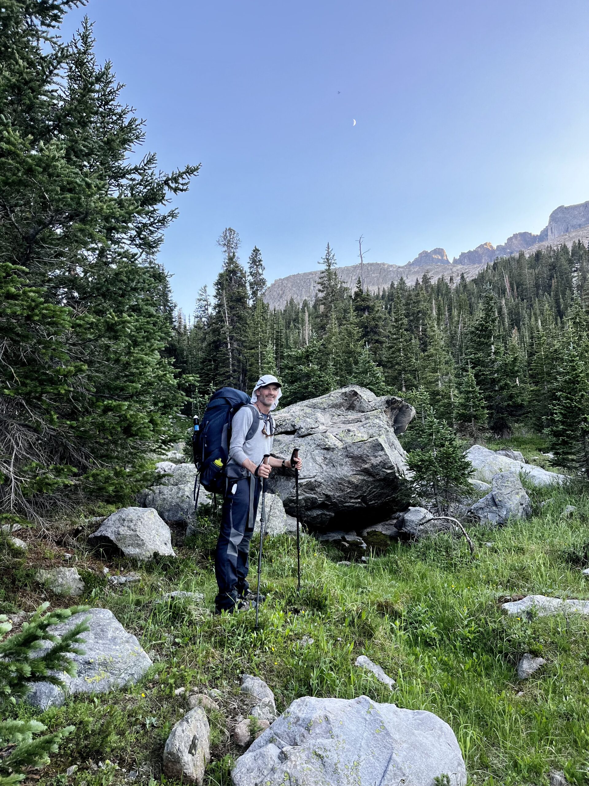
Our start point was Trail Lakes in Dubois and we planned to finish in Lander at Bruce’s Bridge. Flying into Wyoming added logistical challenges. There is a small airport in Riverton (near Lander), but it is pricey and the flight times from Denver are bonkers! Casper was ideal because it had more locations to get gear (bear spray and isobutane). Plus, it was a similar drive to Trail Lakes. The trailheads are remote, so staging cars or chartering a taxi are the best ways to access them. Soon after arriving in Casper, we received a call from the taxi service we had scheduled with months before. Their out-of-town driver had COVID. We were thrilled to find a guy through Uber who offered to drive us early the next day. Gear was easy to find at a local outfitter, and we found a great pizza place downtown. It was a three-hour drive to the trailhead, but we arrived around eight the next morning.
DAY 1: TRAIL LAKES TO FLATS BENEATH DOWNS MOUNTAIN
We were thankful for our early start. Despite our cardio training back east, the elevation had us working. It was easy hiking on the Glacier Trail through short lodgepole stands where we had occasional views back toward the plains.

After some lunch in a meadow, we climbed switchbacks to a plateau and continued off the trail toward Goat Flats.
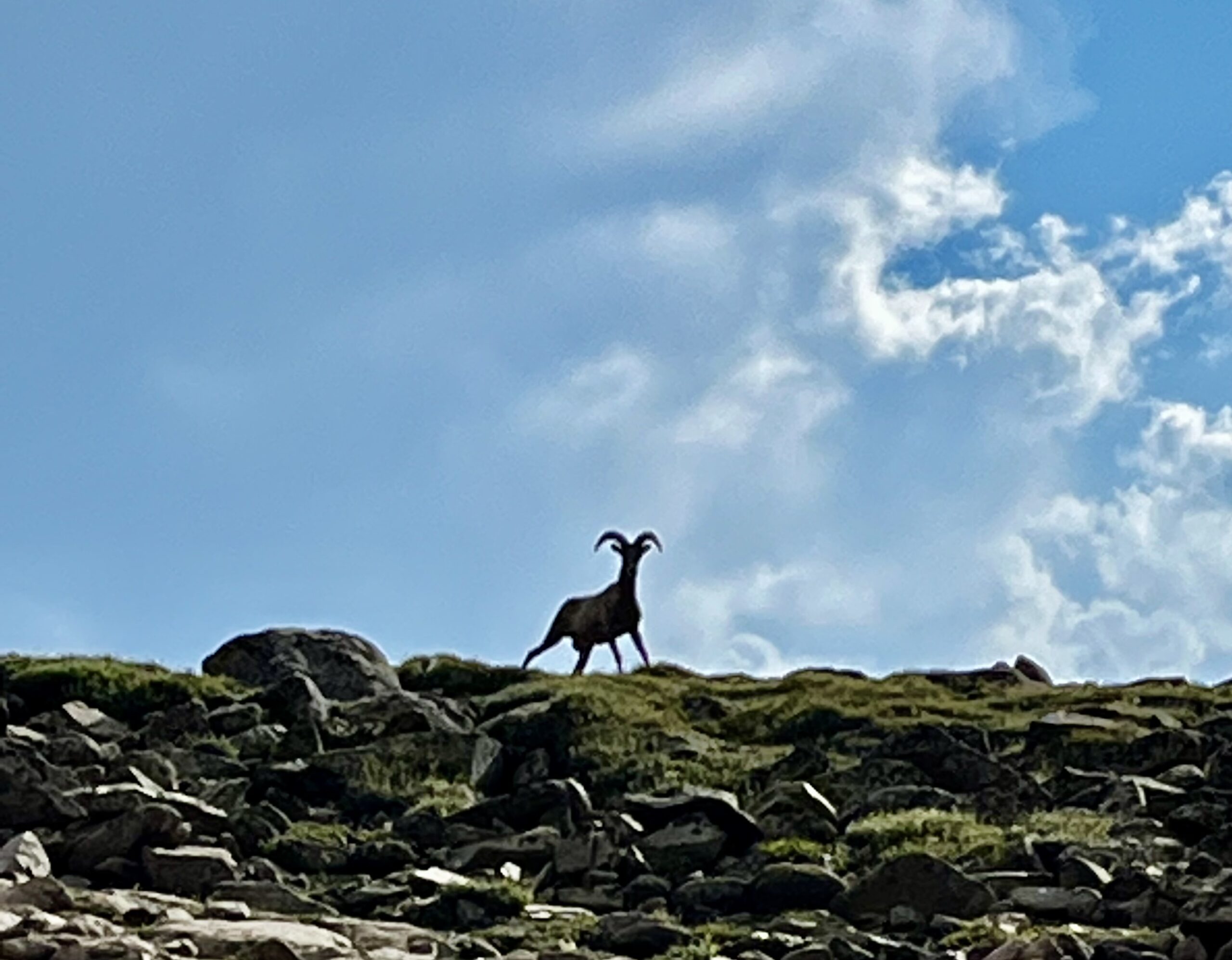
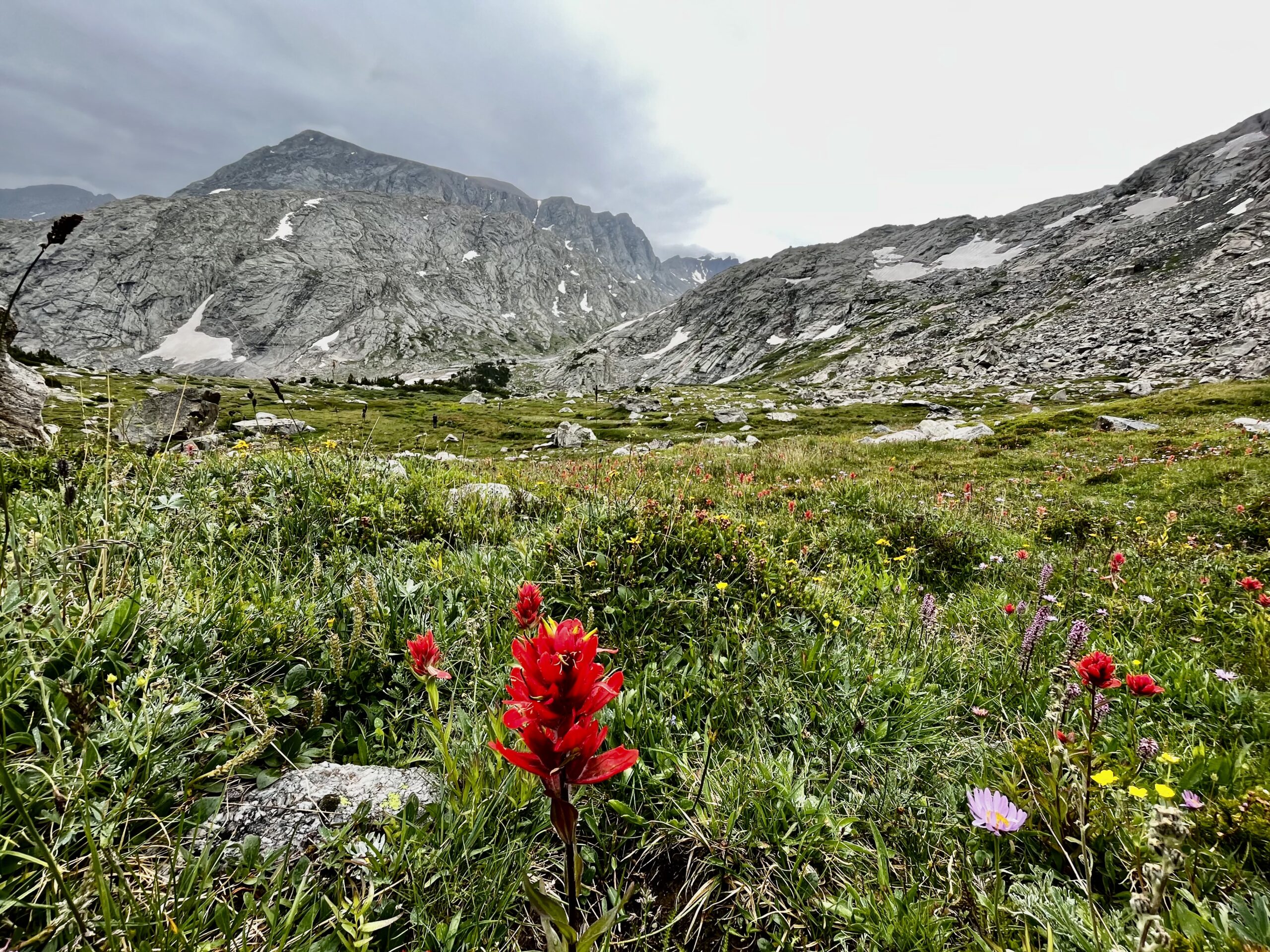
Climbing into the alpine we could see the Gannet Cirque and Downs Mountain. Hiking in the east required long walks through old-growth forests to reach views. The grand western landscape was beyond comparison for us. There was minimal water, so we refilled whenever we could. Our navigational skills were rusty, and we contoured poorly, repeatedly climbing more talus than we strictly needed to. We had printed out Skurka’s maps on 7″ by 11″ paper and accidentally recycled the first set in the hotel. There was no reason not to laugh these mistakes off. They would just add to the adventure!
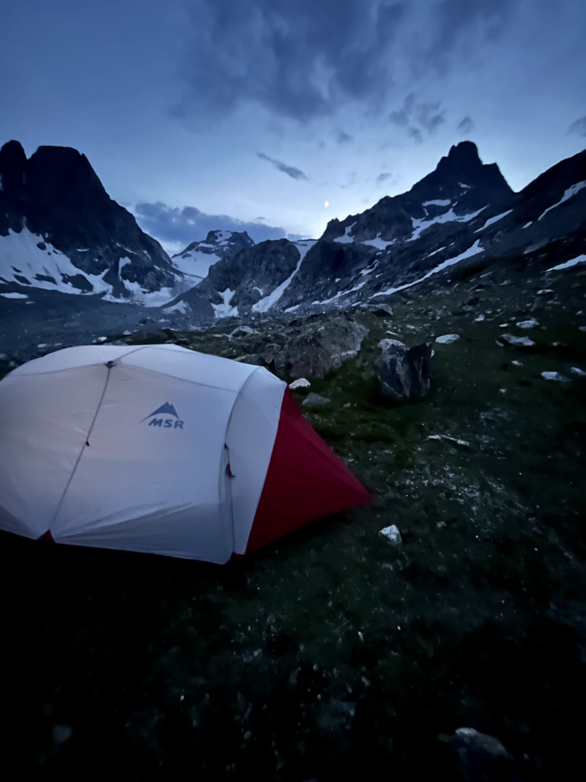
It was good hiking, but I had started to feel altitude sickness that even the views could not cure. Unfortunately, the only unexposed camping was after No Mans Pass, but the weather was clear. Goat Flats was a field of talus at a slight incline. We needed to reach the pass, a ridge between two landmasses after the flats. Our slowing pace finally brought us into camp, where we set up quickly. The flats north of Down Mtn are the best-unexposed camping until Iceberg Lake. I was quite nauseous and wasn’t going to put any food down at 12,000 ft, so we went straight into the tent. Besides, storm clouds were rushing in from the south and we were happy to be dry. The storm came in fast with some electricity, but it dried out within fifteen minutes. All other storms we saw on this trip followed the same pattern. The total for the day was 14.5 miles.

DAY 2: FLATS NORTH OF DOWNS MTN TO ICEBERG LAKE
After spending the night at elevation, we were both feeling better. We had hoped to make it to Dinwoody Creek but quickly decided to shoot for Iceberg Lake instead. A shorter day would be in order to get beyond the sickness. Though only five miles, the hike to Iceberg Lake would provide sufficient challenge for the day.
We left camp at 9:30 am. So much for an alpine start! Putting food down was a necessity as we climbed the glacier toward the summit of Downs. Getting enough air was tough, but the snow was soft and perfect for climbing. The talus on the right of the snowfield looked far less appealing. The summit of Downs Mountain was a scree pile that provided a nice view of Klondike Peak to the southwest. On a clear day, many of Wyoming’s ranges can be seen from here.
The descent on the talus was a relief. We were both happy to get to a lower elevation and walking toward the Gannet Cirque felt spiritual. The mountain expanse was like nothing we had ever seen. It was also fun to make some time back on the flats as we approached Klondike Peak.
This may have been my favorite part of the Northern Winds. Our pace felt brisk after the morning’s slog. Near the summit, we had been passed by a woman shooting for the southbound FKT. She was hoping to complete the 90-mile route in 60 hours and had cruised down the mountain by the time we summited.
We followed her footsteps on the snowfields after the flats. Contouring around Yukon Peak was a breeze. We climbed to a pass and crossed a few snowfields before descending some scree toward Klondike Peak.

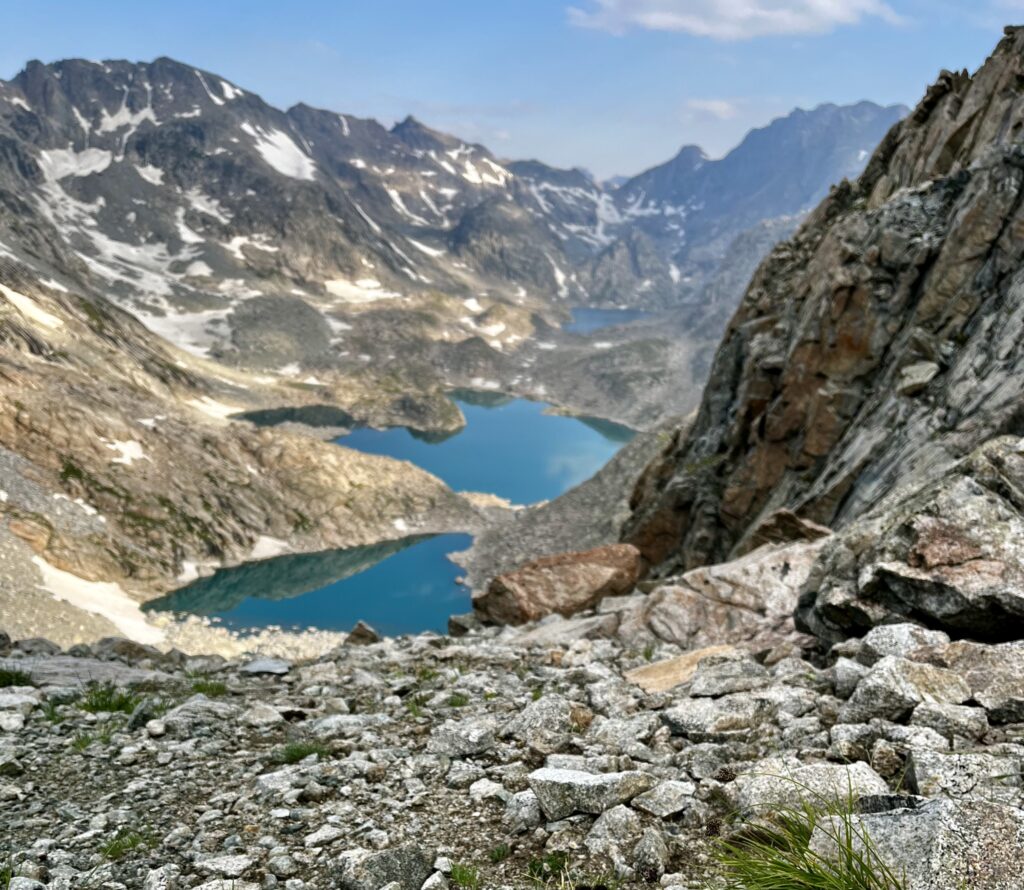
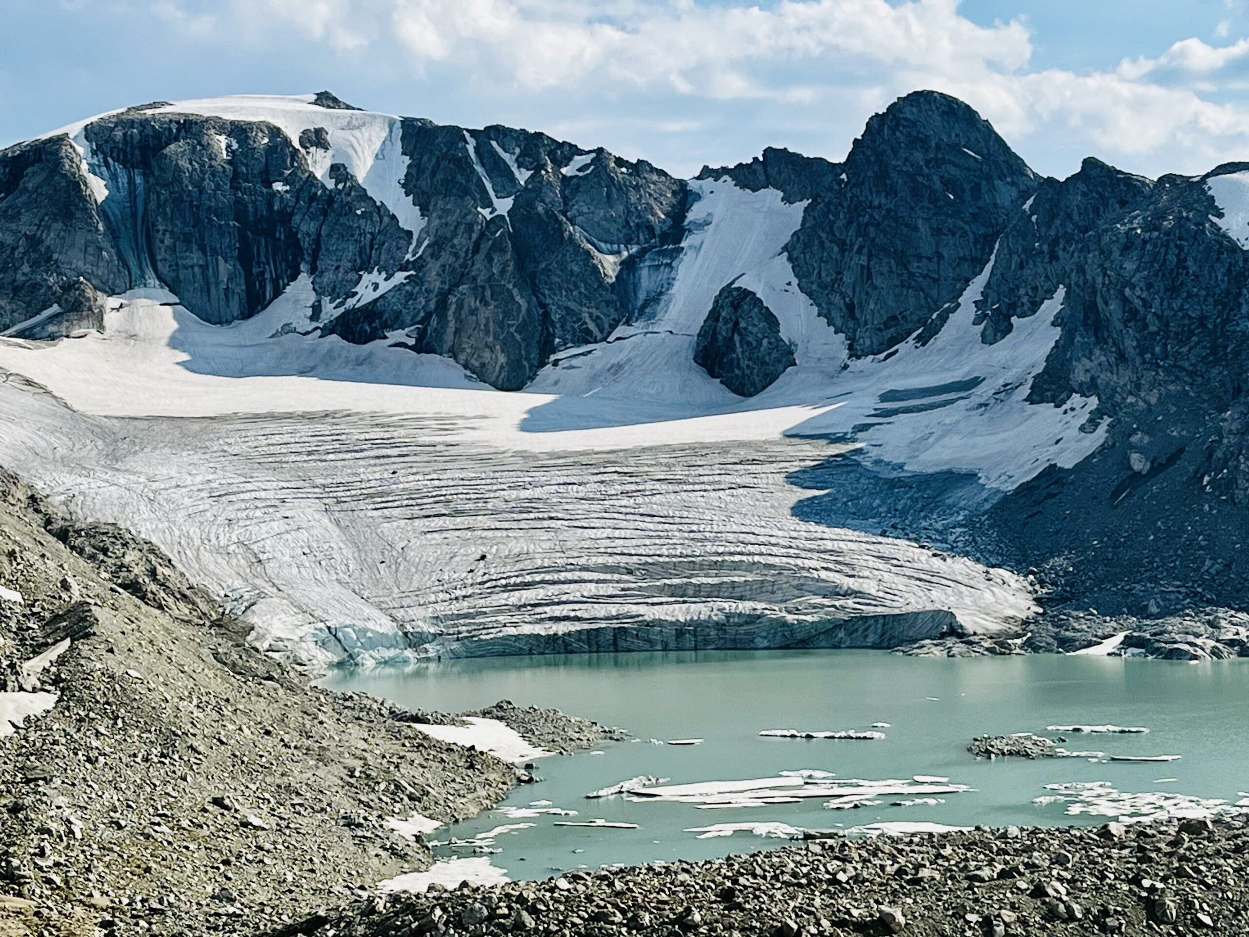
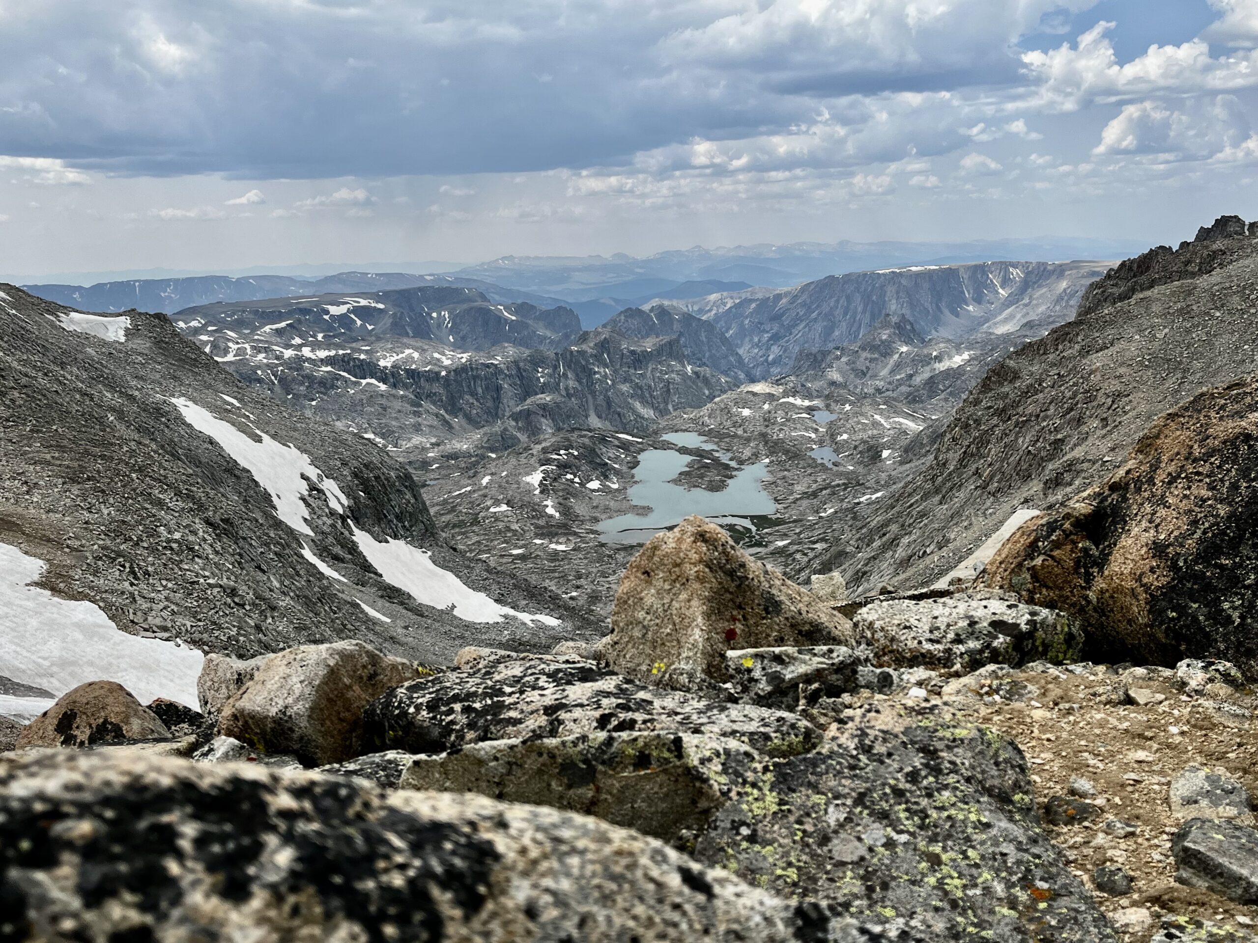
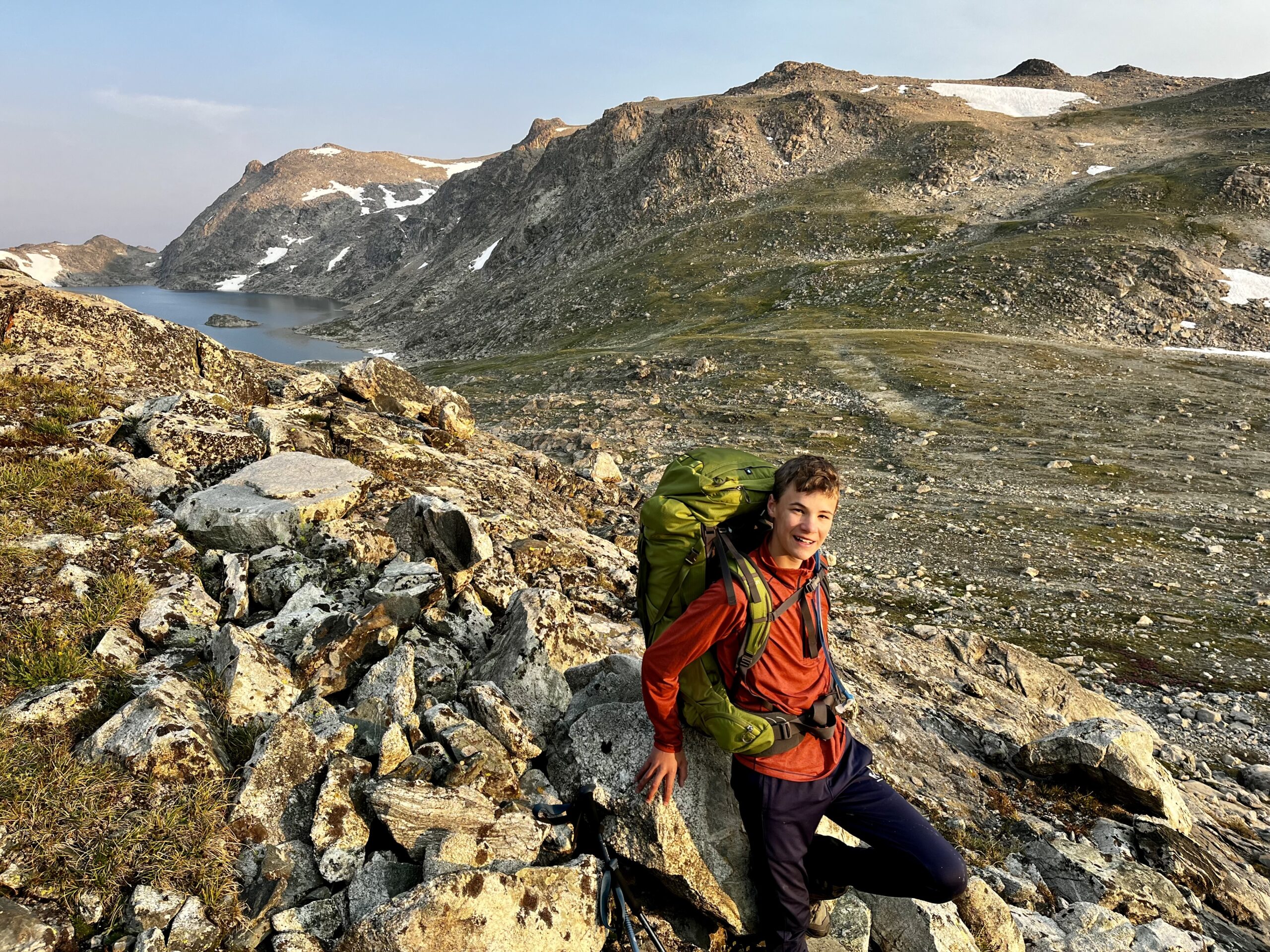
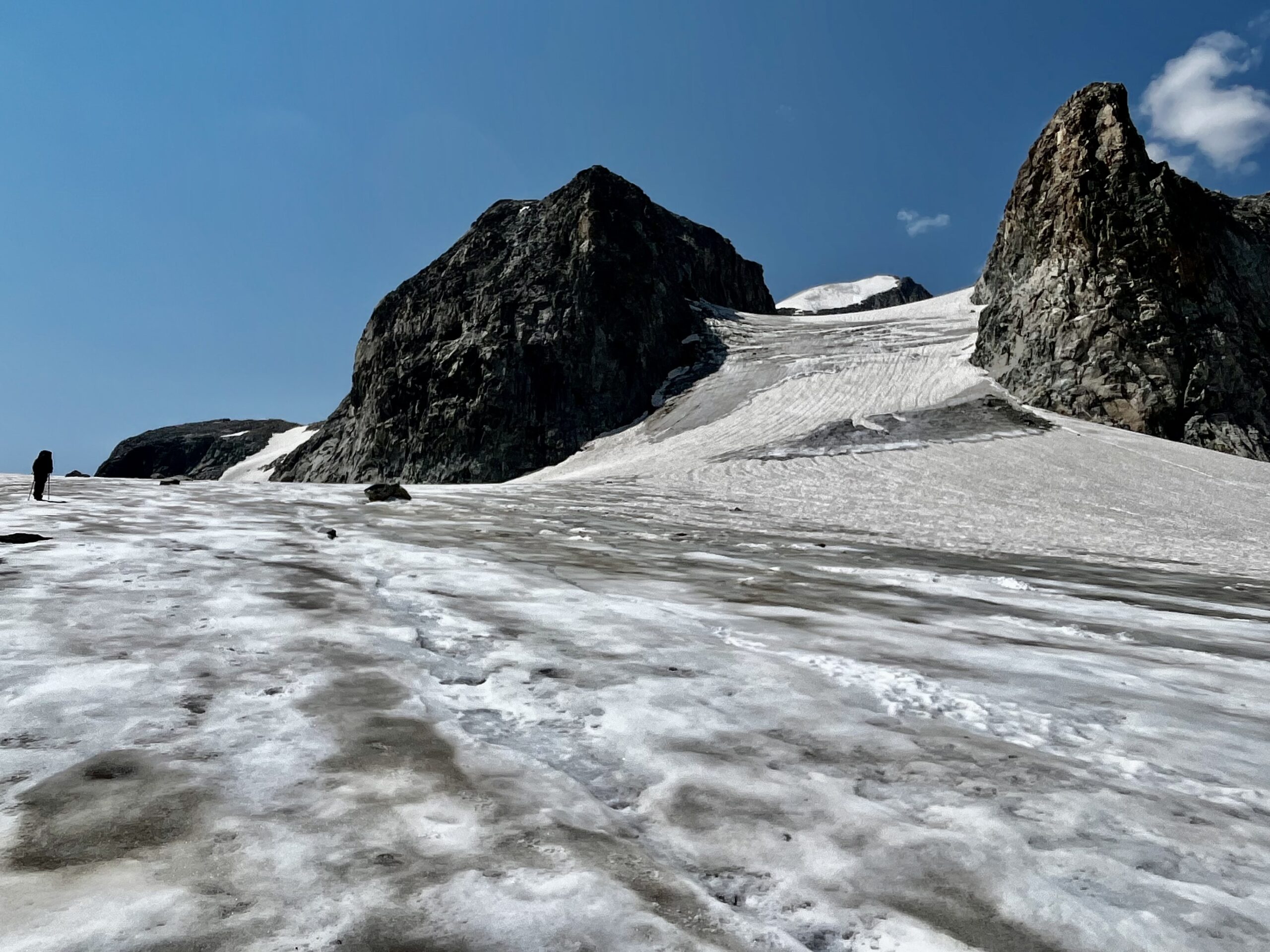
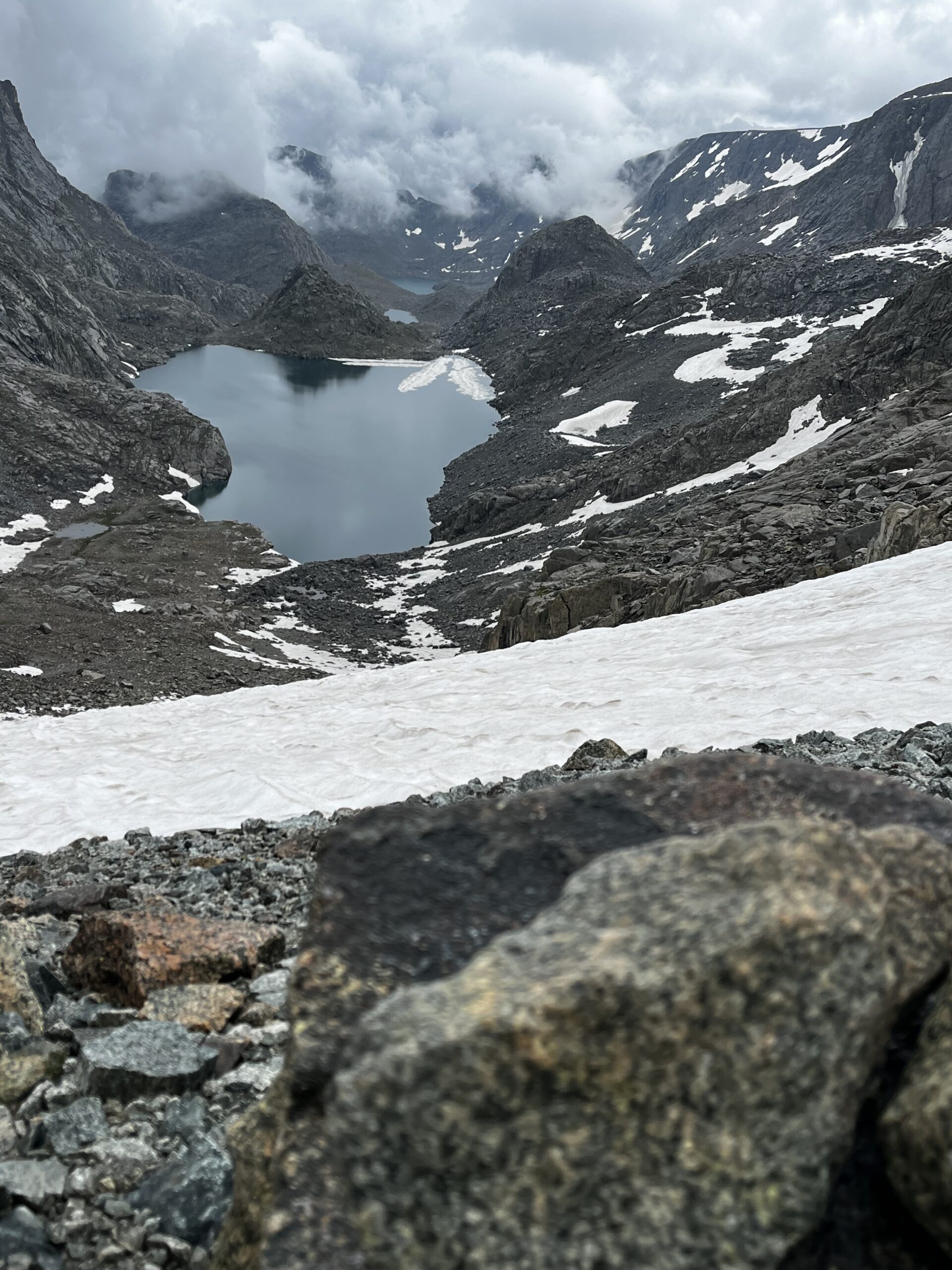
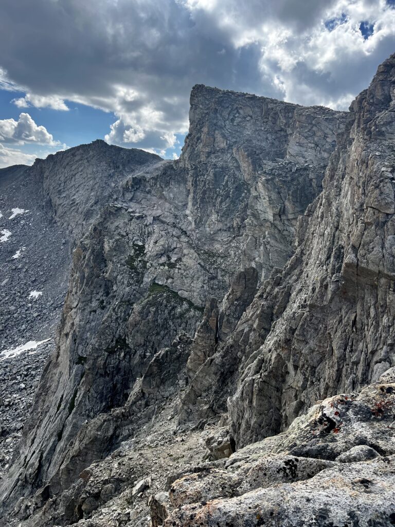
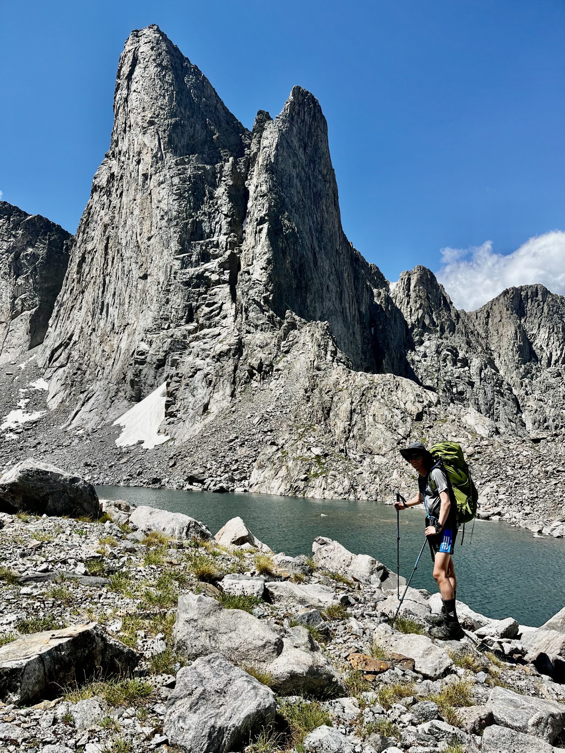
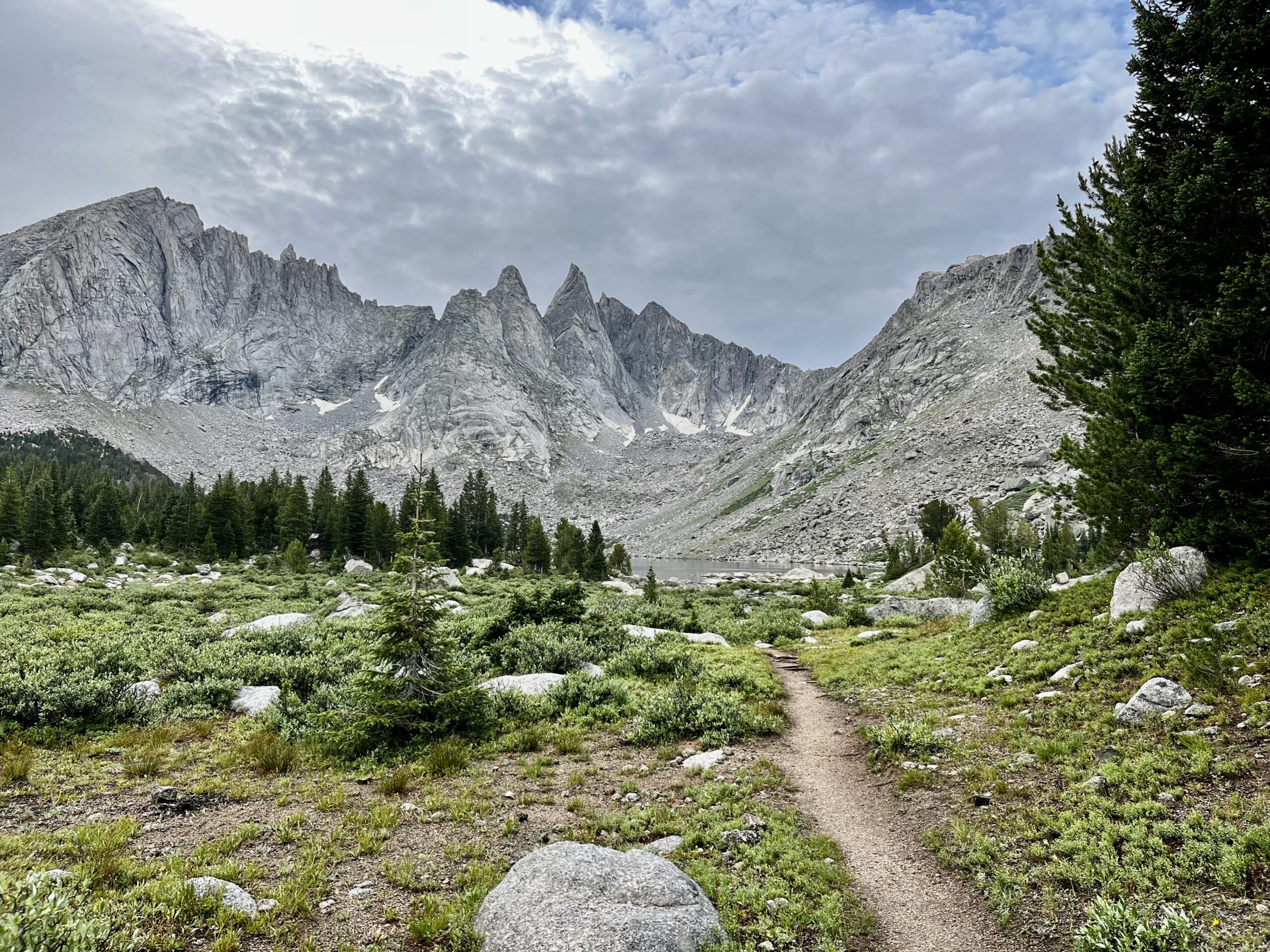
The massive Sourdough Glacier cascades off Klondike Peak into Iceberg Lake. It appears to fold into the lake with one steep ice cliff. How is this in the same state as those plains?

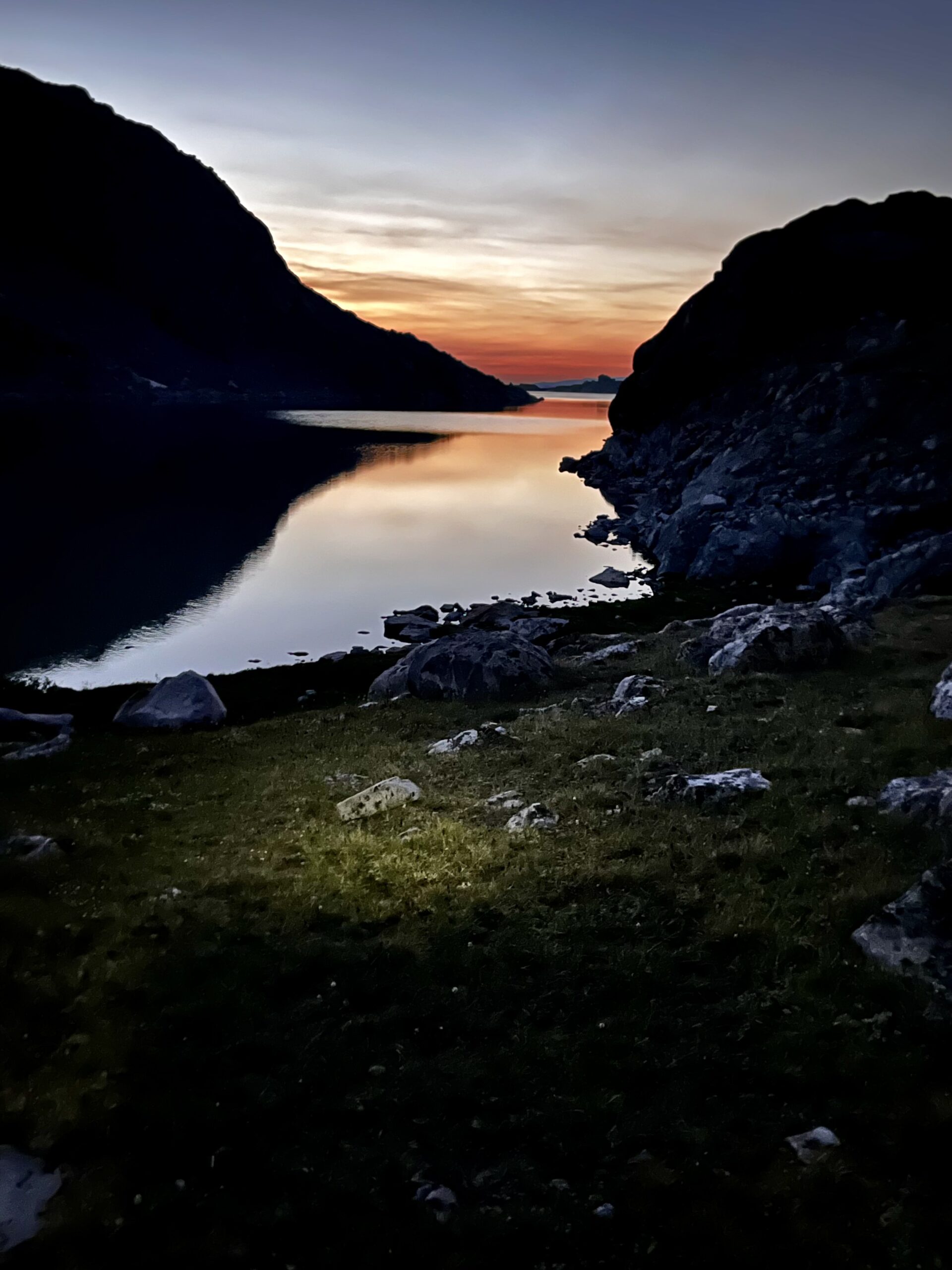
Baker Lake and Iceberg Lake are only 100 ft apart yet they are separated by the continental divide. They are also starkly different colors.
We had planned to camp in the moraine at the base of the next hill, but it looked exposed. Instead, we camped on a grassy slope. Despite the uncomfortable pitch, the views were too good to pass up.

DAY 3: ICEBERG LAKE TO UPPER BULL LAKE CREEK
After checking the maps, we realized we had serious miles to cover to stay on track. We finally got an early start, leaving camp at 7:00 am sharp. The hill on the other side of the basin had looked daunting from our campsite, but it was not a challenging climb.

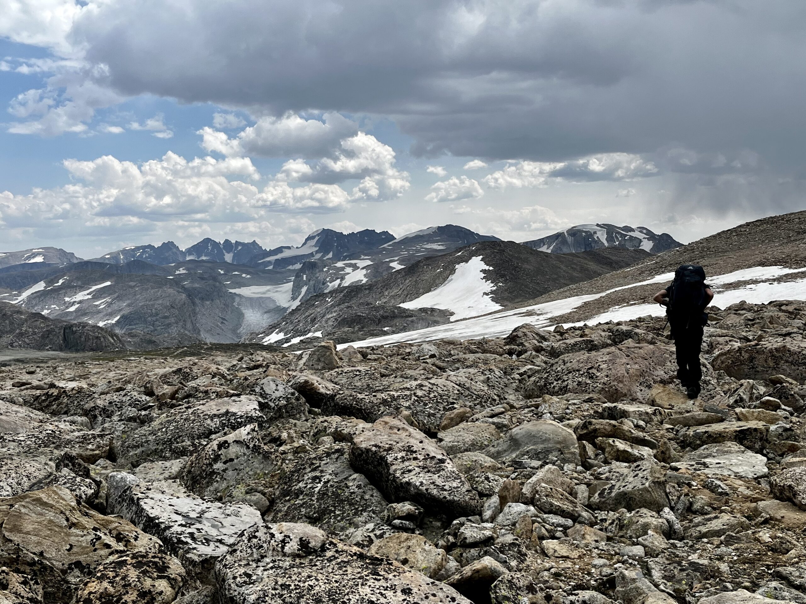
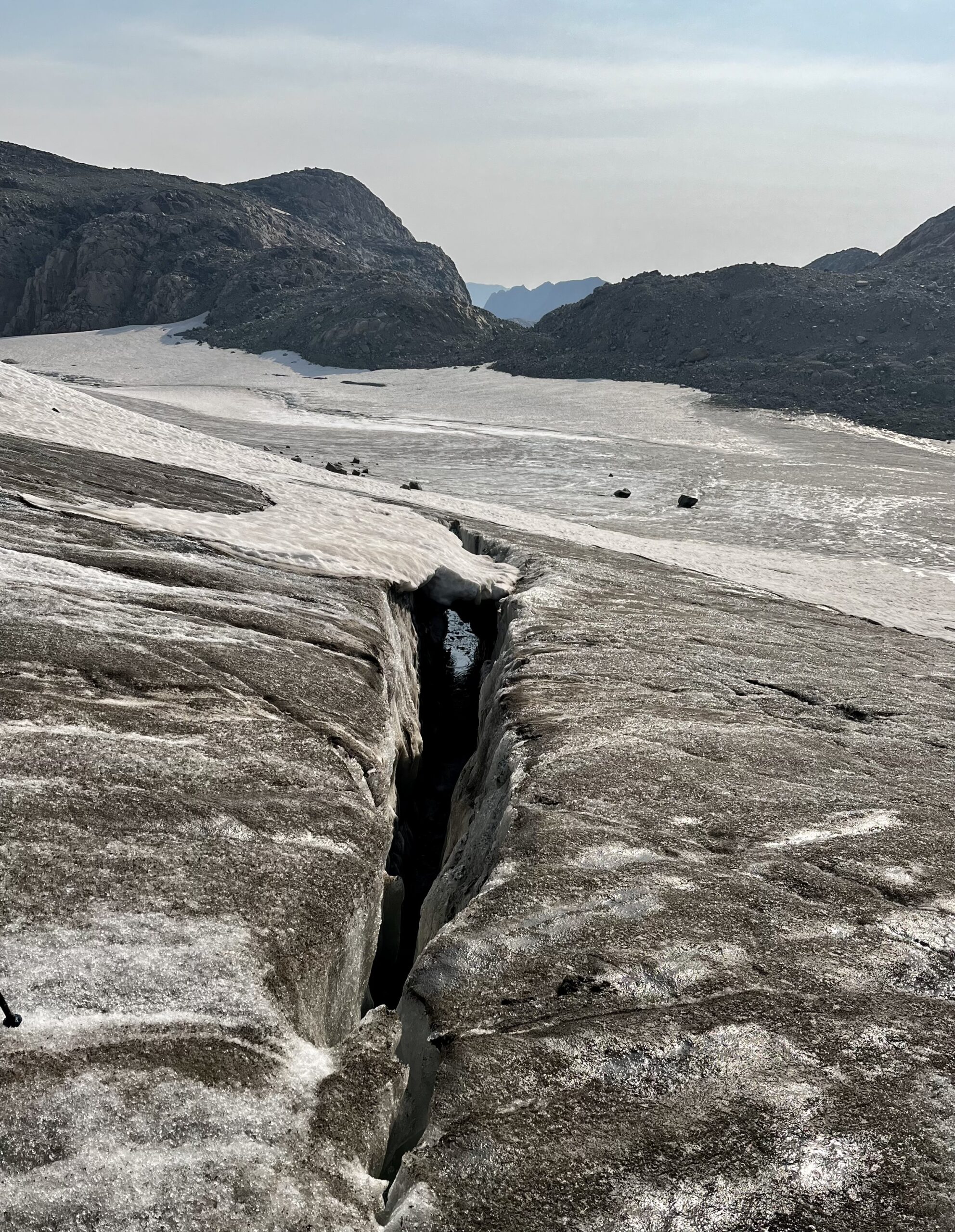
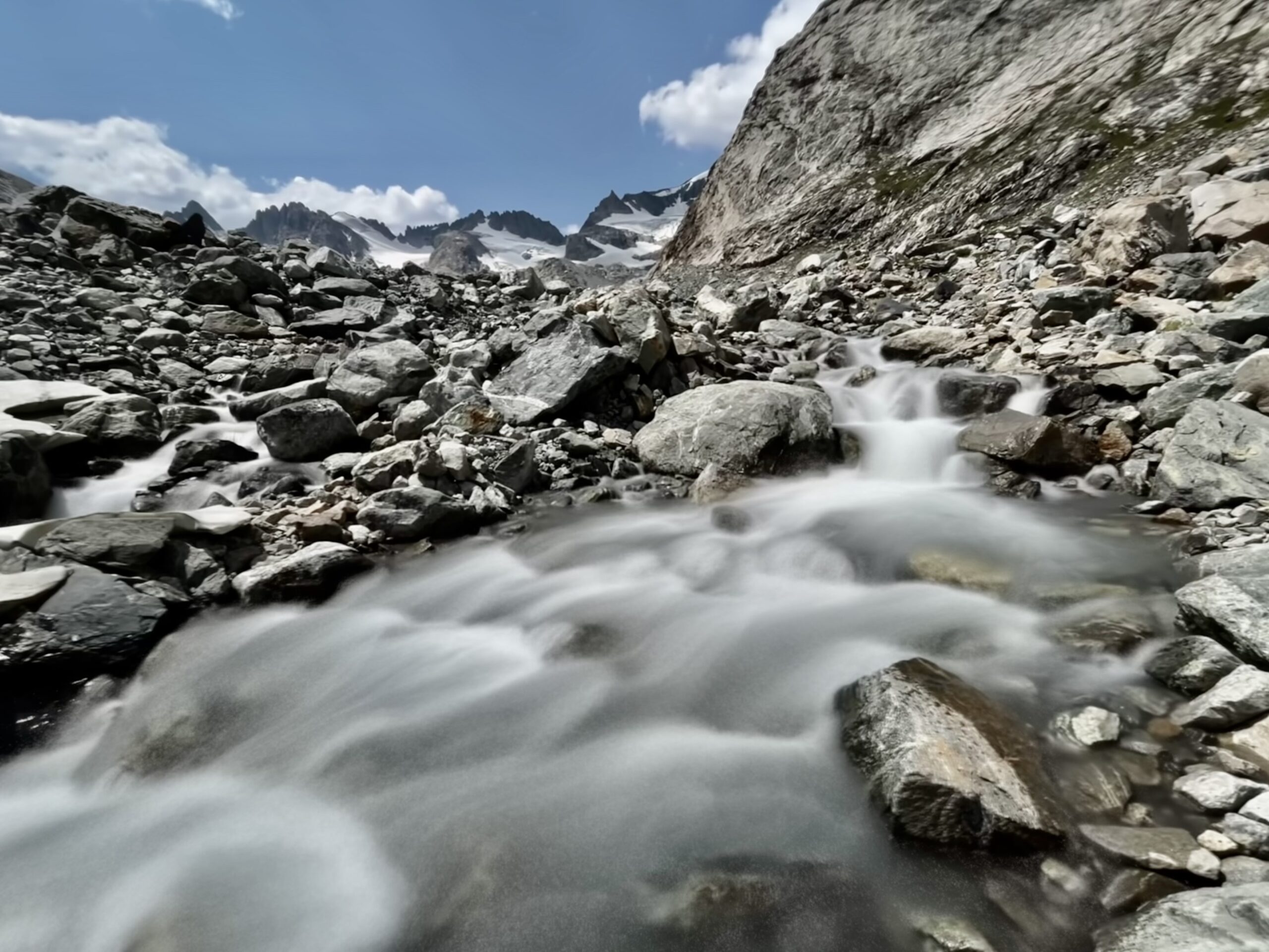
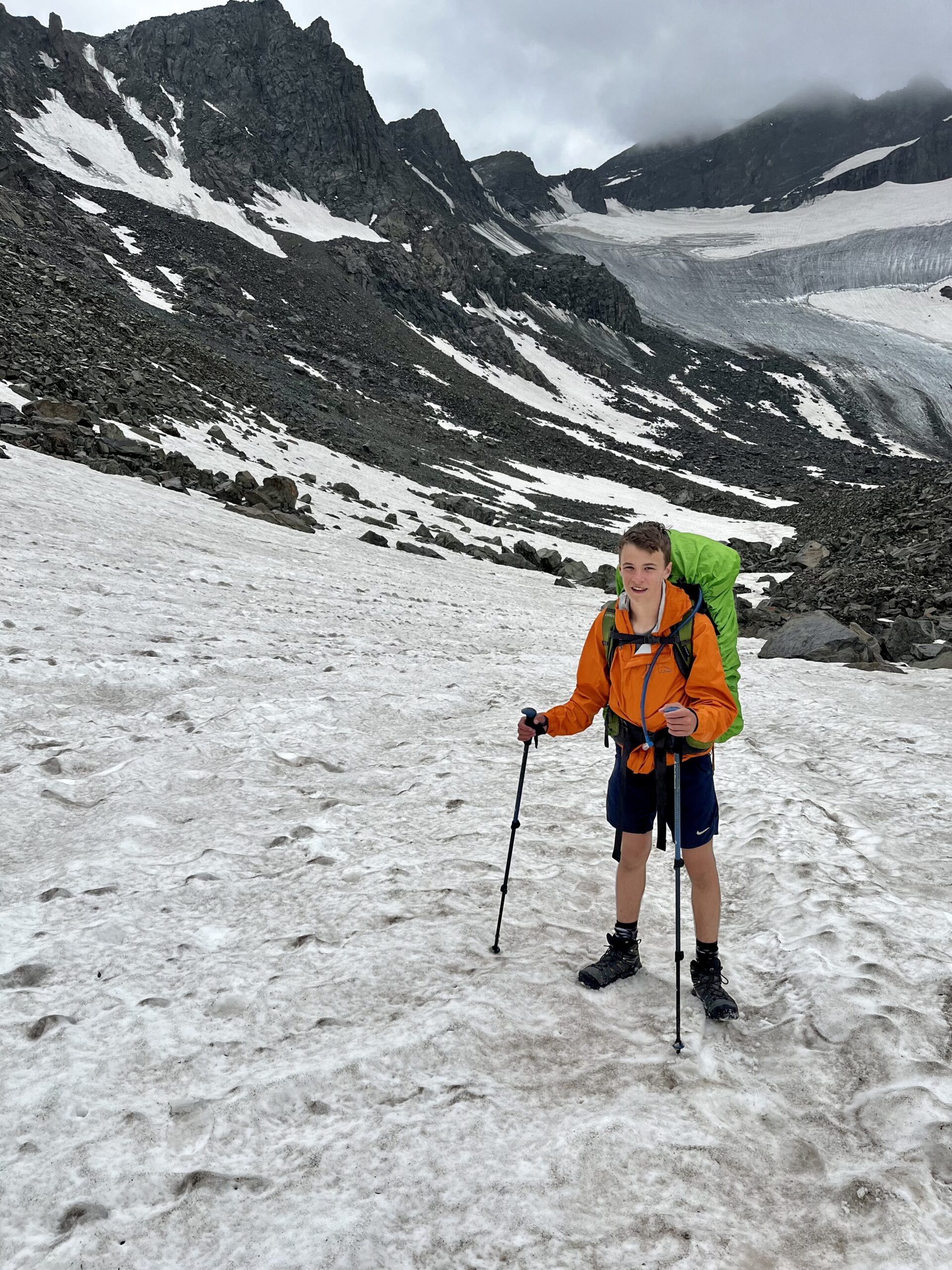
After following the divide on some talus, we reached the Grasshopper Glacier. It was soft enough that we did not need microspikes. There were some fantastic places to boot ski on Grasshopper. After some A+ level navigation on Jim’s part, we reached a melting glacier. It was devastating to see those monuments of ice turning into wet slush. We could see the space they had previously occupied compared to their current size. The difference was depressing.
There was a very imposing snow-covered pass up ahead, but first, we had to cross more rock fields and a stream. We regretted not bringing more sunscreen as the sunlit glaciers reflected the bright sun. When we reached the pass, we were delighted to find our FKT friend’s footsteps leading a practical route up the glacier. After crossing the snow field using the deepest foot holds possible, we had a quick class three scramble on some scree. Then, there was a steep ski down onto the Gannet Glacier.
The morning was heating the glacier underfoot. Streams of water crossed our path making travel more interesting. After one more gradual climb, we (elegantly) scree-slid into the cirque.
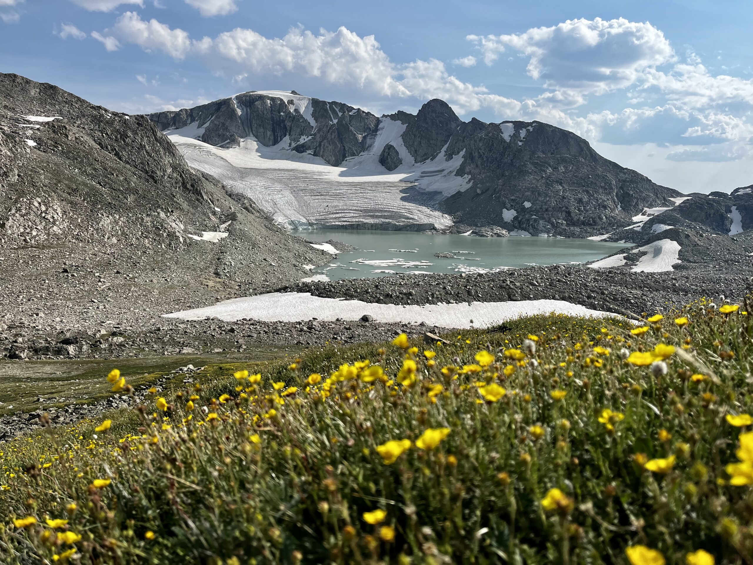
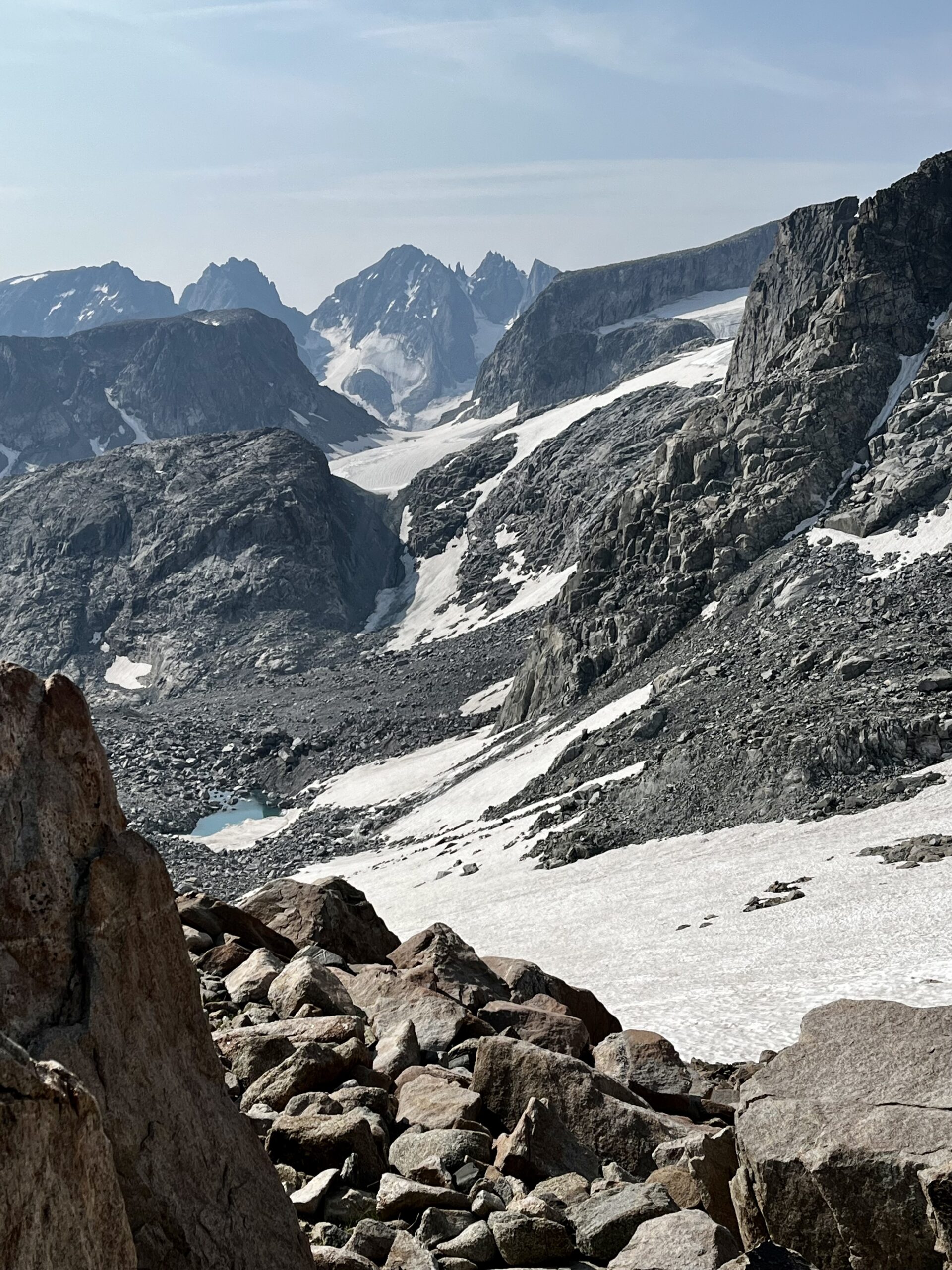
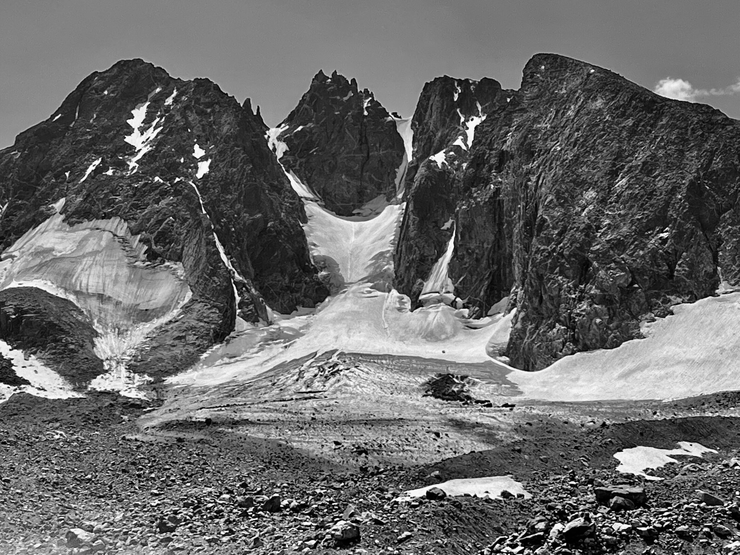
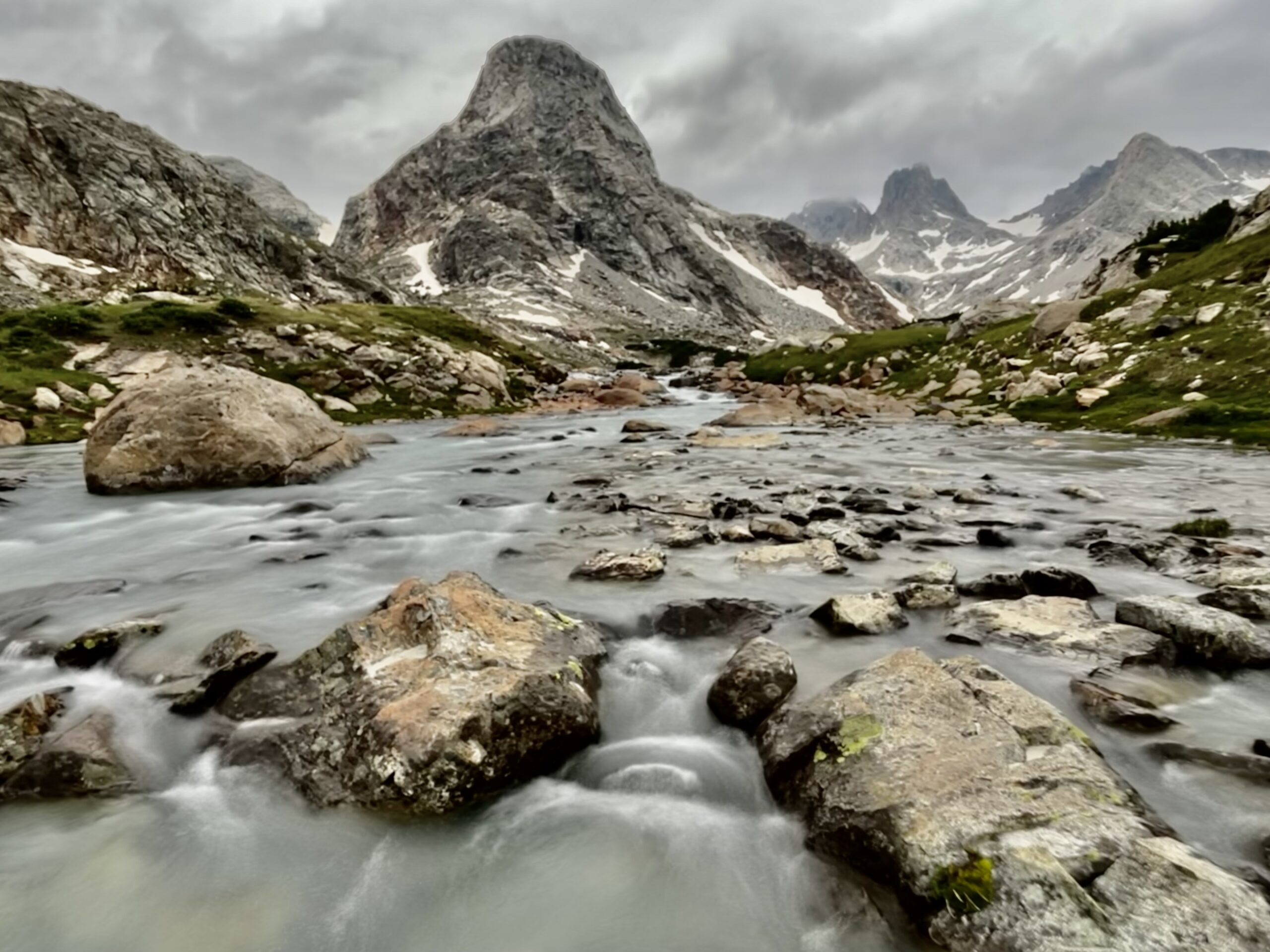
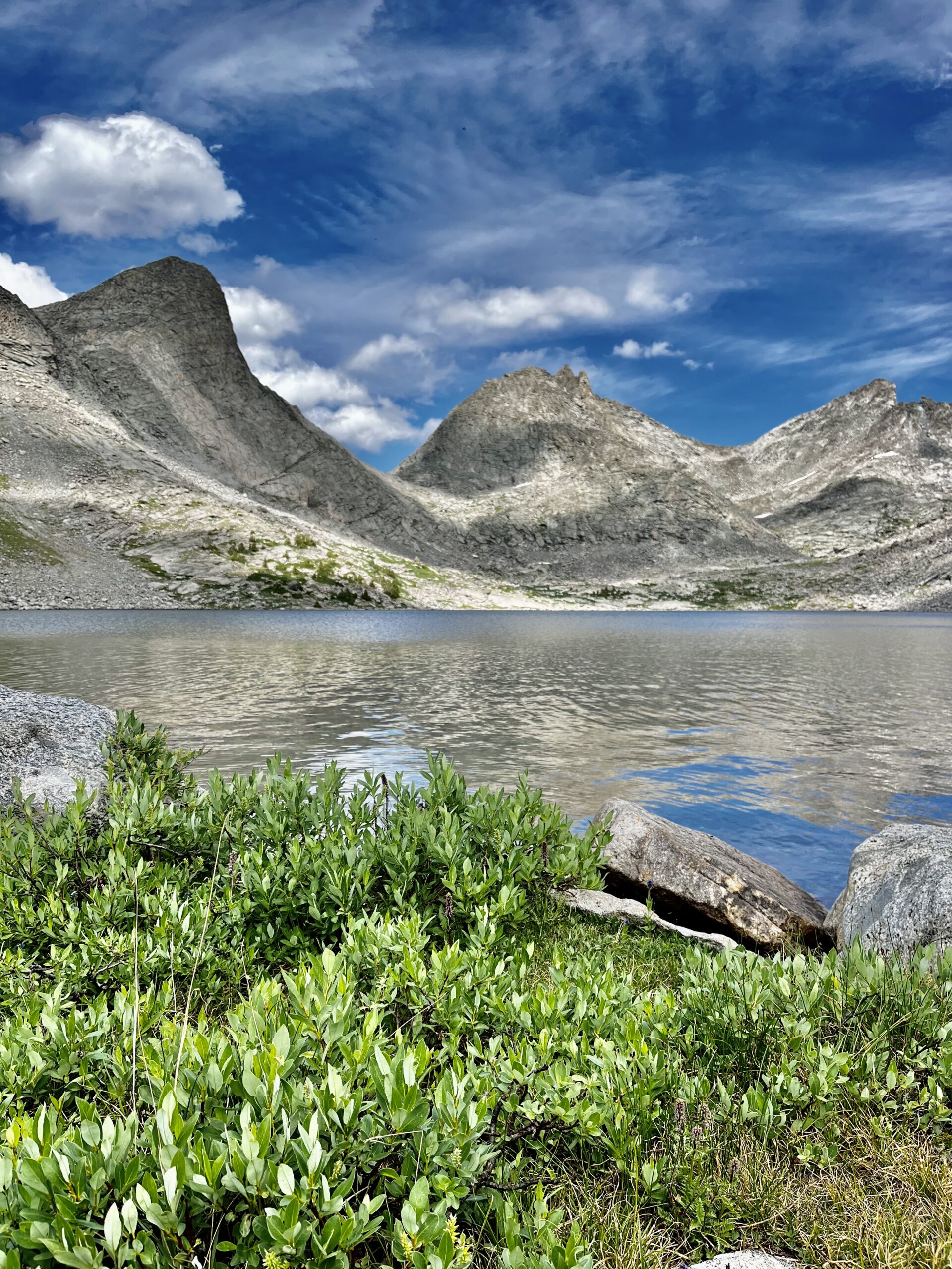
The Gannet Cirque was incredible. Dramatic 13ers surrounded us 300 degrees around. The other space was occupied by the moraine drainage we planned to cross. Each mountain had massive glaciers and waterfalls crashing down into the cirque.

We ate lunch by Dinwoody Creek, near where the Glacier Trail enters the cirque. We were behind schedule already, but feeling strong.
Blaurock Pass was over 1000 ft of elevation above our lunch spot. Though the endless scree was physically challenging, we had pleasant views of the cirque. We reached the top and met a couple who looked unsteady from their climb up the other side. Blaurock Pass kills momentum!

It was late afternoon when we finally reached the pass and made the steep descent toward North Bull Lake Creek. There was an enormous alpine bog near the creek, and the bugs were increasingly worsening.
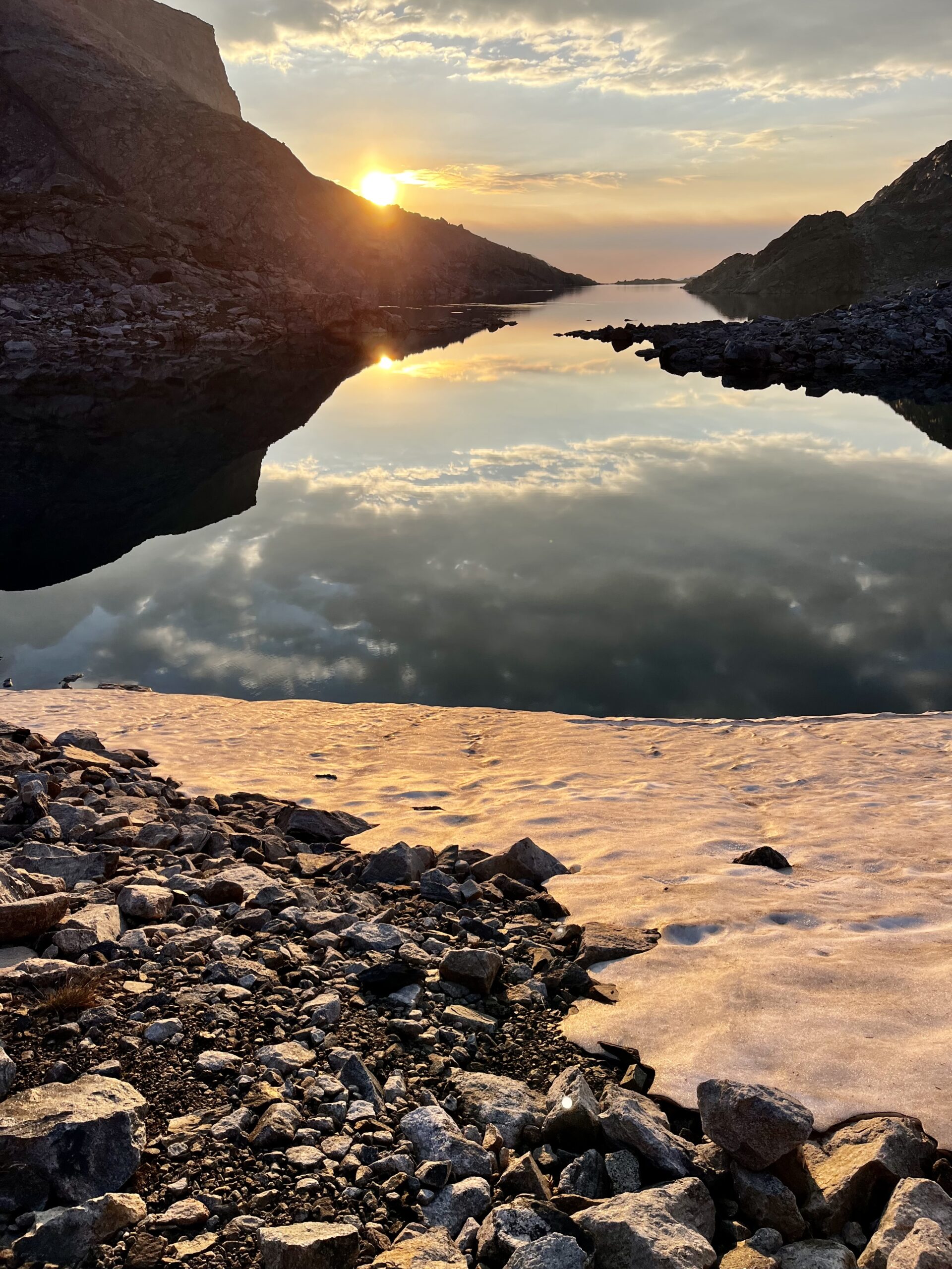
We found a grassy bluff for camp and wasted no time eating and tenting up. My watch read 13.1 miles for the day. I explored the area as the sun went down. There were so many mesmerizing photo opportunities! I almost forgot about my personal bug swarm.
DAY 4: NORTH BULL LAKE CREEK TO ALPINE LAKES
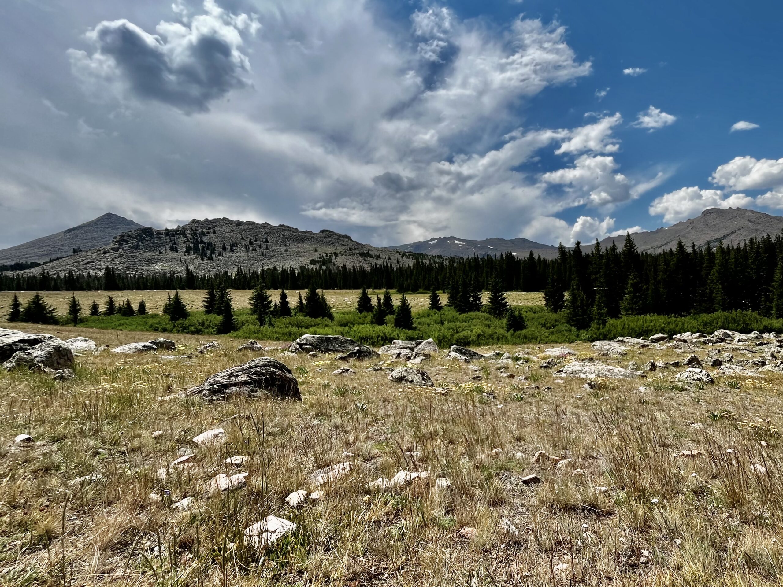
The night was pleasant, but when we left camp the basin was shrouded in fog. We were hiking by 7:30 and quickly rounded the floodplain. According to Skurka’s maps, The Sound of Music was partially filmed here. We could see the resemblance, but they must have shot on a clear, spring day. The flowers were less plentiful and the sky was overcast.
We tried to fjord the stream when we came upon it but ended up having to retrace our steps for a dry crossing. North Bull Lake Creek is the most difficult stream crossing on the route. I recommend resigning yourself to hopping rocks with the possibility of getting wet.
We got our first glimpse of trees (or at least krumholtz), as we descended toward the south fork of Bull Lake Creek. Refreshing!
We walked along the gorgeous South Fork for a while until we found an adequate crossing. We expected to get wet but found a (relatively) dry rock hop.

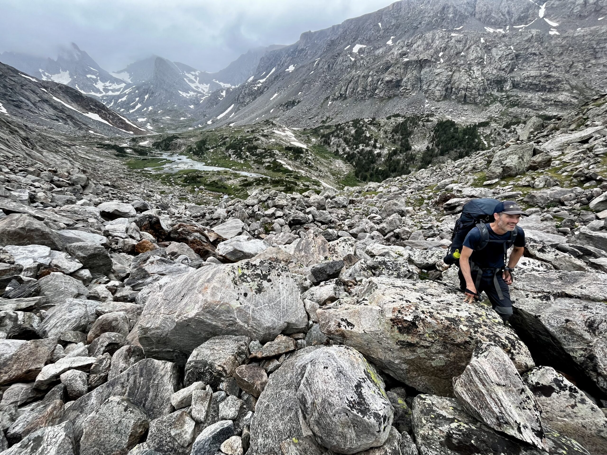
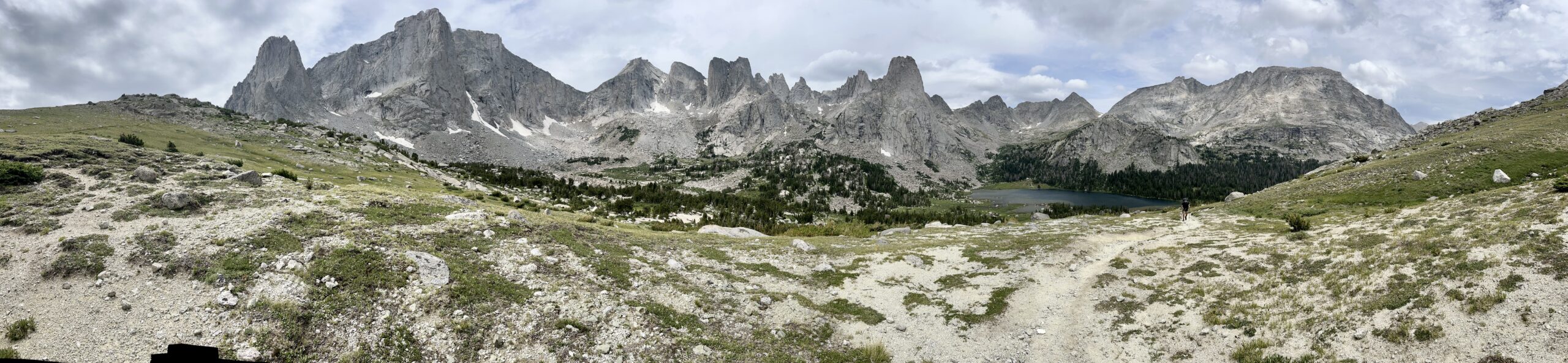
After a slight ascent, we reached some flat talus where we met two groups of hikers. The first was a group of three fit, older men who were hiking the route for the sixth time. They seemed to know their way around, so we asked them about bailing at the Big Sandy Trailhead if we ran out of time. They told us we wouldn’t have trouble getting a ride to Pinedale. The other group was northbound on Adventure Alan’s route. They were making a great time, but missing all those glaciers. There was a goat path winding to the top of the steep scree field leading to Alpine Lakes Pass.
As we came down the pass, the light drizzle turned into full-fledged rain. Traversing around the alpine lakes was far more challenging than it looked on a map. It was unclear which way to hike after the initial snowfield. We climbed up talus to a ledge, reversed our steps to some snowfields, and descended. Then, we were forced to climb down wet, mossy, class three rocks to the boulder field between the upper and middle lakes. We stopped to eat, sheltering from the wind behind a rock. Fifteen minutes later the skies cleared. We contoured down, around the middle lake, and arrived at a walled campsite beneath Douglass Peak Pass after 12.5 miles of hiking.
We could have kept hiking, but we didn’t want to risk exposure to storm clouds building to the south. We ate a relaxed dinner, explored, and sheltered in our tent just before the first drops of rain blew in. Suddenly, we were enveloped in a lightning storm. The campsite abruptly felt highly exposed. We huddled on a sleeping pad as the storm passed directly over us. Weather sure changes rapidly in the Winds!

DAY 5: ALPINE LAKES TO PHOTO PASS
It was a surprisingly restful night. We got an alpine start at first light and booked it towards Douglass Pass.
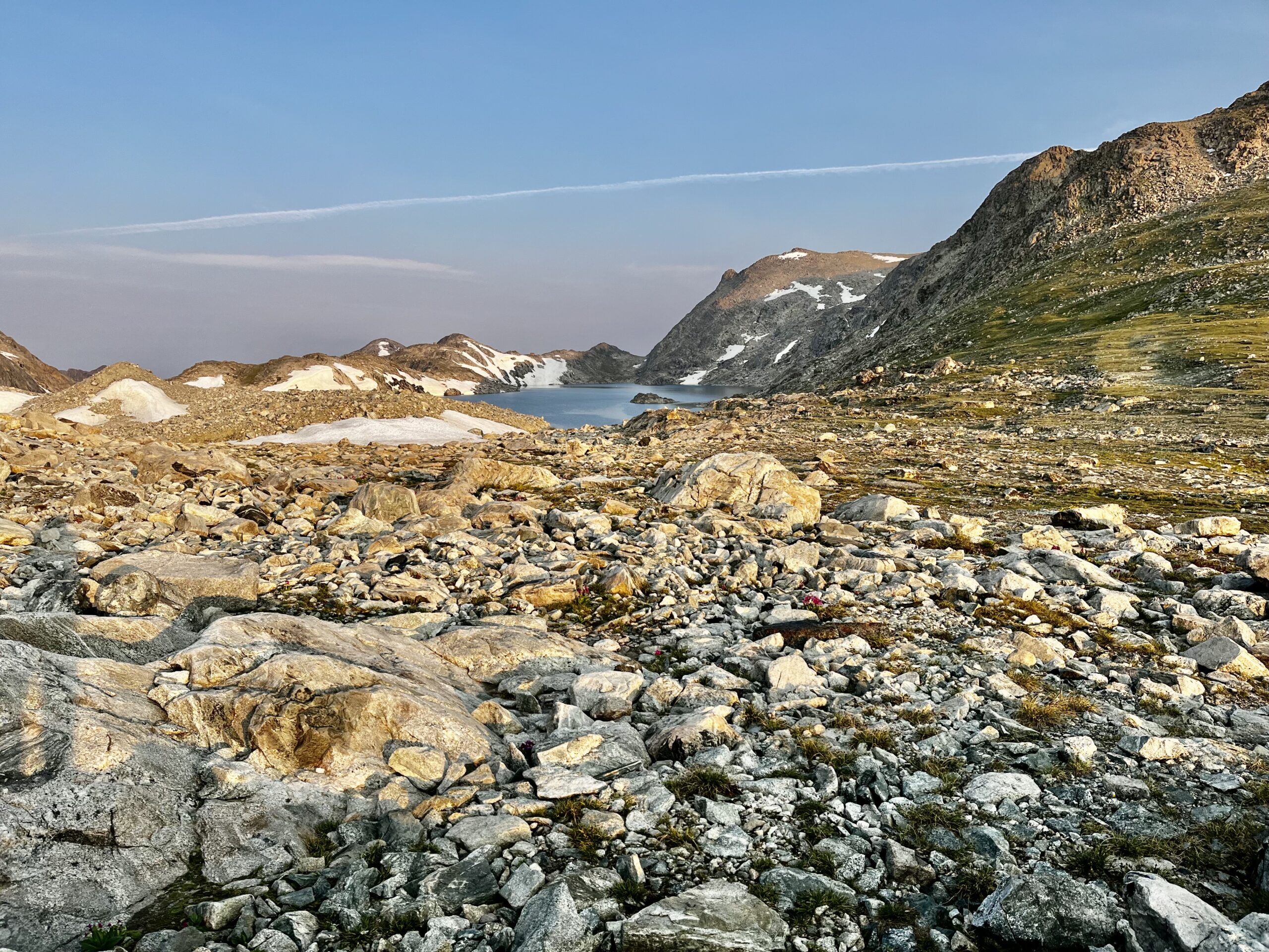
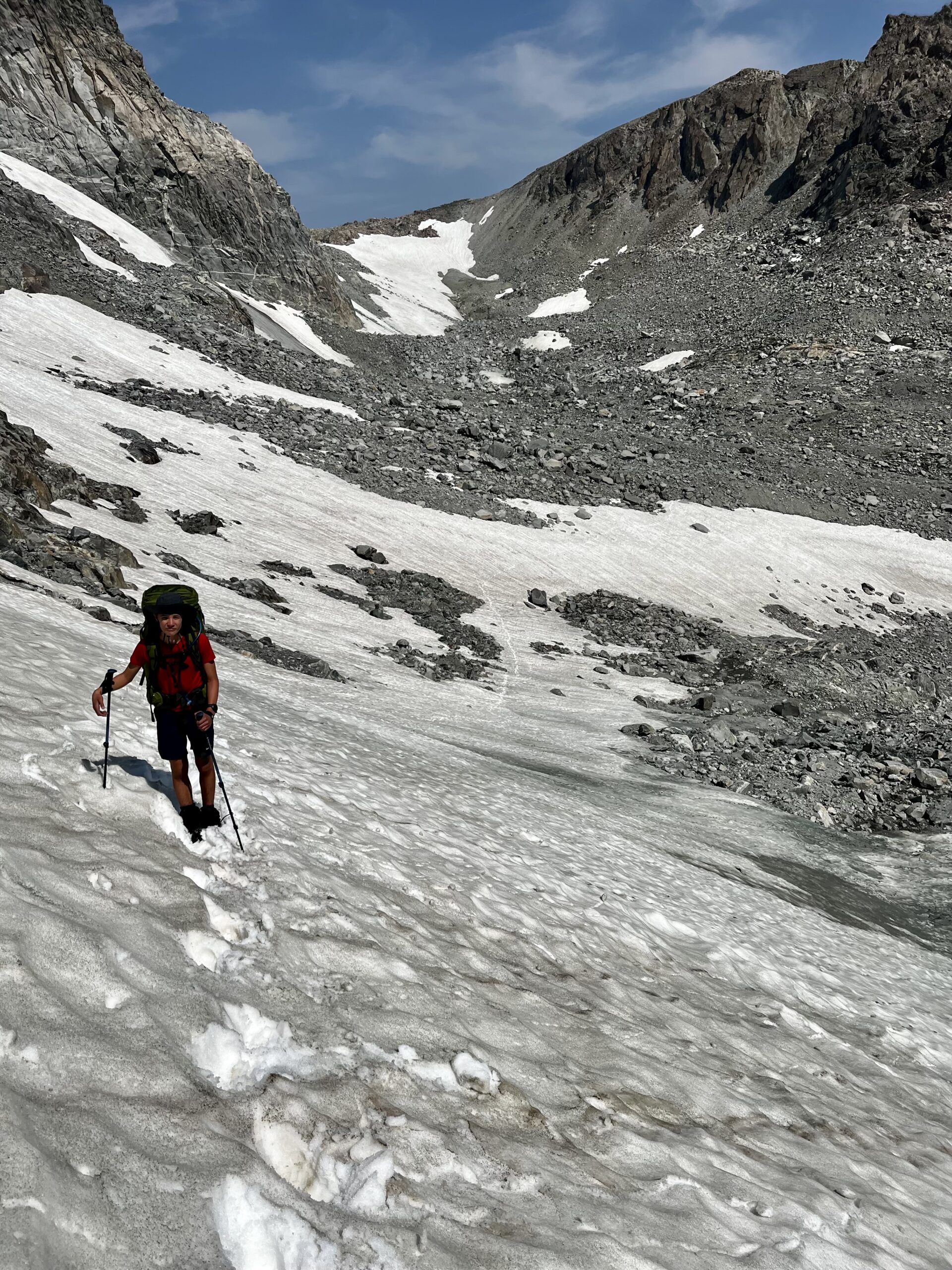
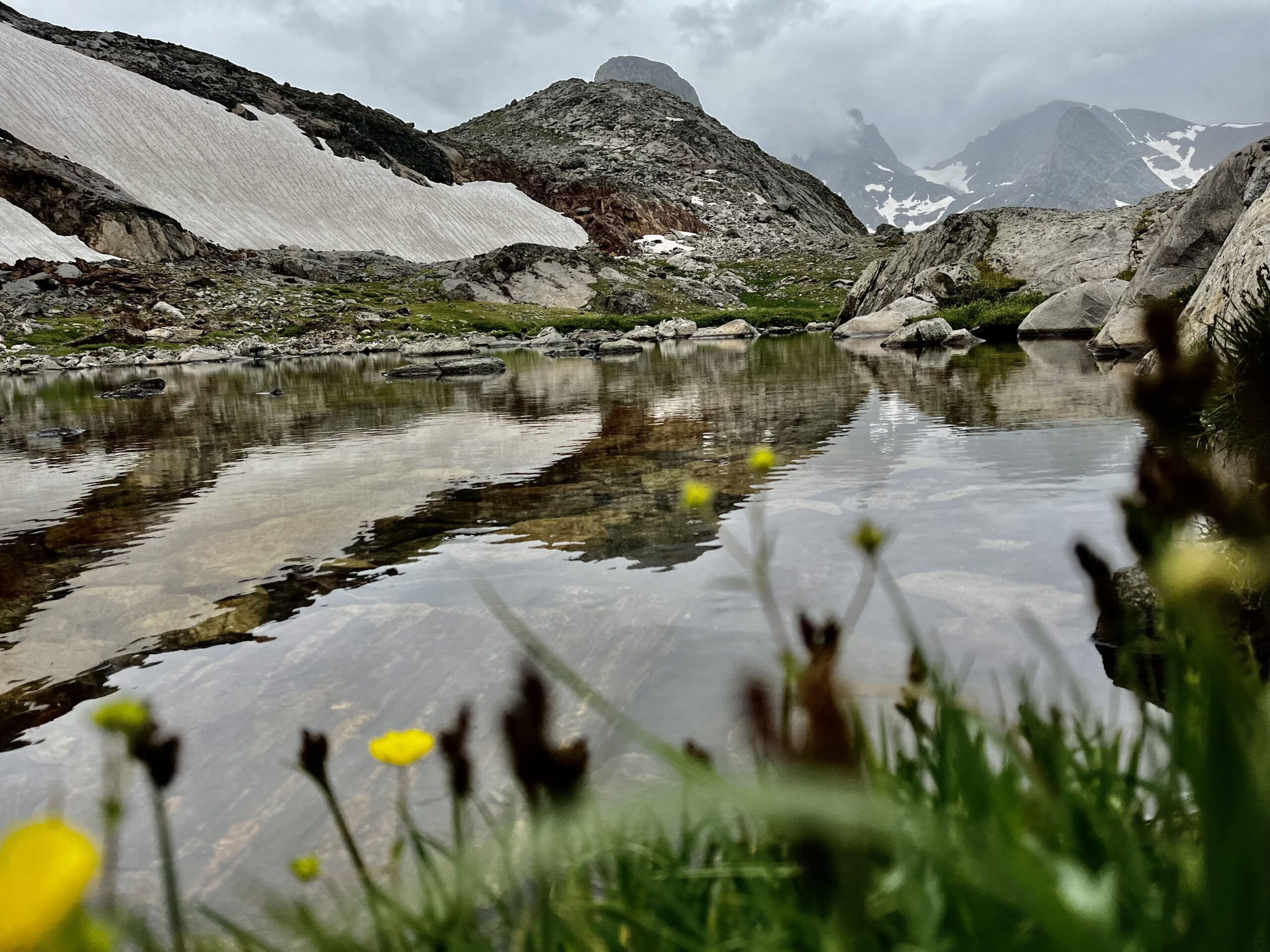
We needed our microspikes for one 50 ft crossing of a snowfield that spilled into the lower lake. The ice was too hard to gain footholds, but with microspikes, we got across with speed. There was a beautiful lake just below the pass.

We hugged hikers left as we climbed the loose scree field spreading out to avoid injury. The descent was so loose it was almost easier to slide down. After contouring around a lake over annoying ankle-grabber talus, we were glad to reach the Hay Pass Trail. Navigating is incredibly rewarding, but following a path is good too. Just before reaching the junction, we met a guy who wanted to know what was in store for him up north. Most of the northbound hikers were uneasy about the harder terrain ahead. We were glad to be heading into a more leisurely section, following a trail through alpine flower gardens toward Golden Lakes.

It was hard to follow the designated trail around the lakes, but deer paths through the woods sufficed. Every time we crossed a stream we would lose the “trail”. I whooped occasionally so we would not surprise any animals. It was relaxing to walk under the shade of trees, but we had to say goodbye to the subalpine terrain when we left the Hay Pass Trail and climbed around some lakes toward Europe Peak.

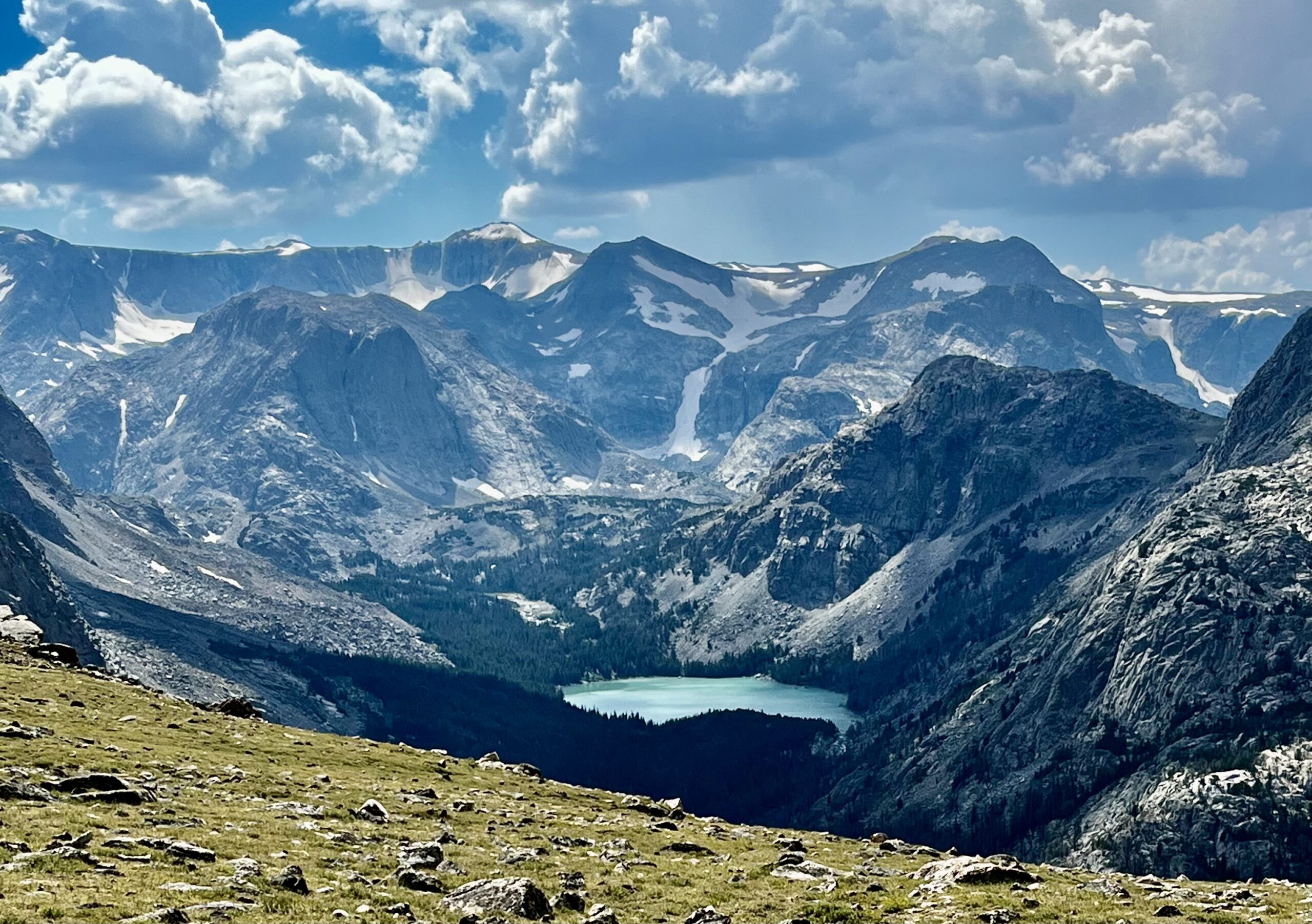
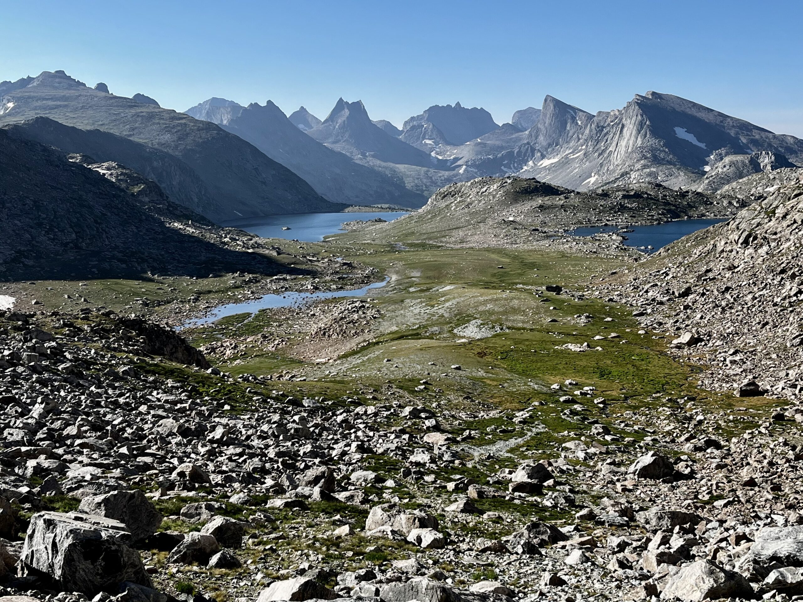
It was nearly a straight line into the alpine, over a tarn, and up to Europe Peak. The climb was gradual, and we made good time despite eating two lunches along the way. We reached our first spot of cell coverage on Europe Peak where we had to make a couple phone calls. Despite our gradual ascent from the north, the southern side yielded a steep dropoff. From Europe Peak, we saw our progress through the northern winds and our destination in the Cirque of the Towers.
We didn’t want to be caught on Europe Peak late, so we descended the breathtaking, “knife edge” promptly after summiting. There was easy climbing off the side into the valley below.

We met some hikers hoping to get to Golden Lakes. They were moving pretty slowly, but after asking us a couple of questions, they decided to continue. We climbed out of the national forest and proceeded toward the Europe Canyon Trail. This area clearly did not get much traffic. We had to slide down some snow, then bushwack through a large lodgepole forest to reach the base of Photo Pass.
We tried to avoid boulder fields and stuck to deer paths until we reached a clearing near the base of the pass. There was optimal camping there. It was 8:40 pm, so we set up camp in record time and ate dinner. We had traveled 18.6 miles over some highly diverse terrain.

DAY 6: PHOTO PASS TO WASHAKIE CREEK
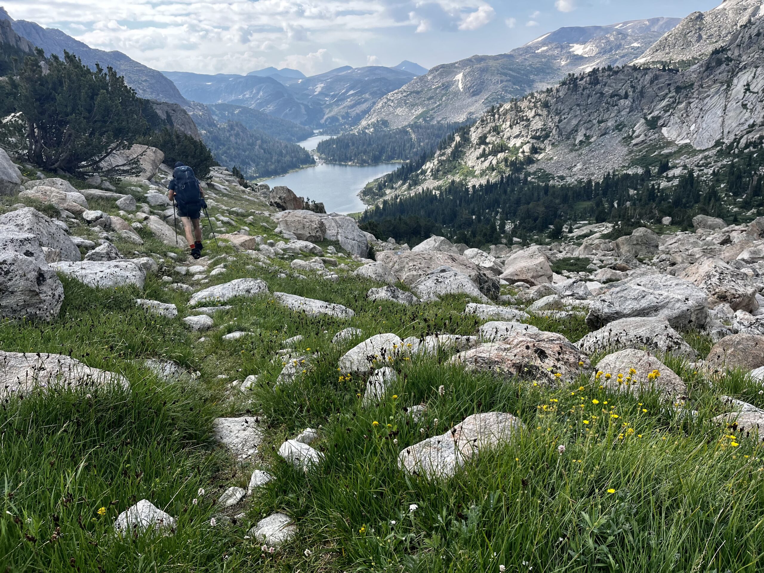
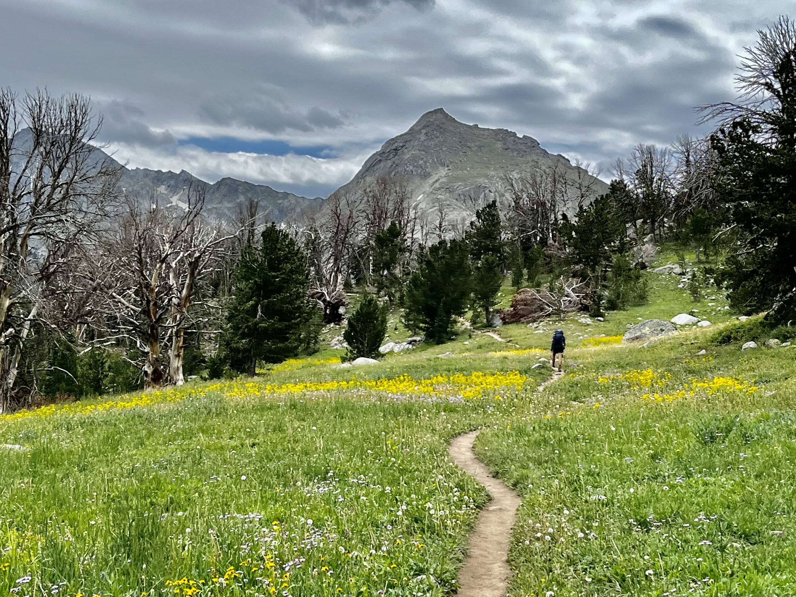
It had been a windy night. We were well sheltered and slept through most of it. We were both excited to have reached the Southern Winds. Once we had gotten through the initial morning sluggishness, we were ready to finally make some good time. We followed the pattern of the past few days, starting off the morning by climbing up a pass. Photo Pass was a breeze with a trail switchbacking up it. At the top, we reentered the national forest land and continued to Middle Fork Lake.

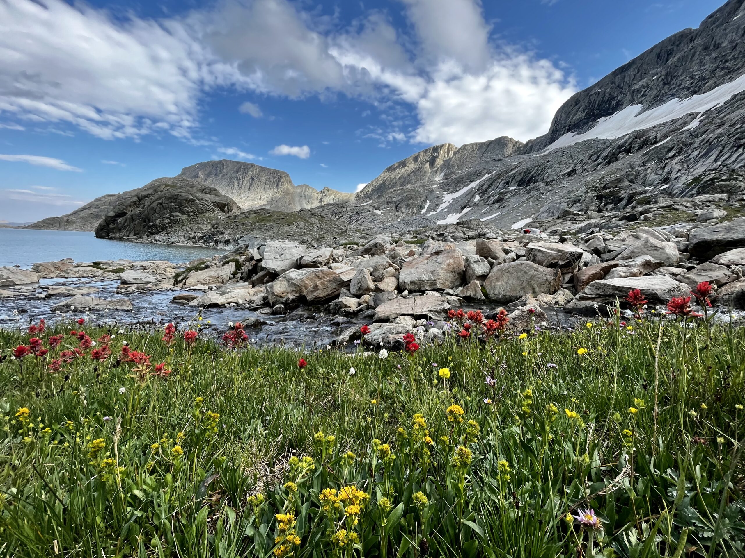
We dropped down a steep bank and turned into a dazzling valley. Dragon Head, Pronghorn, and Nylon Peak are unique and dramatic mountains.
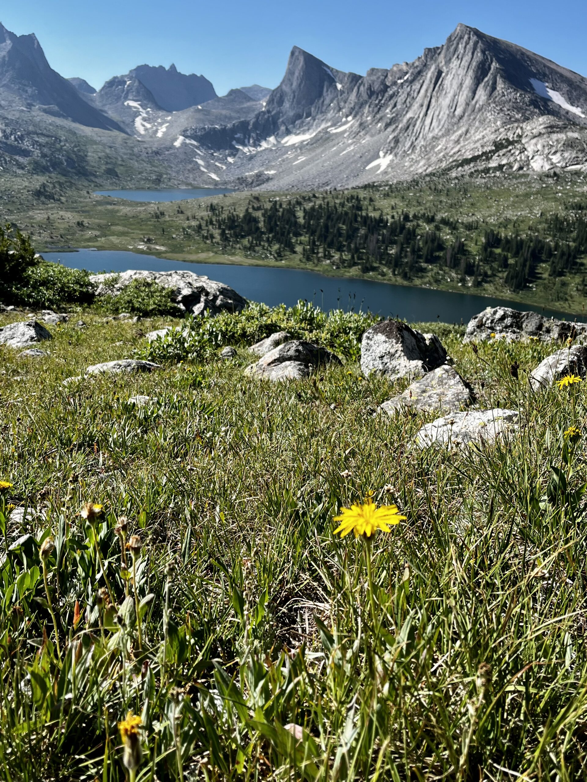
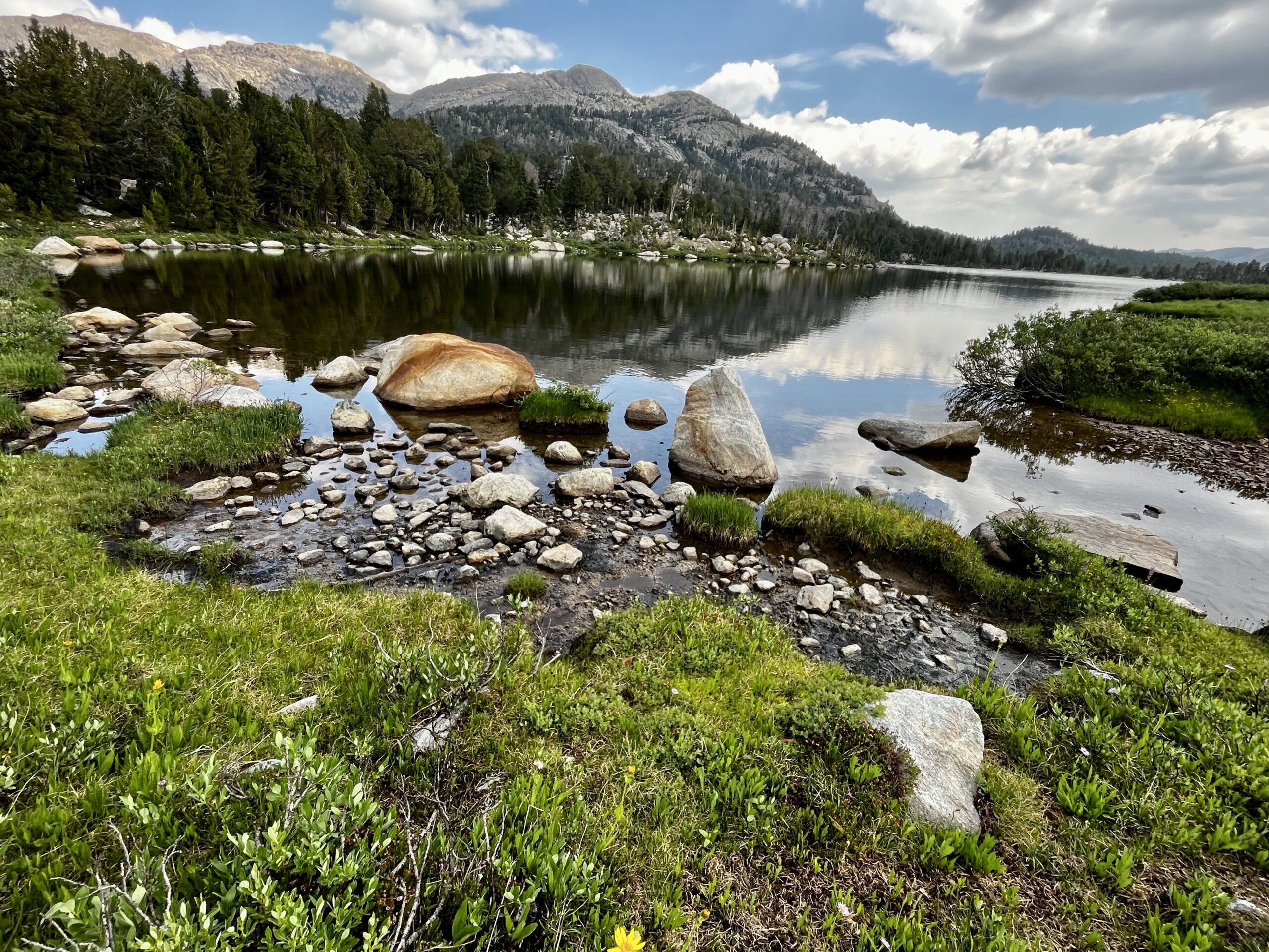
The wildflowers were in full bloom around the Middle Fork and Lee Lakes. The landscape in the basin was so photogenic that we stopped for fifteen minutes to soak up the views and refuel with snacks. It was easy hiking through meadows and up towards Sentry Peak Pass.

We ascended Sentry Peak Pass, then dropped into the Bonneville Basin near Jim Harrower Lake. There was class two on the descent where I somehow rolled both my ankles. We picked up a trail to round the lake and crossed a drainage that offered nice views of the plains near Pinedale. Raid Peak Pass may have been the toughest climb of the route with class three slabs where a fall would cost a lot. After the initial climb, it’s talus and scree to the top. On the other side of the pass, we saw Ambush Peak above three beautiful lakes with steep mountain faces reaching right to the shore. I can see why the winds are a climbing destination. Ambush would be a great climb with proper gear. We joined a path but soon had to leave it.

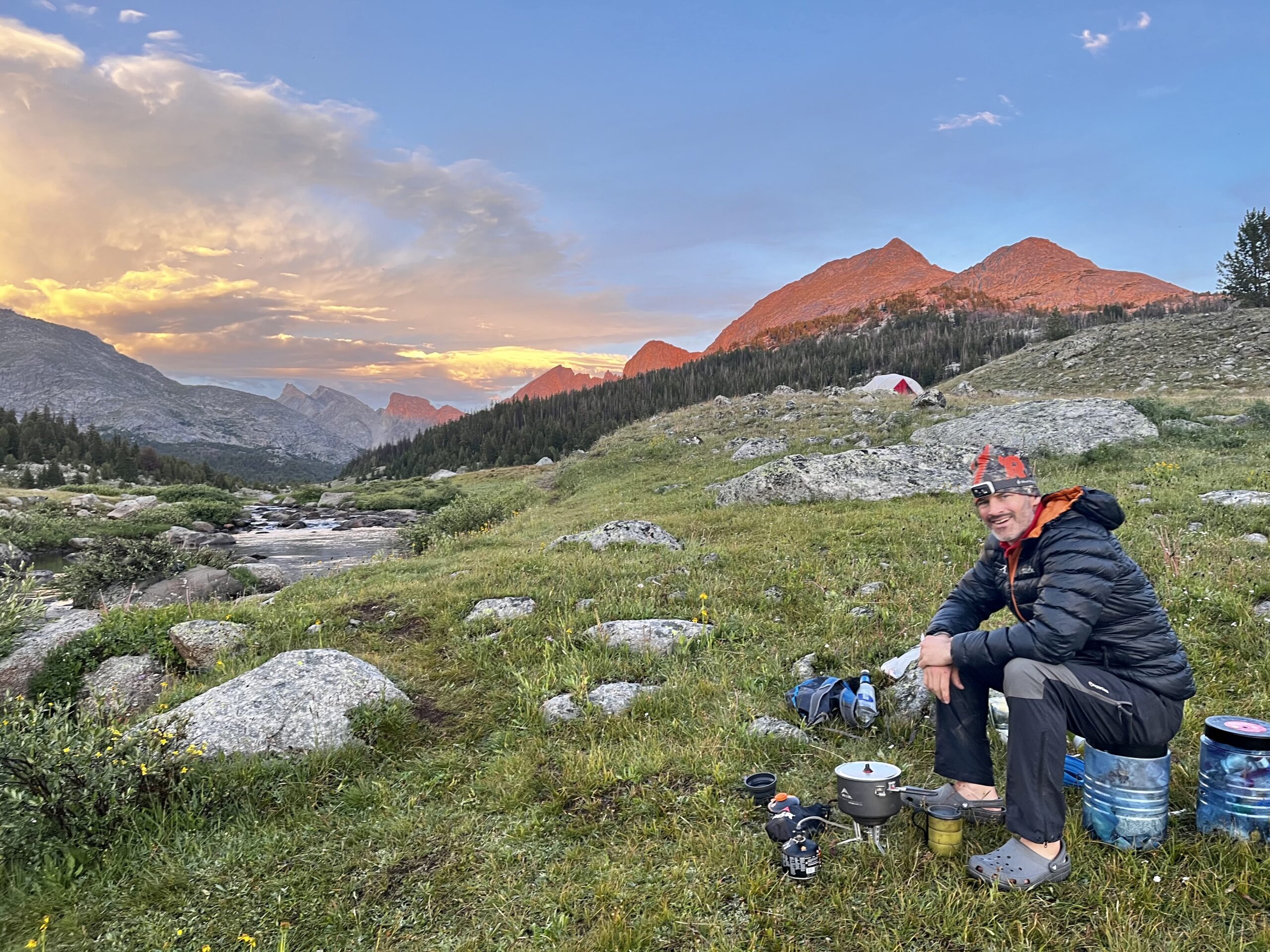
Jim led the way through some forest toward the Hailey Pass Trail. I had to stop to put rain gear on as clouds were building nearby. We were taking a picture when lightning struck somewhere far behind us.

For a second, I thought it was a flash from the camera!
The Hailey Pass Trail was our first well-defined trail since the Glacier trail five days before, and we made good time. We passed Skull Lake and cruised into a junction. Since it was getting late, we set up camp. It had been another 18-mile day, but well worth getting to see the Cirque later. At this point, we decided to go out to Big Sandy. We had lost too much time in the North and weren’t motivated enough for an eighth day in the mountains. We could have walked seven miles to the trailhead from the junction, but that would mean missing Cirque of the Towers. We planned to hike to Big Sandy Lake and take the five-mile path to the trailhead. After we set up camp, I walked around a bit and spotted a tent in the distance. This was the first time we had camped near anyone else on the trip.

DAY 7: WASHAKIE CREEK TO BIG SANDY TRAILHEAD
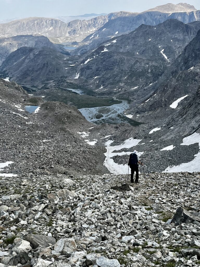
When we emerged from the tent, we were treated to the last rays of sunrise over the cirque. For the first hour of hiking, we were shaded by the steep wall to either side of the trail. It wasn’t until we reached Shadow Lake that we got direct sunlight. Our lovely footpath transformed into zillions of small trails. We tried to follow one along the lake, accidentally adding half a mile to our day. We passed at least four groups camping by the lake, so we were pleased to have stayed at the Washakie Creek Junction. After rounding Billy’s Lake, we had a long climb on talus to New York Pass.

The descent into the cirque was another scree field better done as a slide. We slowly picked our way down to the trail and wound through the trees. There were many intersecting trails that were all well-worn, but there was a clear “main” path. Despite the Cirque’s reputation for insane numbers of backpackers, we only encountered a couple of people fishing.


We rounded Lonesome and crested Jackass Pass.
We were making good time but kept getting caught behind large groups. It was a bit of a shock to see so many humans after having the beautiful range to ourselves for six days. We skirted around group after group enjoying the scenic lakes.

The switchbacks down to Big Sandy came as a surprise after the slopes we had been climbing. Right before we left the WRHR, we met climbers packing out of the cirque. They explained that there was severe weather coming in. That news explained the mass migration to the trailhead.
By the time we reached Big Sandy Lake, we were ready to pack out. It was an easy five miles to the trailhead. We met a generous man coming out of the winds after a weeklong trip. He offered us a ride to Pinedale.
SUMMARY:
The WRHR is an aesthetic, enjoyable, and awe-inspiring week in the mountains. Though we had to bail before reaching Lander, we felt like we had the most perfect experience imaginable. Climbing Wind River Peak would be incredible, but the 18-mile slog down was less appealing. I will be back someday to complete the last 23 miles. We were both satisfied with the Big Sandy exit. Having this trip work out without a hitch was remarkable.
I will always recommend doing the route north to south. Knowing the most manageable sections were ahead was very comforting. We were well within our comfort zones for most of the hike, and the terrain rarely ranked above class two.
NOTES:
- Our (abridged) route was just over 90 miles per my GPS Watch. Much of this was added because of route finding.
- We hiked on Andrew Skurka’s route from north to south.
- We brought Gaia GPS on our phones, but I would encourage not using it whenever possible. The most rewarding part of the trip is the navigation.
- Trekking Poles and Microspikes are handy. Microspikes might not get used much, but they may be needed in specific situations.
- Skurka’s maps (buy on his website) are helpful. Do not use printer paper. We ended up with some soggy maps.
- We brought bear canisters, and they were far too heavy. Find another solution as we had zero bear encounters.
- We brought the Sawyer Squeeze water system, and it worked great!
- Bear spray is never a bad idea. Definitely have it.
- I wore Salomon Ultra GTX hiking boots. They served me incredibly well and made it through the entire trip.
- If you are looking for a map of the area, use the Beartooth Publishing map. It served us well throughout the trip.
Amazing photos and wonderful descriptions of an incredible hiking experience. Kudos to you, Ben, and to Jim!
Thank you so much. It was an amazing trip.
Pingback: Running The Teton Crest Trail - Backpacking Ben
What a gorgeous hike you did. The photos are so amazing, and your blog is also very well written. You are such an inspiration!
Pingback: Running The Beautiful Teton Crest Trail: An Epic Experience
Amazing pictures!! Looks like an amazing trip. Would love to do that one day!
Hi Eric,
Glad you enjoyed the photos. I hope you get the chance to give it a shot.
Absolutely! Feel free to email me with questions as you plan your trip. Good luck!! My email is backpackingbenh@gmail.com.
Pingback: Six Special Days on the Sierra High Route - Backpacking Ben