As one of the world’s seven natural wonders, the Grand Canyon holds exceptionally stunning backpacking. On my first time in the canyon, I followed the Escalante Route which generally takes three to five days. It dips into the canyon from Lipan Point on the South Rim via the Tanner Trail. Eventually, the Tanner Trail intersects the Escalante Trail which follows the Colorado River. Hikers follow the Escalante Trail from Tanner Beach to Red Canyon. From there, it is a long climb on the New Hance Trail back to the rim.
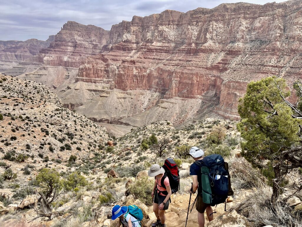
The route itself is remote and unaffected by the hordes of people that visit other parts of the park. Across three days of backpacking, we saw only four other parties. When climbing in and out of the canyon water is scarce, but the Colorado River is an ideal source at the bottom. The Escalante Route is 24.5 miles with just over 10,000 feet of elevation gain. The total gain and loss combined with intense heat make for slower days, but we enjoyed an easier pace in such a special location. We hiked the route downcanyon, which is logical given the layout of the trail, but it can be done in either direction.
Planning Material:
Trip Notes
Maps
Getting Permits
Camping in the Canyon
Food Storage
Water Filtration and Water Sources
Trailheads and Directions
Escalante Route Day 1: Lipan Point to Cardenas Creek
Tanner Trail:
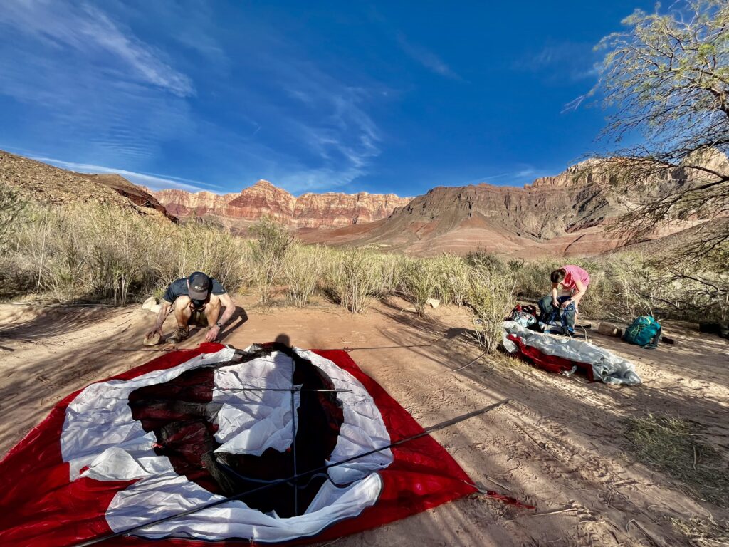
We woke at 6:00 am and reached the trailhead at Lipan Point by 6:30 am. Lipan Point is east of the main park complex. It is easy to reach from the park road.
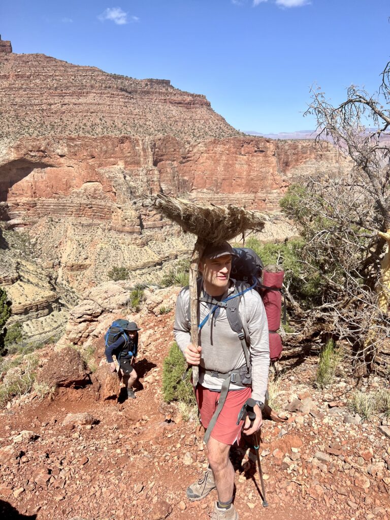
It took longer than expected for all five of us to get organized, but once we started hiking we made good time. The trail was well maintained with a steep first descent covered in loose pebbles.
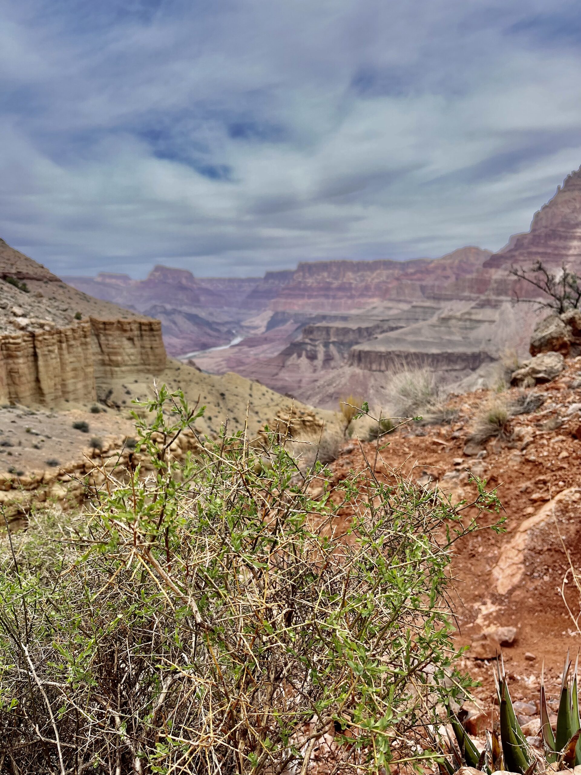
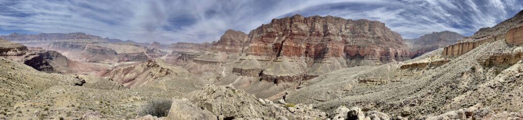
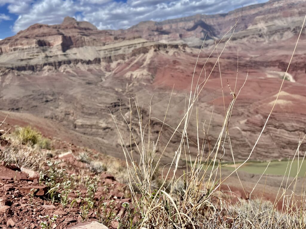
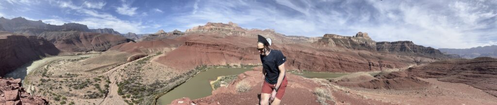
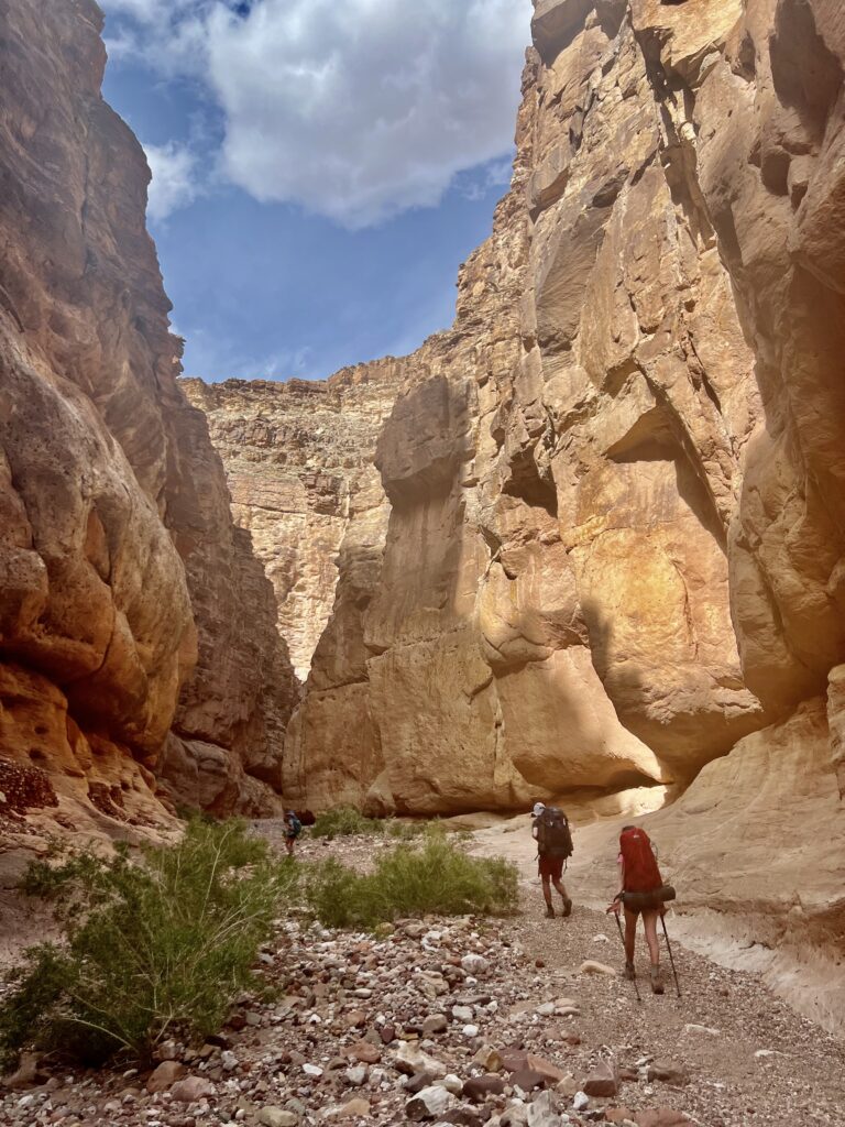
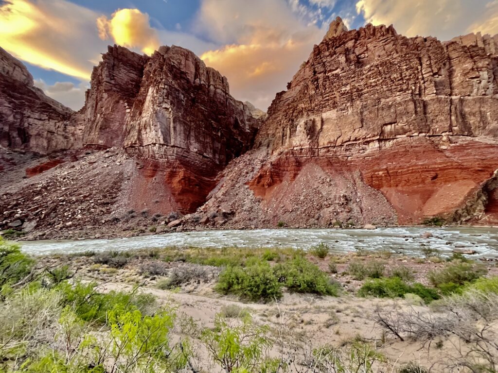
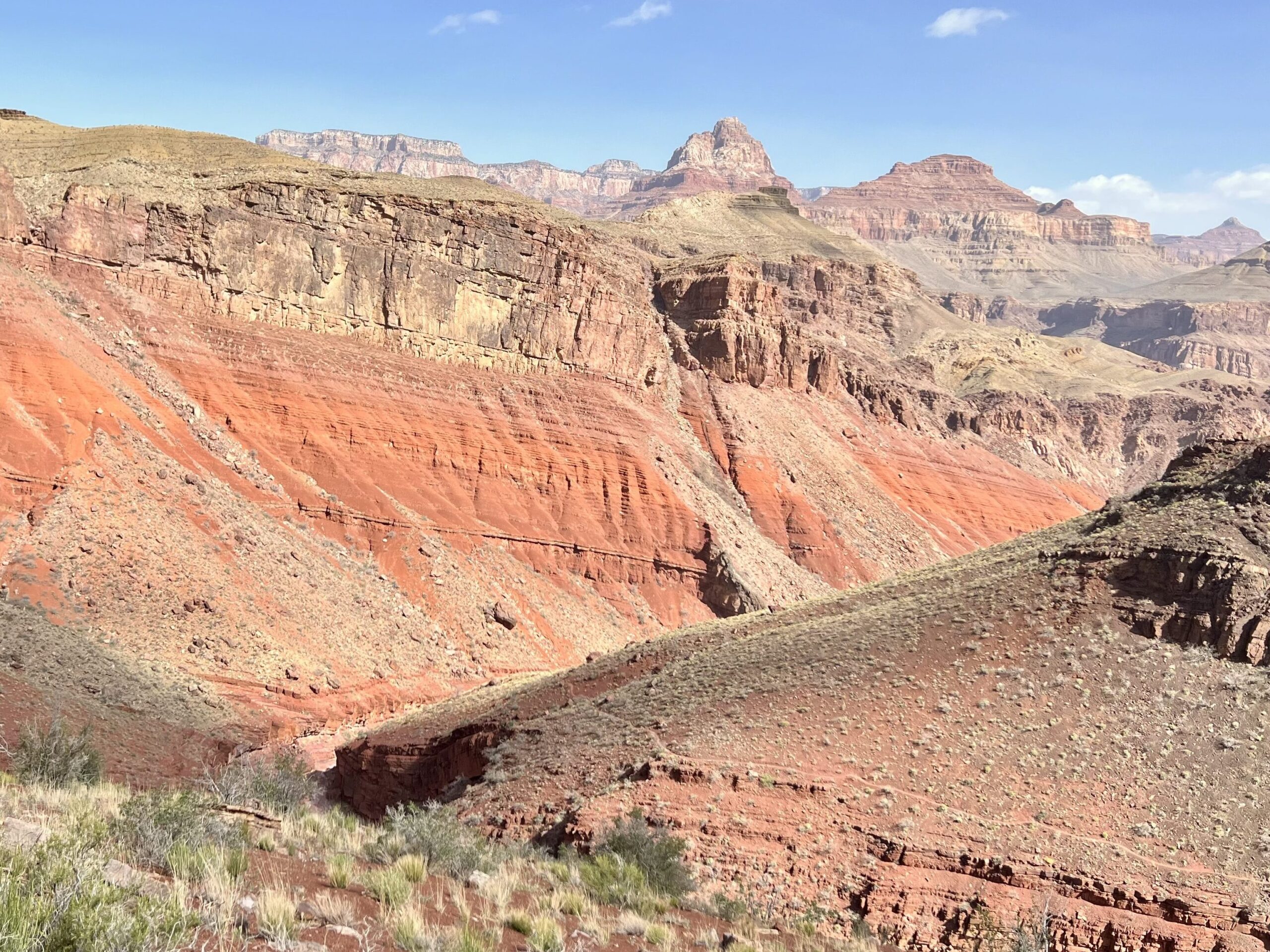
After descending the initial bowl in the wall, the trail flattened out. It felt lifeless in the canyon. We rounded a bend and found a complete change in scenery. The trail crossed a land bridge with massive cliffs into the canyon bed on both sides. Each canyon seemed to contain a deeper one. The Colorado River was a brown ribbon deep below our vantage point. To the hiker, the Grand Canyon is a series of connected canyons.
We followed switchbacks and skirted around red bluffs covered by shrubs for the next few hours. The landscape changed with each bend in the trail. As the sun rose to its peak, the heat intensified. I attempted to drink out of my water tube and found it empty! Over 2 Liters in 2 hours!
Just before we stopped for lunch on a steep slope overlooking the river, a rabbit darted across the path. It seemed out of place given the lack of water or shade. The terrain looked too steep to cross without technical descent, but the trail always managed to find a path of least resistance down the steepest of walls.
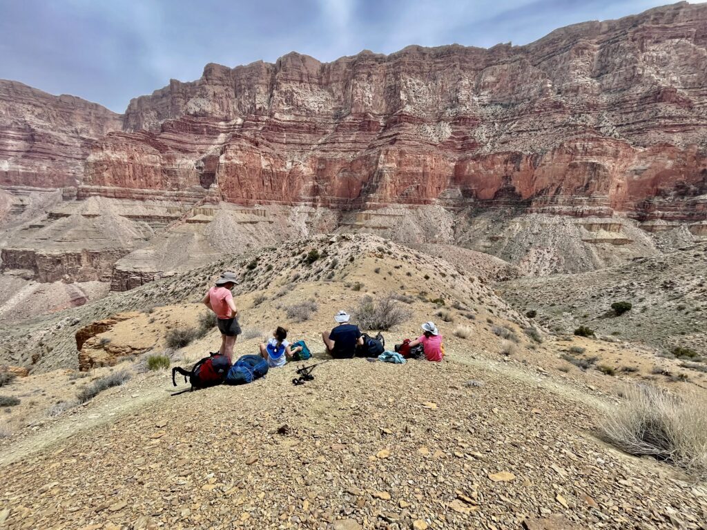
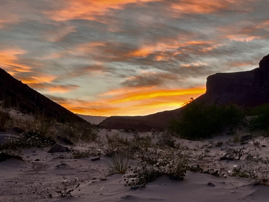
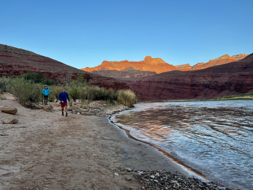
We covered the distance quickly. The descent became more gradual as we approached the canyon floor. Kathryn and I reached Tanner Beach first, resting our feet in the sand while waiting for the rest of the group. Across the river, a staircase buttes lead up toward Ochoa Point. We passed the time in silence, transfixed by the patterns and colors in the sandstone.
Escalante Trail:
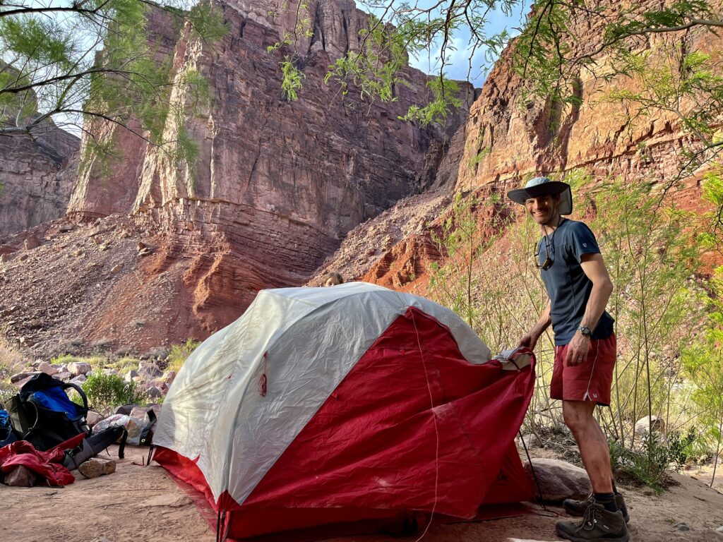
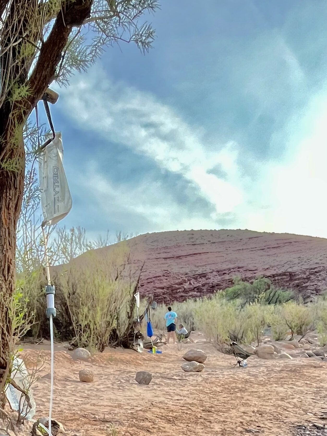
Soon enough, Jim and Char arrived, jumping into the freezing, April water. It was still early afternoon, so we decided to continue from Tanner Beach to Cardenas Creek. It was not challenging hiking, but the path was covered by sand which slowed our progress. We ascended above the river, then descended, and soon enough, we reached a turnoff for camp.
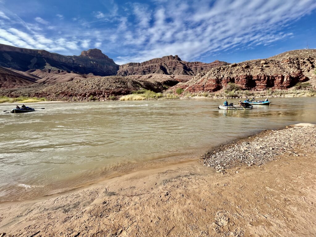
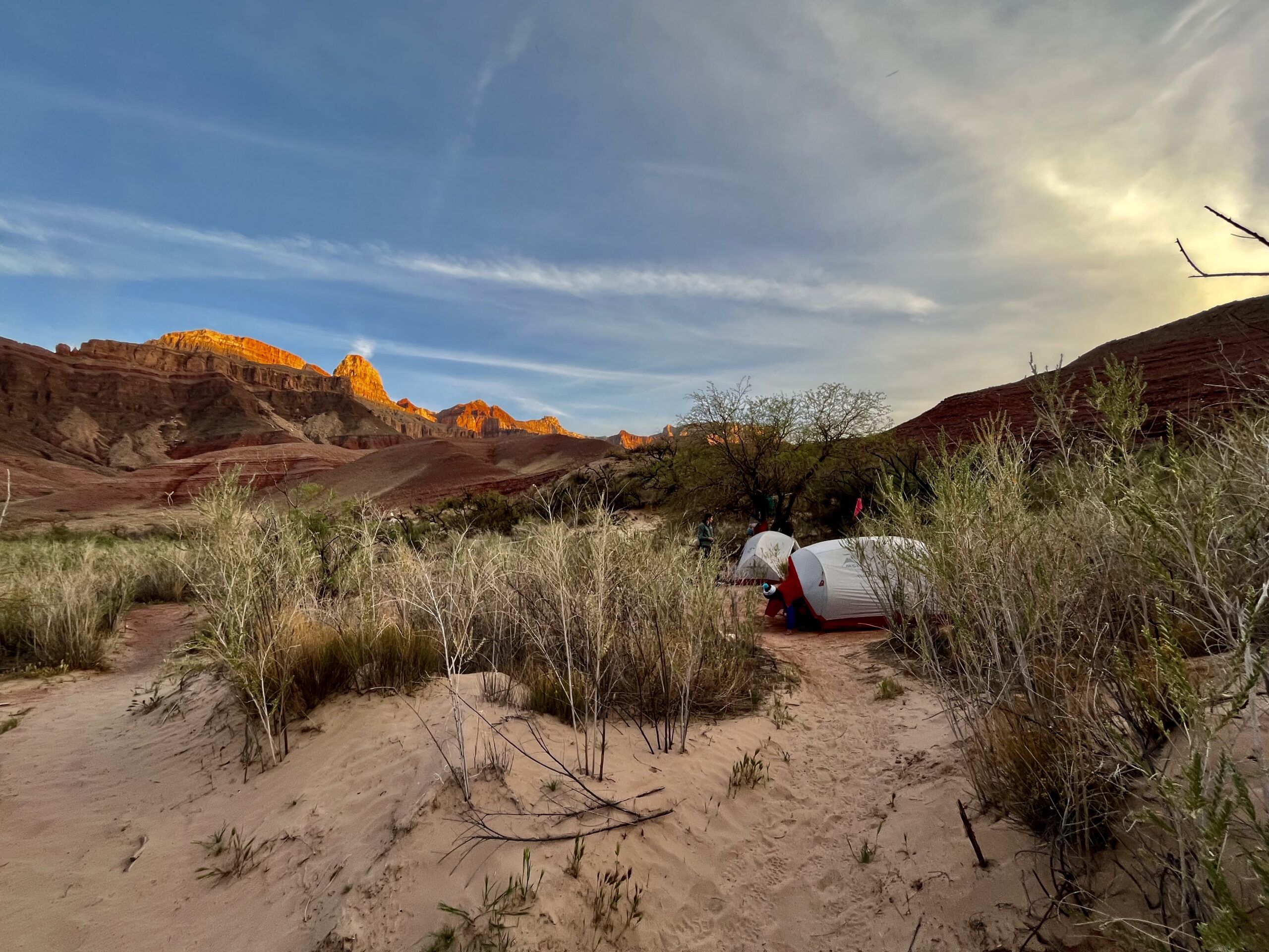
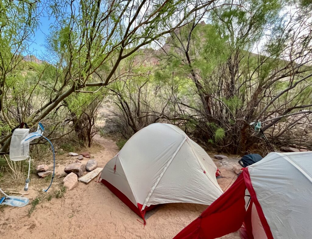
Cardenas was an ideal camping area with many secluded campsites in the brush. There was a sandy beach by the river that served as a common area for the campers. There were two other groups who were spending the night at Cardenas. One family from Arizona made the route a routine vacation. They were enjoying each other’s company at a more relaxed pace, having only come three miles that day. They’d even brought beer! We were just setting up camp when a group of rafters floated down the river. Everyone ran to the beach to show that Cardenas was full.
Escalante Route Day 2: Cardenas Creek to Hance Rapids
Our second day in the canyon started early. I woke up feeling sick and worried that I might have COVID. Backpacking is as great a form of isolation as any, but I took extra precautions. After downing a liter of water with a bowl of oats, I took some Ibuprofen and prepared to start hiking.
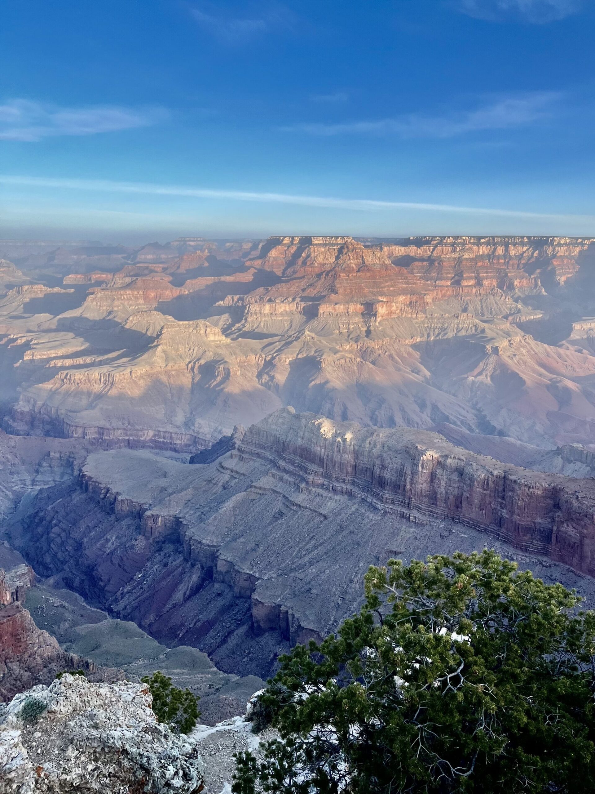
Plodding forward did not require much thought and the canyon was gorgeous! We ascended until we stood on massive cliffs above the river, then we came to a junction. Jim and I followed a spur overlooking the river at Unkar Creek. The wind became intense atop the cliffs and my sunglasses were blown off my hat! It was obvious that the glasses were lost.
The rest of our group explored the spur while we guarded the bags. It is important to never leave items unattended in the canyon because rodents and other critters will find them almost immediately.
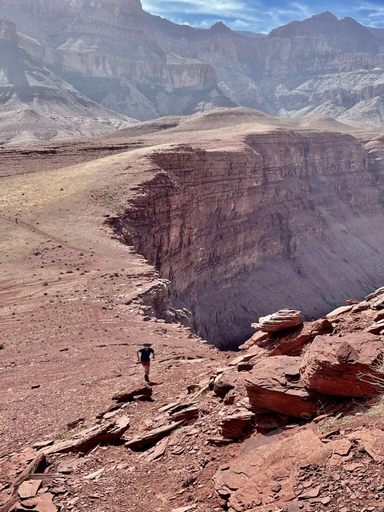
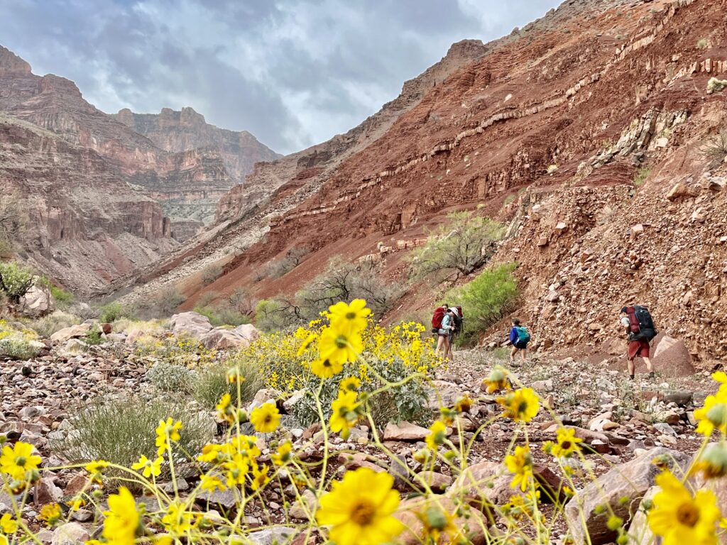
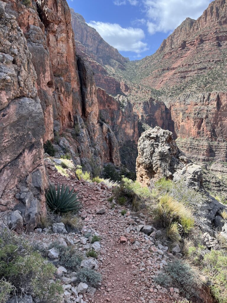
The Escalante Trail contours along slanted canyon walls where a misplaced step could lead to a big drop. It winds in and out of basins that double the distance each hiker must cover.
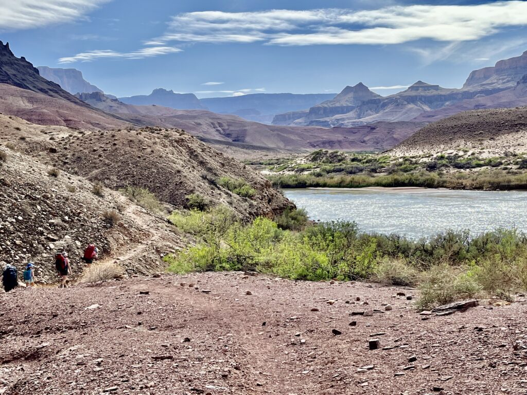
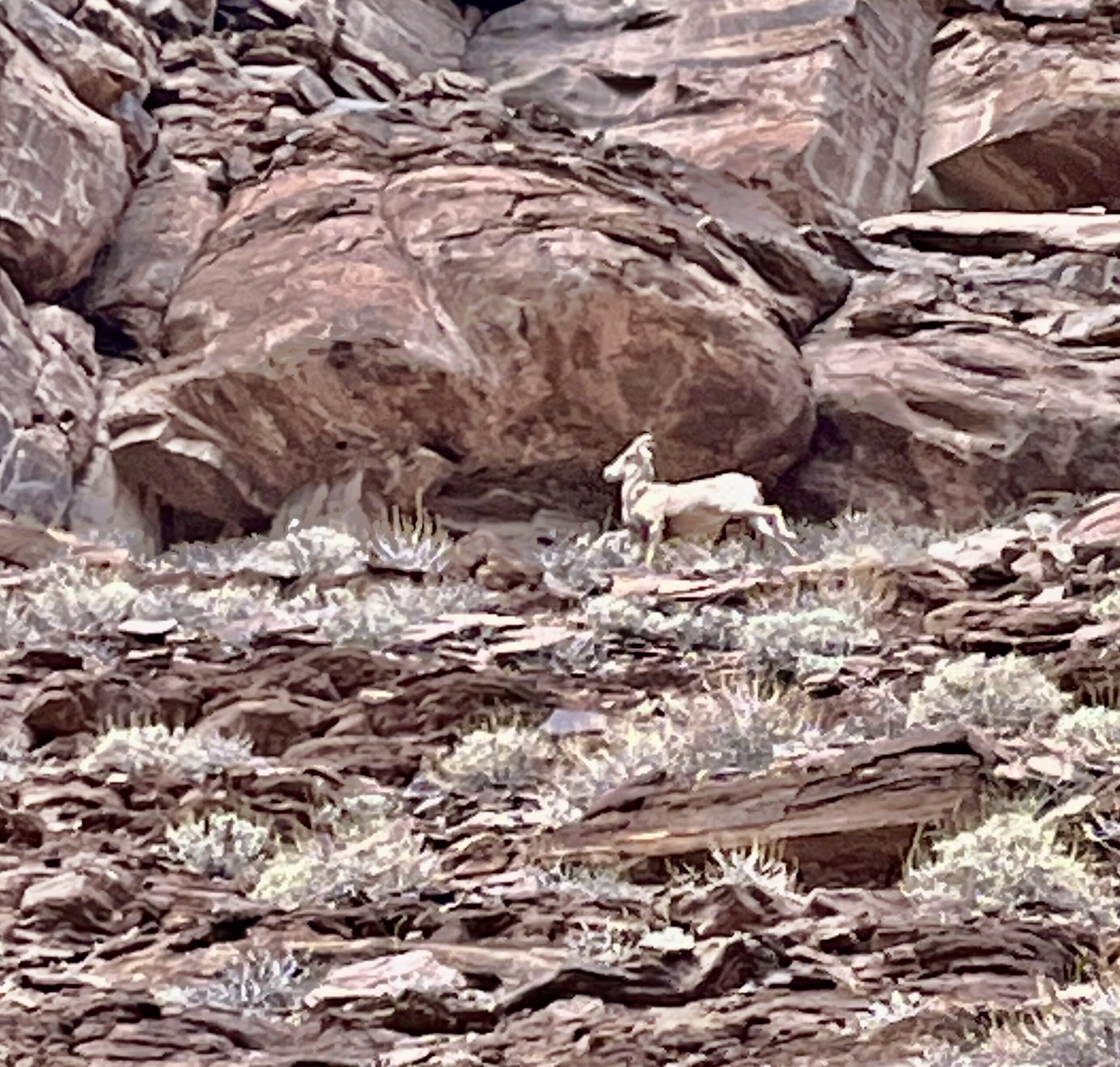
The wind intensified again, threatening to blow more loose items over the edge. We crossed the difficult terrain at different speeds but finally reconvened at a sheltered creek. After eating lunch, Char, Margaret, and I jogged toward the river across slabs of rock. We saw some wildlife, including a Bighorn, before the trail flattened out. It was an easy couple of miles along the river bank to 75-Mile Creek.
75-Mile Creek:
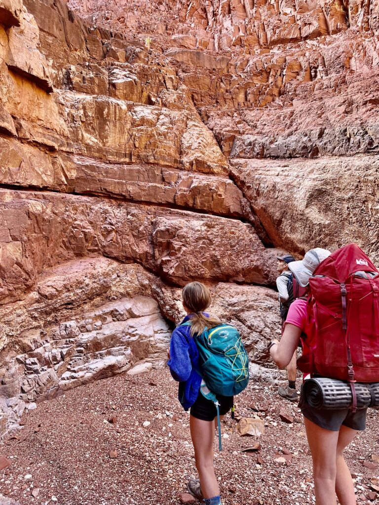
As a slot canyon, 75-Mile Creek completes the canyoneering experience along the Escalante Route. Slot canyons are tight channels with tall rock walls on either side. At 75-Mile Creek, the Escalante Route contours above the left side of the slot canyon near the edge then dips into the slot canyon via a steep rock slab. I almost lost the trail by attempting to follow a goat path on the right side of the 75-mile Creek. The descent into the slot canyon isn’t as challenging as it looks and is far superior to any goat path. Hiking through the slot is one of the highlights of the route.
Papago Wall:
After the slot canyon, we decided to follow a shortcut along the river rather than add more vert to follow the designated trail. It was about a mile to the base of the Papago Wall; a well-known landmark on the Escalante Route. We followed the dry river bed by the Colorado River with ease, taking care not to twist any ankles. At the Papago Wall, the river takes a sharp turn, so hikers must climb up a steep rock face to cross into the next section of the canyon. The Papago Wall is chronically overhyped online. Its neighbor, the Papago Slide, is a considerable challenge, but even that is just a steep talus field. At its core, it is a steep rock face with clear handholds. There is camping beneath the wall, but we chose to continue to Hance Rapids.
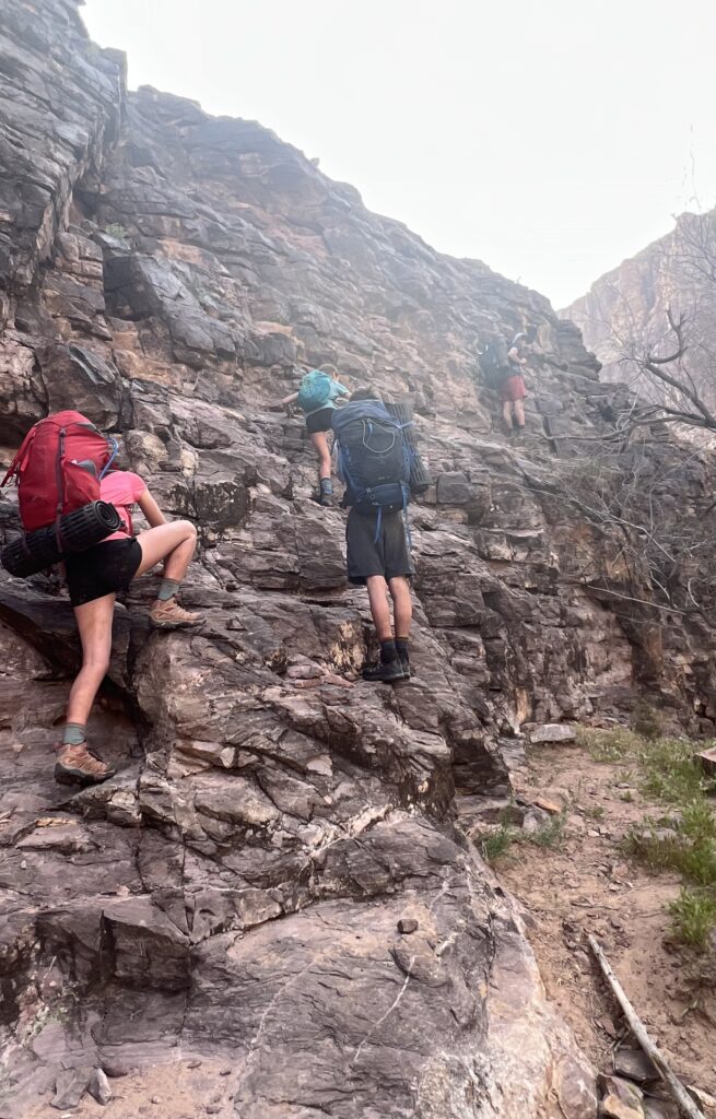
Papago was relatively easy bouldering. There was one part that required us to lift our packs, so we could climb unencumbered, but the ideal route was clear. Descending the Papago Wall by hiking the route in the other direction would have been more difficult. After the wall, the trail diverged into goat paths that lead to the Papago Slide.
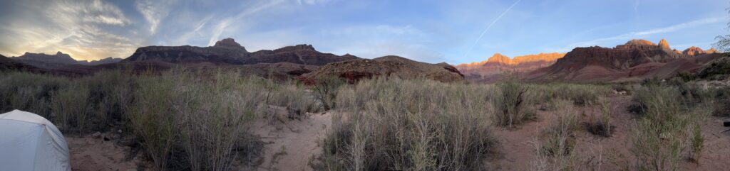
The Escalante Trail uses the slide to descend back to the river after ascending the Papago Wall. Hikers must tackle it in tight pairs or by themselves because of the loose rock that inevitably cascades upon each hiker’s passing. After the slide, it was a short riverside walk to where we made camp at Red Canyon.
Escalante Route Day 3: Hance Rapids to The New Hance Trailhead
New Hance Trail:
Red Canyon was a beautiful place with marked campsites, but our tents were pummeled with sand through the night. It took time to shake them clean in the morning.
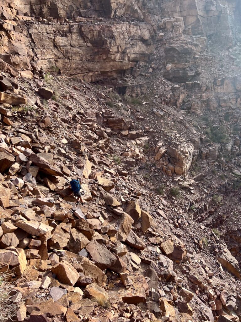
We started the day by hiking along a dry stream bed for about three miles on the New Hance Trail. The ascent was gradual and we covered the distance in about an hour. The New Hance Trail veers out of the stream bed very suddenly, so it is easy to miss the turnoff. Unfortunately, we did just that, continuing into a slot canyon. We followed the stream bed to a steep cliff that looked unscalable and realized our mistake.
After checking our GPS, we learned we were pretty far off the trail. It would be three-quarters of a mile to backtrack. The route was just above us to the right, so we climbed up a steep gravel slope to find it. Jim was excited by the climb because it added adventure not found on the trail.
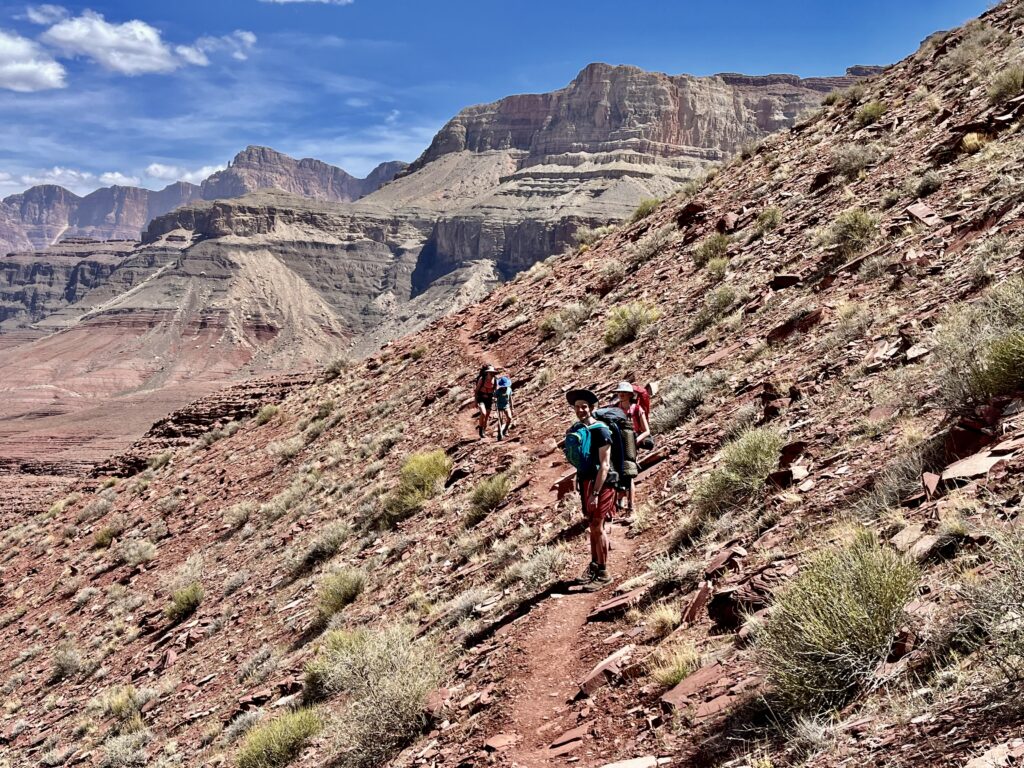
Following switchbacks, we quickly ascended the canyon. Soon, Coronado Butte blocked the view of the river, and we continued to contour around obstacles that seemed impassable without difficulty. As someone who built trails throughout college, Jim was impressed at the design of the route.
There was more greenery as we gained elevation, and we found some shade for a lunch stop.
Finally, we reached the tree-covered saddle near Coronado Butte. The trail turned left and after one final steep ascent to the rim, we passed the trailhead sign.
Trip Notes:
- Bring tons of sunscreen. We used sheer zinc which works well though it is cumbersome to put on. I’ve linked it here.
- After 75 Mile Creek, hikers can avoid distance and elevation by hugging the creek. Be prepared for rocky terrain and use a GPS map.
- We used the Trails Illustrated Map for Grand Canyon National Park from National Geographic. This is a worthwhile buy especially if you are not using a GPS. I’ve linked that here.
- Never leave anything unattended in the canyon.
- My backpack weighed in at about 30 lbs. I had never used it before this trip, but it was spacious enough to hold much more than three days of provisions. It also was designed conveniently. I highly recommend this model.
- I was sick during this trip. There is a good chance I had Coronavirus. Thankfully, it only affected me in the mornings.
- The camping was very sandy. I would plan for that.
- My LaSportiva hiking boots broke at the toe on day two. I had never worn them on a major hike before the Escalante Route and was disappointed in the quality. LaSportiva gave us a refund. The breakage is a testament to the wear and tear in the canyon. I recommend bringing some extremely durable shoes.
Maps:
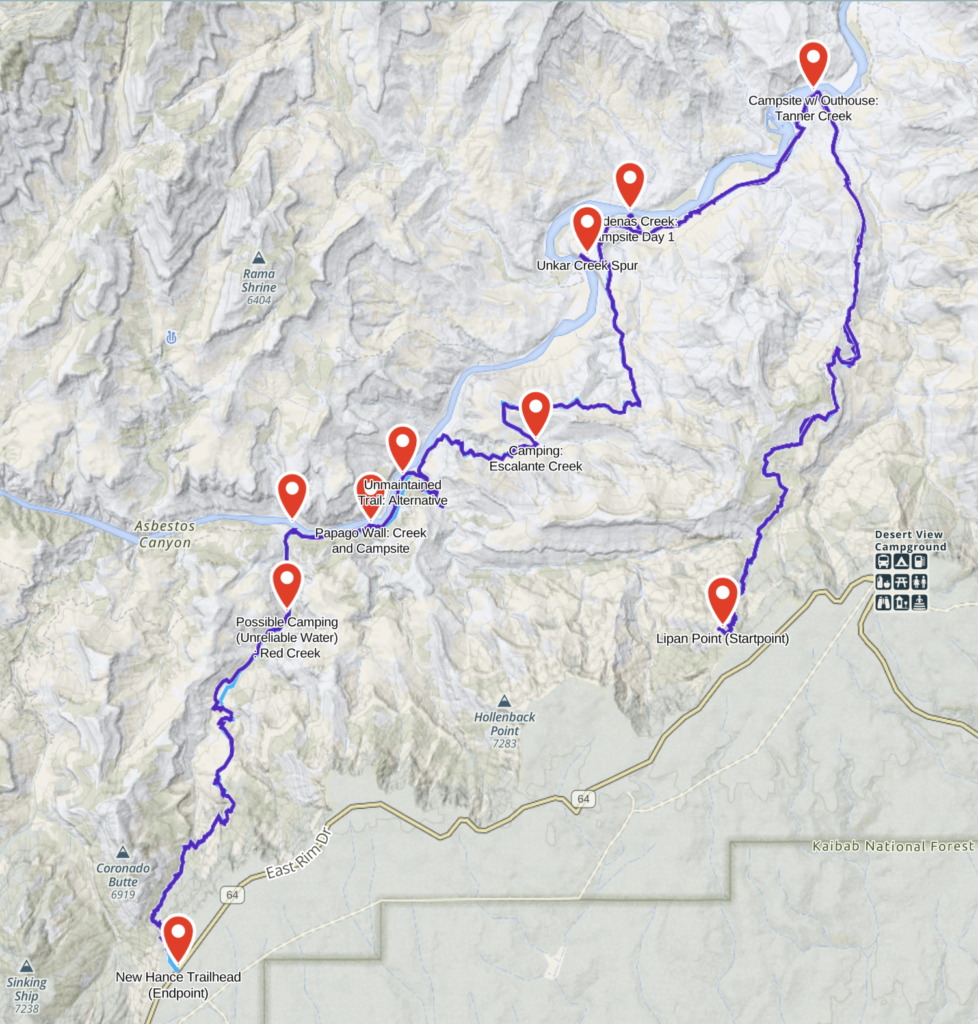
Another version of the Escalante Route finishes at Grandview Point by following the East Tonto Trail, the Hance Creek Trail, and the Grandview trail instead of the New Hance Trail. I have never hiked this portion of the route, but I imagine it is incredibly beautiful, if not a bit busier. I’ve inserted a map for your consideration below:
The route adds five miles (29 total) with about 10,000 ft of elevation gain as opposed to 12,000 ft.
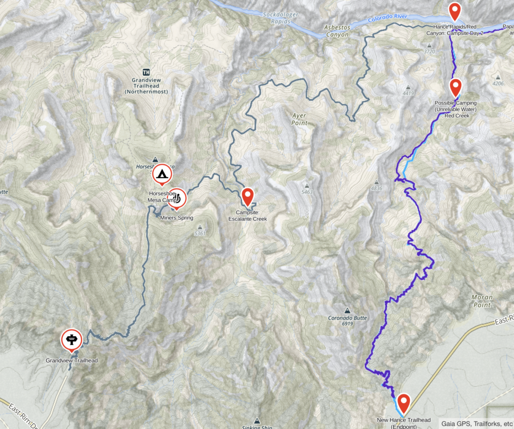
I highly recommend using a GPS map service to do this hike. We used Gaia. It is easy to lose the trail, so knowing the surrounding landscape is important. No matter what, it is important to understand the route and your means of navigation well before you go.
Permits:
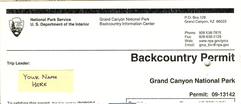
Like it or not, backpacking in the Grand Canyon requires permits. The park is divided into sections with unique permits. Hikers must have a permit for each section they plan to pass through.
Use Areas:
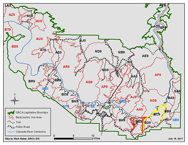
| Code | Name of Use Area | Management Zone | # of Parties | Maximum People | Camping Type |
| BC9 | Cardenas | Primitive | 2 | 23 | Allowed Anywhere (At Large) |
|---|---|---|---|---|---|
| BD9 | Red Canyon | Primitive | 2 | 23 | Allowed Anywhere (At Large) |
| BE9 | Hance Creek | Primitive | 2 | 23 | Allowed Anywhere (At Large) |
When to apply:
| The planned month of the trip: | Written Permit Requests Can Be Submitted | In-Person, Oral Requests Allowed |
| January | September 1st (prior year) | October 1st (prior year) |
| February | October 1st (prior year) | November 1st (prior year) |
| March | November 1st (prior year) | December 1st (prior year) |
| April | December 1st (prior year) | January 1st (same year) |
| May | January 1st (same year) | February 1st (same year) |
| June | February 1st (same year) | March 1st (same year) |
| July | March 1st (same year) | April 1st (same year) |
| August | April 1st (same year) | May 1st (same year) |
| September | May 1st (same year) | June 1st (same year) |
| October | June 1st (same year) | July 1st (same year) |
| November | July 1st (same year) | August 1st (same year) |
| December | August 1st (same year) |
How to apply:
- Fill out the Backcountry Permit Request Form and be sure not to leave anything empty.
- There are more “small group” (1-6 people) than “large group” (7-11 people) permits.
- There is a ten-dollar fee to receive a permit. It costs five dollars for every person per night in the canyon. There are no refunds for permit fees, but hikers can buy a “Frequent Hiker Membership” for 25 dollars per year. This allows members to receive many permits free of additional charge. Pay with a credit card and state the maximum fee the park could charge based on your application. Additionally, it is $25 per vehicle in the park, but that is charged upon entrance.
- Get the form to the GC’s “Backcountry Information Center”
- You can mail your form to the Backcountry Information Center, Post Office Box 129, Grand Canyon, AZ, 86023.
- You can reach the center by phone or fax at 928-638-2125.
- Both offices on the North and South Rim accept forms in-person, but the North Rim is closed from October until May.
- The office WILL NOT accept requests via phone or email.
- You should get a response to your request BY MAIL.
- Last-minute permits are available at the Backcountry Office, but they depend on cancelation and are highly variable. Hikers who choose this option can enter a waitlist. This can be done on the day they hope to depart or the day prior.
Helpful sites for more information:
For more details see the park service trail description here: https://www.nps.gov/grca/planyourvisit/upload/Escalante_Route.pdf
Camping in the Canyon:
You can stay (at maximum) seven nights in one use area. This will not be necessary for the Escalante Route. The route generally takes 3-5 days, all in “at large” camping areas. It could be done by an experienced runner in a day. We hiked with two kids, ages nine and eleven without difficulty. Neither had much prior experience in the backcountry. There is good camping along much of the river with specifically designated spots such as Cardenas, Tanner, and Red Canyon. There is adequate camping beneath the Papago Wall and on the New Hance Trail at Red Creek. There is sheltered terrain at Escalante Creek and 75-Mile Creek as well.
If you choose to finish at Grandview Point available campsites include Hance Creek and established tent sites at Horseshoe Mesa (accessed by a spur). There is reliable water at Miners Spring.
Food Storage:
Mice and other critters live in the canyon and often steal food from unprepared hikers. It is important to use wire mesh bags to safely store food. Any bag with a chainmail layer will keep mice out of your dinner. It is also imperative to hang your food off the ground. There are plentiful shrubs that serve this purpose.

Water:
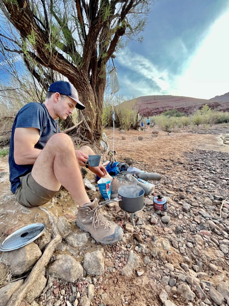
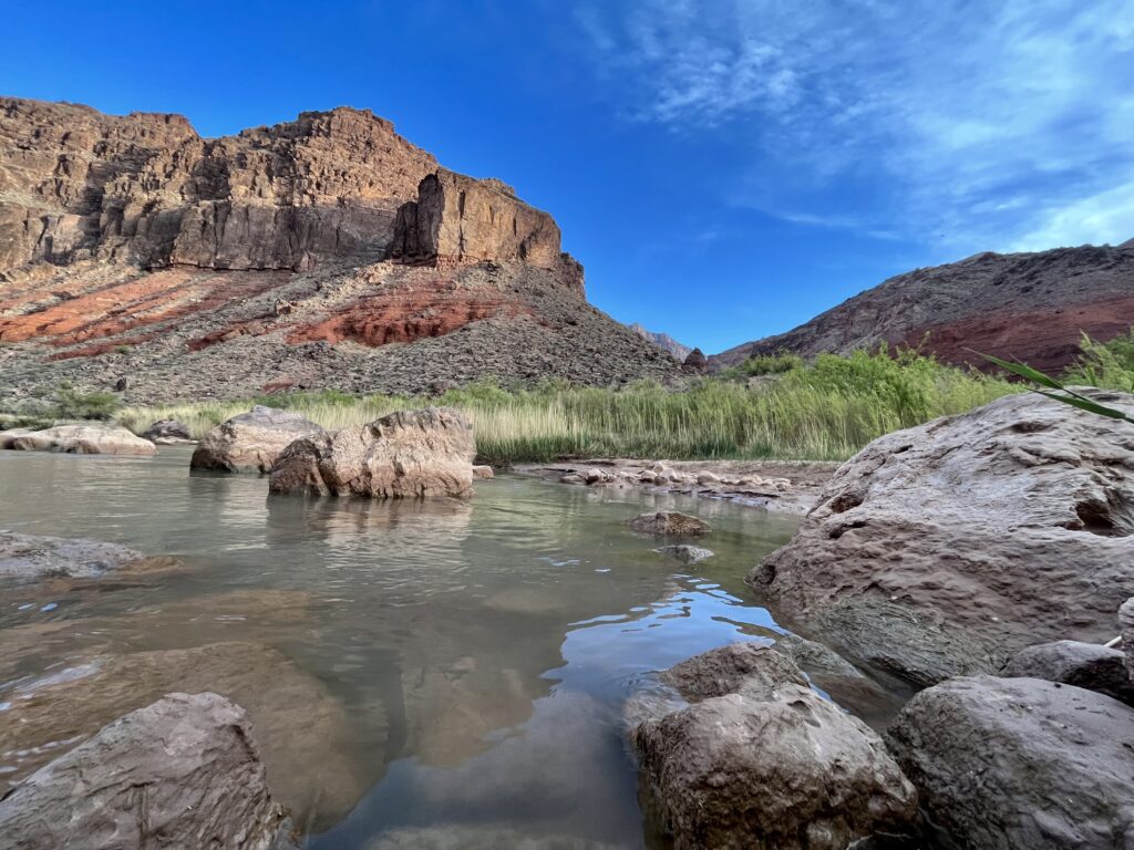
Hikers should pack a substantial number of water containers. There is no water between Lipan Point and the Colorado River. Sources are also unreliable on the New Hance Trail and infrequent on the Hance Creek/Grandview Trails. The Colorado River is a steady source on the Escalante Trail, but water must be well-filtered to drink. We used the Platypus Gravity Works filter which worked very well for a larger group. Dirty water is dropped through a filter from a “dirty bag” into a “clean bag”. Both other groups we met also used these filters.
Trailheads and Directions:
The park service recommends starting at Lipan Point due to trail design. Hiking downcanyon is more aesthetic as the trail follows the flow of the Colorado River. Parking at Lipan Point is far better than the New Hance Trailhead, and it is easy to hitchhike back (as one of us did). It is even easier to hitchhike from the parking at Grandview Point to Lipan. Since the parking is good at Grandview, staging cars is also an option. Lipan Point is not on the main park shuttle route.
For more Southwest National Parks, click here.
Hi. I really appreciate your thorough trip description. My husband and I are scheduled to do the same trip at the end of April this year, 2024.
Last fall we hiked down the New Hance and up Grandview with no issues at all, so are thinking that we want the bigger challenge of the Escalante.
I’m still nervous about the Pagago Wall, however. You said the scariness of it has been overblown on the internet, and that your kids did it with no problem.
What was the hardest part for them?
Full disclosure: I am 70 years old, but with extensive backpacking experience, and am training hard for this. My husband is a climber so it won’t bother him but I just don’t want to get there and not be able to do it.
Any more thoughts from your experience would be very helpful!
Hi Mary!
It is great to hear from you. I absolutely think you could do the Escalante Route (including the Papago Wall). Though it is certainly more difficult than the rest of the route, I stand by my statement that it is overhyped online. The wall has a incline leading to its base that you should have no problem ascending. I would recommend taking off your pack and having your husband scale the steepest part before you. You can both push your packs above the steep section and climb up to them. We climbed up and reached down to pull the rest of our party (which included inexperienced kids) up the steep section. There is a false route, but stay left and you should be totally fine if you take your time. The first section of the wall is an easy incline. The second section is most difficult. That section is no taller than five feet, so you can easily push your pack up and climb unencumbered. The third section is slightly exposed as you the crest the steepest incline and traverse on goat paths toward the slide. Having an experienced partner to give you a handhold on your climb is great for sure!