Given the large concentration of stunning national parks in the southwest, many people visit driving parks to park in a loop. Tourists often find themselves driving between Arches and Bryce with a possible stop at Capitol Reef. Though most visitors at Capitol Reef are just passing through, it’s a highly underrated attraction and should be considered a destination in its own right. Whether you plan to spend three hours or have an enjoyable overnight there, this guide will have useful information. Between Capitol Reef and Bryce, there is the lesser-known Petrified Forest State Park which is home to many petrified logs and a brief walking path touring them. This is another great way to break up driving detailed below.
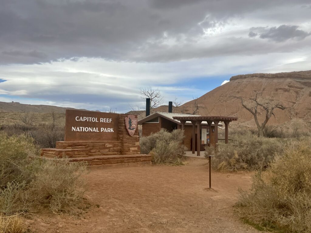
Capitol Reef National Park is a hidden gem in between Arches and Bryce. It is about one-third of the way coming from Arches and is right en route. There is a range of activities in Capitol Reef, depending on how much time you would like to spend there. We hiked the Hickman Bridge Trail, visited roadside petroglyphs, and bought delicious pies in Fruita at the Gifford House. If you would like more time in the park (and do not mind more driving), the loop road showcases much of this diverse area. We opted out, as it adds three hours. This guide will explore the park from north to south (or from Arches to Bryce), but it can be followed backward for a similarly enjoyable experience. It is easy to configure the information compiled in this article for another plan as well.
The Capitol Reef name includes “Capitol” because of a distinct mountain shaped like the US Capitol dome and “reef” because it was a location that explorers struggled to access. It was “settled” by Mormons but originally occupied by the Ute, Paiute, and Navajo tribes.
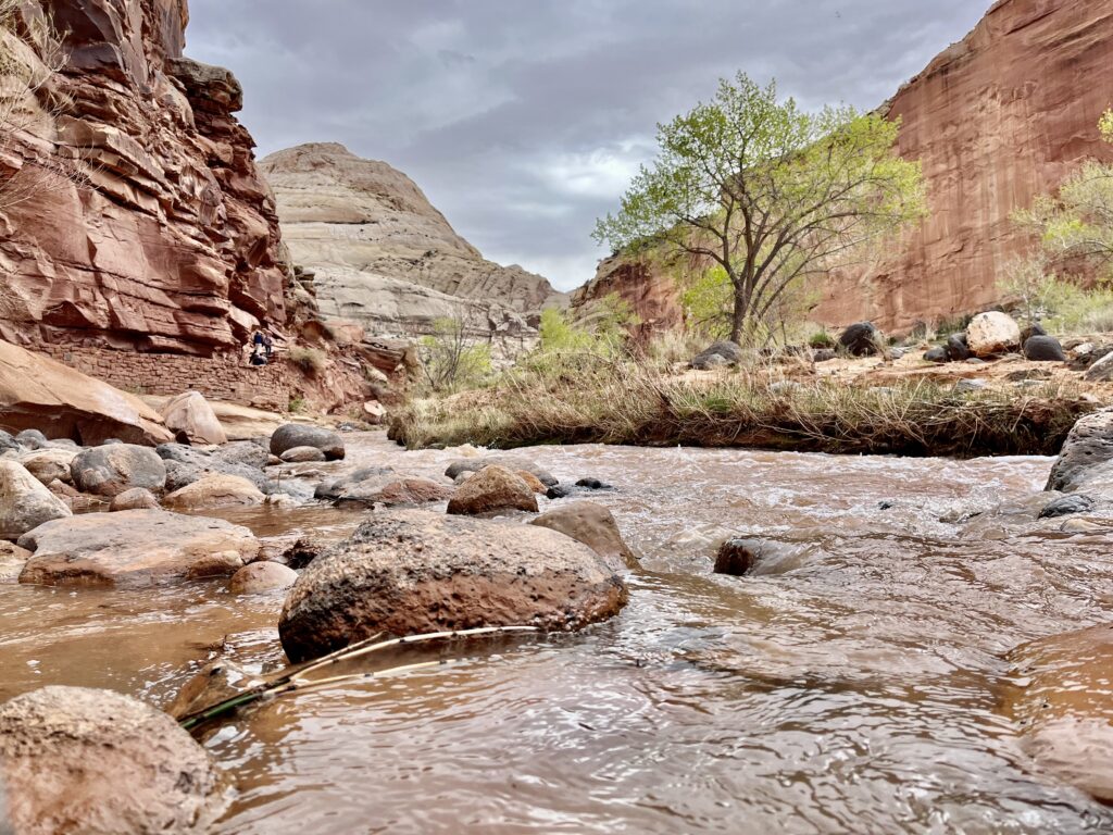
If approaching from Arches, the Hickman Bridge Trail is a great starting point, as it provides a place to stretch legs after driving. It winds up from the Fremont River to a natural bridge, visiting some other sandstone features along the way. It is an easy two miles, and we enjoyed getting a sense of the park with fantastic canyon views. If you are approaching from the other side, or plan to spend more time in the park this is still a great attraction to add to your list.

We started at the trailhead mid-morning and briskly hiked along the path as it hugged the bottom of a cliff along the river. The trail ascended some switchbacks towards a junction. There was a good number of people hiking, but not enough to detract from the experience. At the junction, most followed the main trail, but we saw a couple of backpackers who continued into the backcountry. Backpacking here would be a unique experience that would be worth coming back for.
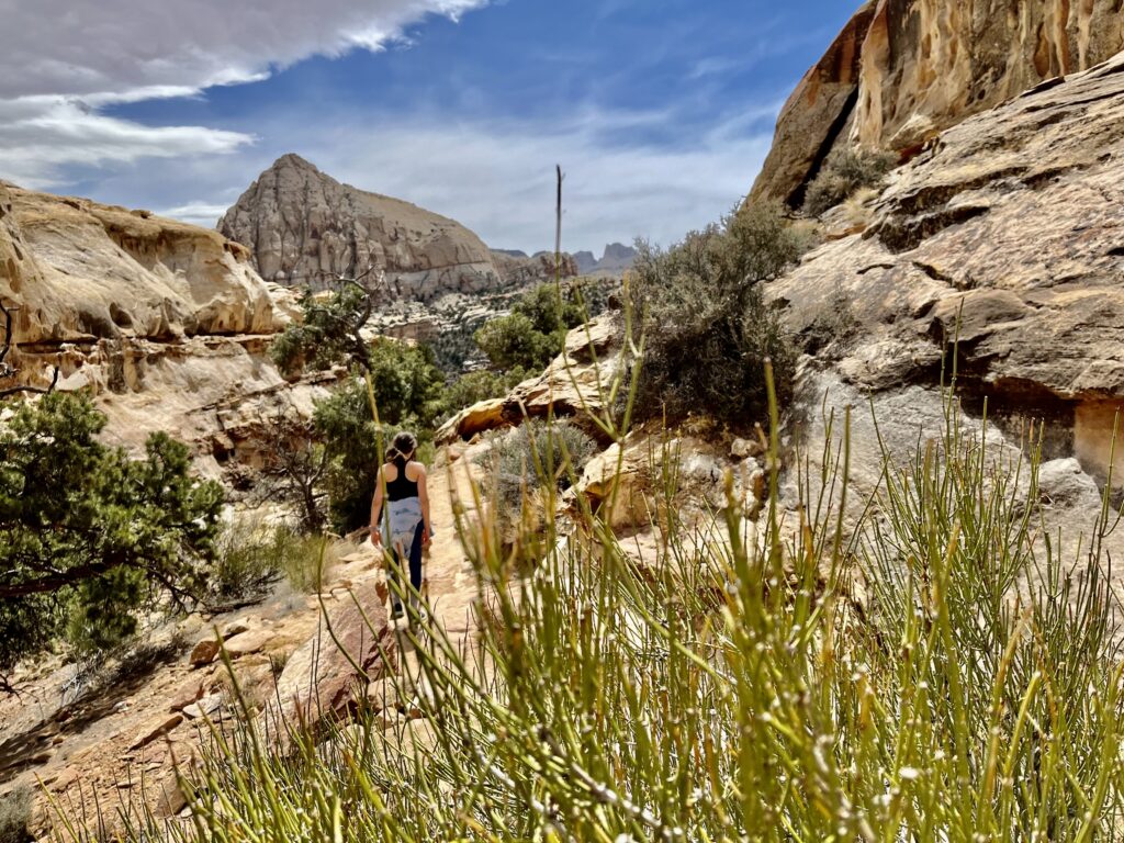
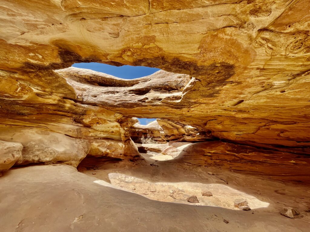
The trail wound through classic southwestern shrubs, with a couple of interesting rock formations and arches. We had fun posing in some smooth holes in a rock wall. Hickman Bridge was similar to some of the arches we had just visited. Honestly, it was the journey there that made the hike worthwhile.
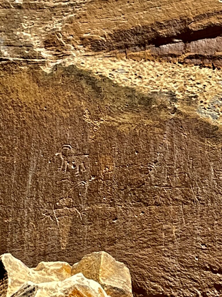
After hiking back to the trailhead and the rest of our group, we hopped back into the car and drove down the road to see some petroglyphs. Petroglyphs are drawings or writings on the walls of the canyon and these were easily accessed from a turnout on boardwalks that hugged the cliff faces. The flowering oasis-like environment was aesthetic enough to justify walking around, even for people with less interest in cliff-writings like me.
The next stop was the Fruita Valley, where we bought pies from the historic Gifford Homestead. The pies are delicious, and worth every cent. The oasis vibe is omnipresent here with lush trees and foliage. The landmark homesteads were cool to check out as well. From Fruita, you can take the scenic drive into Grand Wash, but it is a two-hour round trip along the seven-mile road. We decided to skip it given the amount of driving left that day.
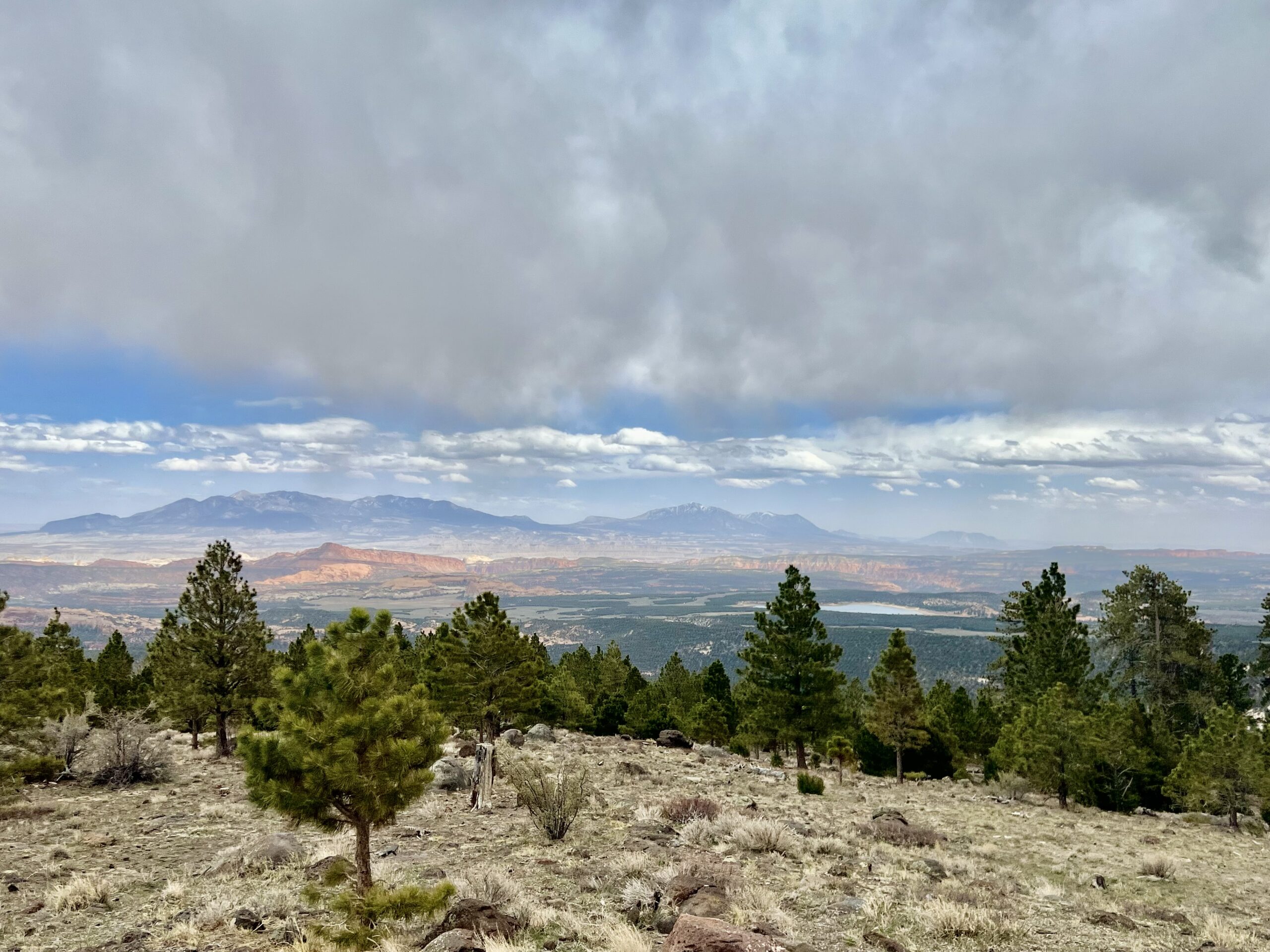
Route 24 was quite scenic. The highway took us over some steep mountain passes but was otherwise normal driving. There were turnouts atop many of the high points with gorgeous views.
We stopped at Anasazi State Park and checked out the museum there. It was a museum dedicated to the local Anasazi Tribe with a $5 admission fee that was en route. They had a couple of native shelter recreations, but it wasn’t extensive. Honestly, I would skip it because there isn’t much there.
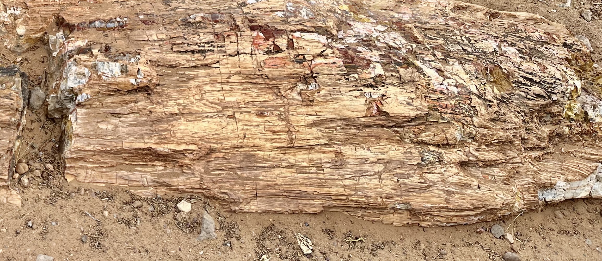
Soon after, we arrived at Petrified Forest State Park. There was an easy loop trail where we saw some petrified logs. Petrified logs are fossilized underground and preserved for thousands of years. It was fascinating to touch the petrified wood spread around the landscape.
About an hour after our stop in the state park, we arrived at Bryce Canyon National Park. Despite having six hours of total driving, the way we broke it up made it far less arduous.