Table of Contents:
This is a long article, so I’ve inserted this table of contents to help you navigate to the information you need. If you are just browsing, scroll below the table to the trip report and background information.
Background:
At 13,206 feet, the Acatenango Volcano is Guatemala’s third-highest peak. It is the tallest accessible volcano in the country since the higher two require a police escort for climbers due to unsafe conditions. Climbing the mountain means passing through four unique microclimates: farmland, cloud forest, tropical alpine forest, and volcanic rock. Each climate differs from the last, making for a diverse climb. The volcano isn’t technical; there is just a lot of uphill. From the summit, hikers can explore the crater while enjoying views of the active Fuego Volcano and surrounding terrain. In this guide, I will do my best to provide a snapshot of the Acatenango climber’s experience while providing background on the trip and instructions for various hikers.
Trip Report:
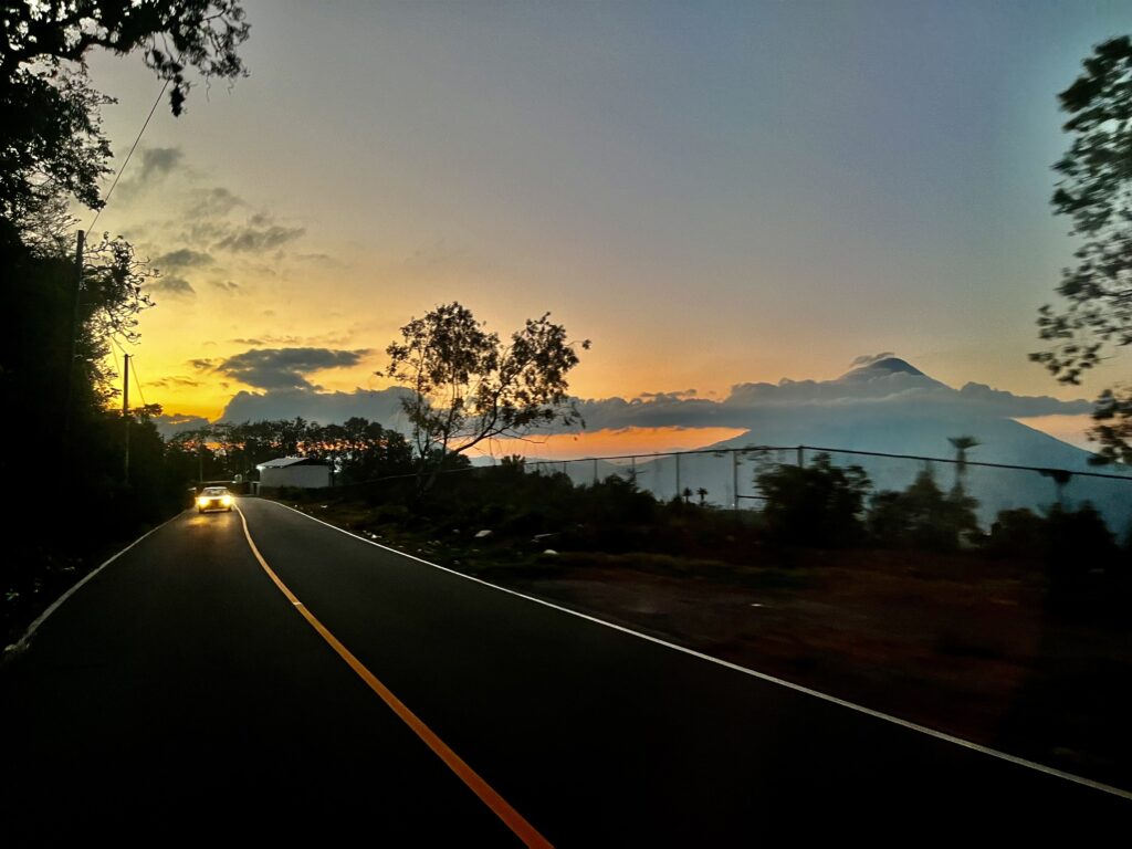
Our group of five hurried through the dark, cobbled streets of Antigua, Guatemala. I checked my watch. It was 4:45 am, and we were running late! We passed a hospital with people huddled on the steps and found our driver’s van parked at a cross street. The van bumped over the carefully laid cobblestones, eventually finding even pavement. Cluttered houses turned to farms, as we climbed into the foothills of Volcán Acatenango.
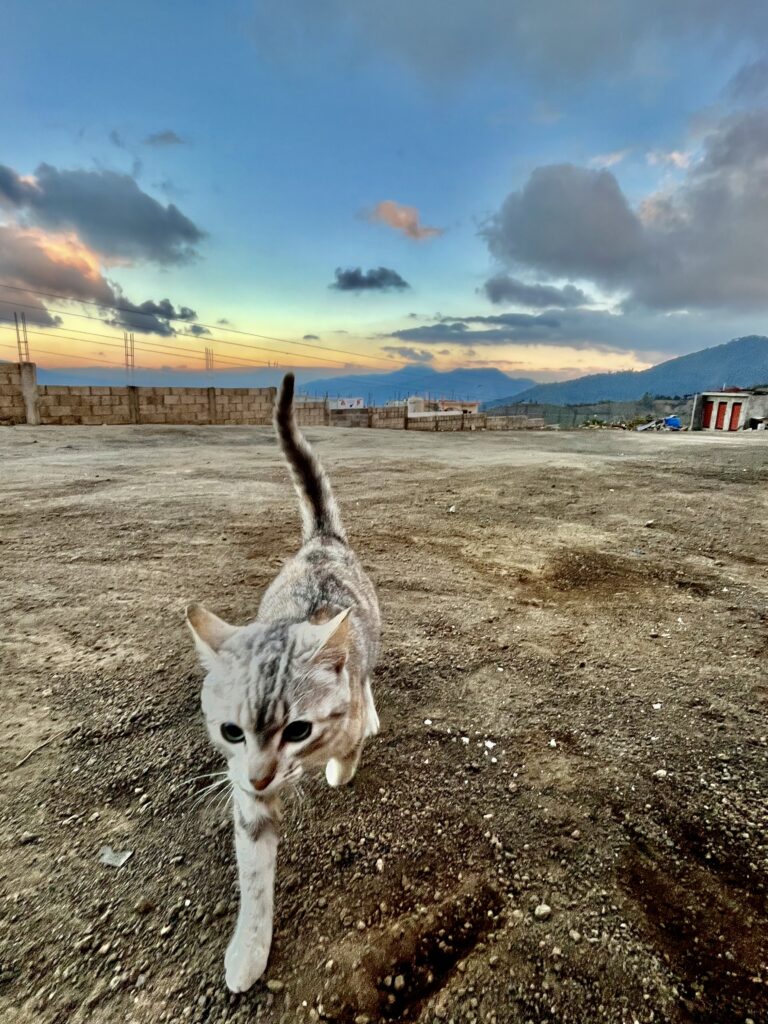
When we arrived at our destination, a small shop in the village of La Soledad, Guatemala, we found ourselves 8,200 ft above sea level. La Soledad translates to “the loneliness”, and the village lived up to its name. We opened the van’s green door, and a stray cat jumped up, looking for food. Brightly decorated “chicken busses” flew down the mountain roads carrying their passengers to the nearby cities.
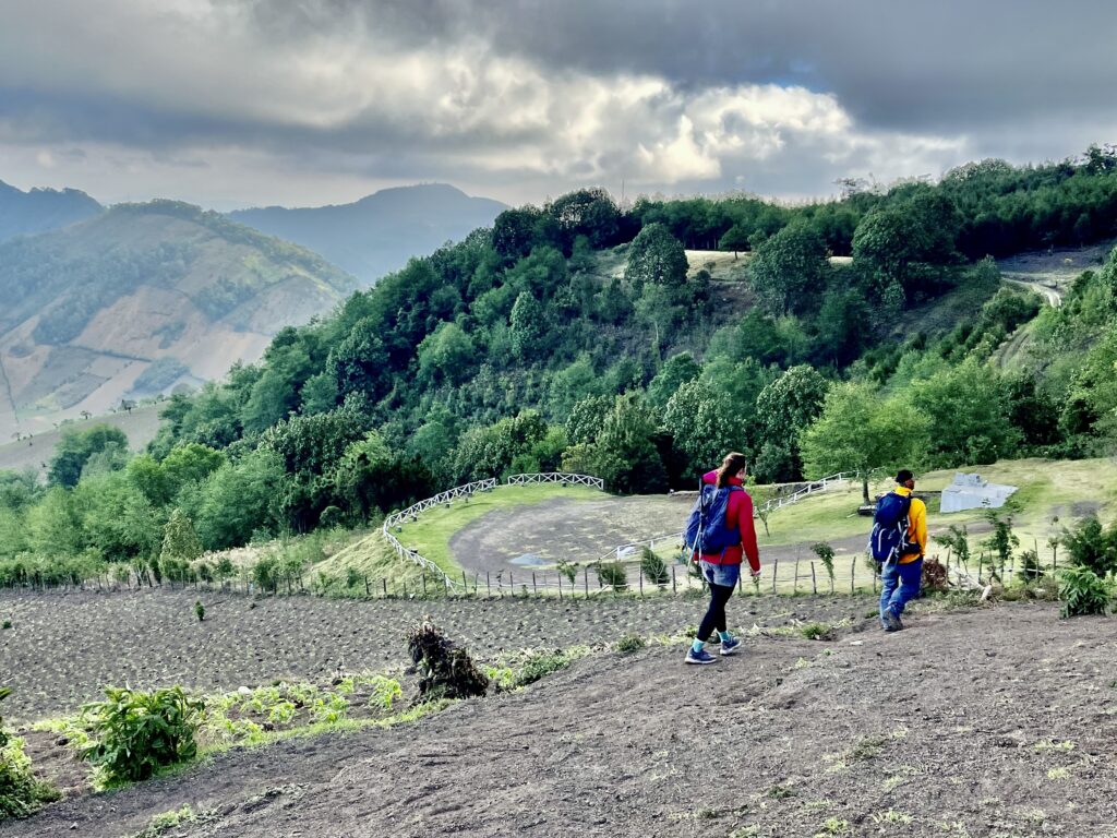
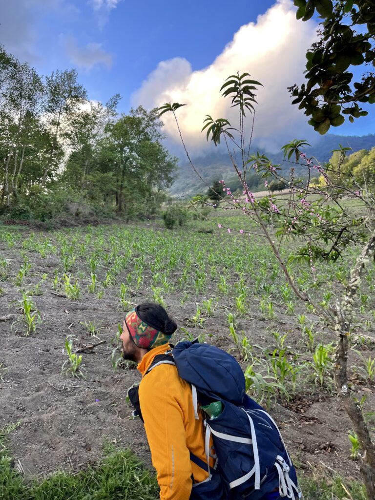
The town was quiet, as the sun finished its rise over the highlands. Our guide was pacing on the phone, trying to locate a missing porter who had not shown up for work that day. We put on layers to fight the persistent chill while we waited. Soon enough, we have led up a cobbled road, far too steep to drive without acrobatics, and onto a farmer’s dirt path. There were horses and crops scattered through the lush foothills, signaling our entrance to the farmland microclimate.
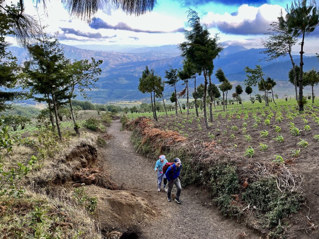
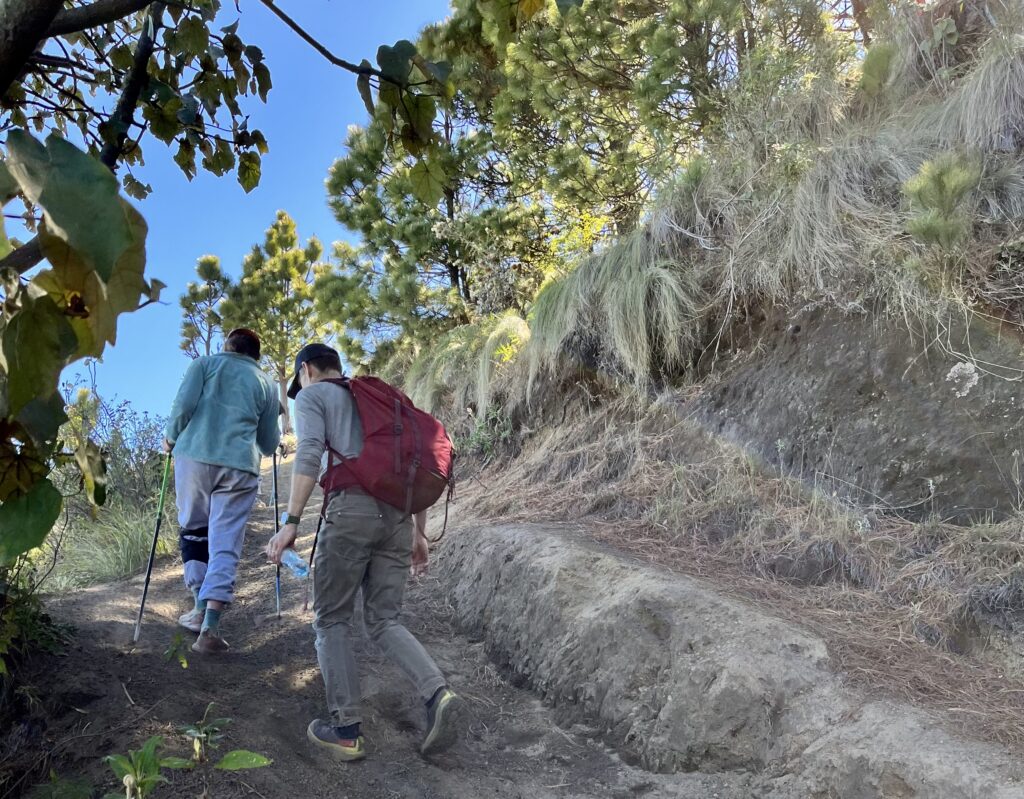
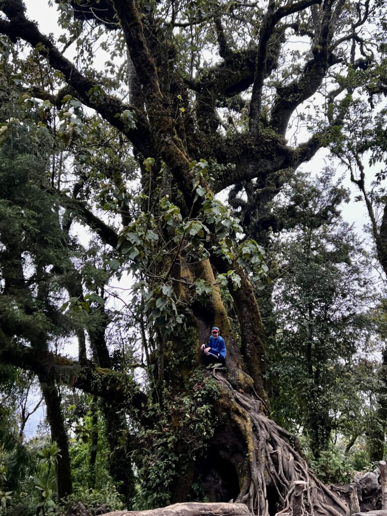
Our pace was sluggish as we adjusted to the altitude. The trail was lined with barbed wire fencing on both sides and had been carved deep into the dry earth by water flows of which there were no signs. We were led past a well-kempt hostel that sat on a ridge, overlooking the village and surrounding farmland. From here, the trail veered sharply left and climbed more steeply. A group of workers carrying pickaxes and hoes passed us. Deep holes had been dug in the earth to collect water, and we found ourselves carefully dodging them. There was a heavy mist shrouding the trees above, but we could make out the steep cloud forest ahead.
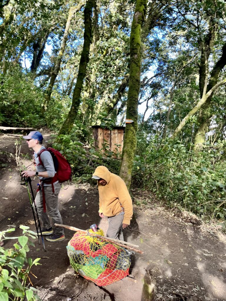
The forest was surprisingly lush for the dry season in Guatemala. Our guide had hiked over thirty volcanoes in Guatemala, and he told us about some of the climbs nearby. Unfortunately, a number of these locations have become dangerous as a result of increased criminal activity during the pandemic. We reached a cleared area with benches for resting. Although we were disheartened to find the ground littered with empty bottles and cans, we took it upon ourselves to pick up a few pieces. Mist still clung to the jungle vines, but the clouds were lifting. We regrouped before entering the National Park which includes Acatenango.
We continued upwards through the forest, occasionally glimpsing the carpet of the valley below La Soledad. As the sun rose and the elevation increased, our surroundings became drier, warming up. We reached a shelter where a man operated a shop. A hot oven sent plumes of smoke through the trees.
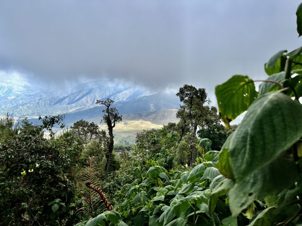
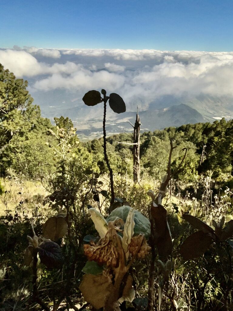
The sparse vegetation and new flora were a sign of our entrance to the alpine forest microclimate. The views from here were less dramatic because we were looking down upon everything. I soon realized the beauty of the volcano is the mountain itself and its close neighbors. A floor of clouds blew in below us.
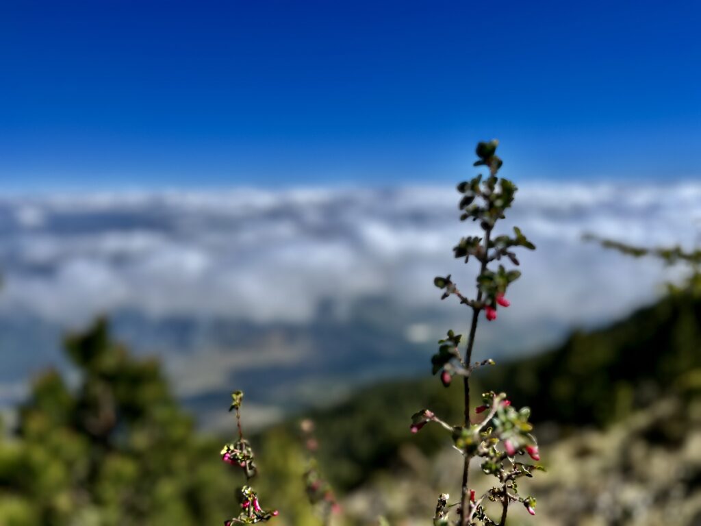
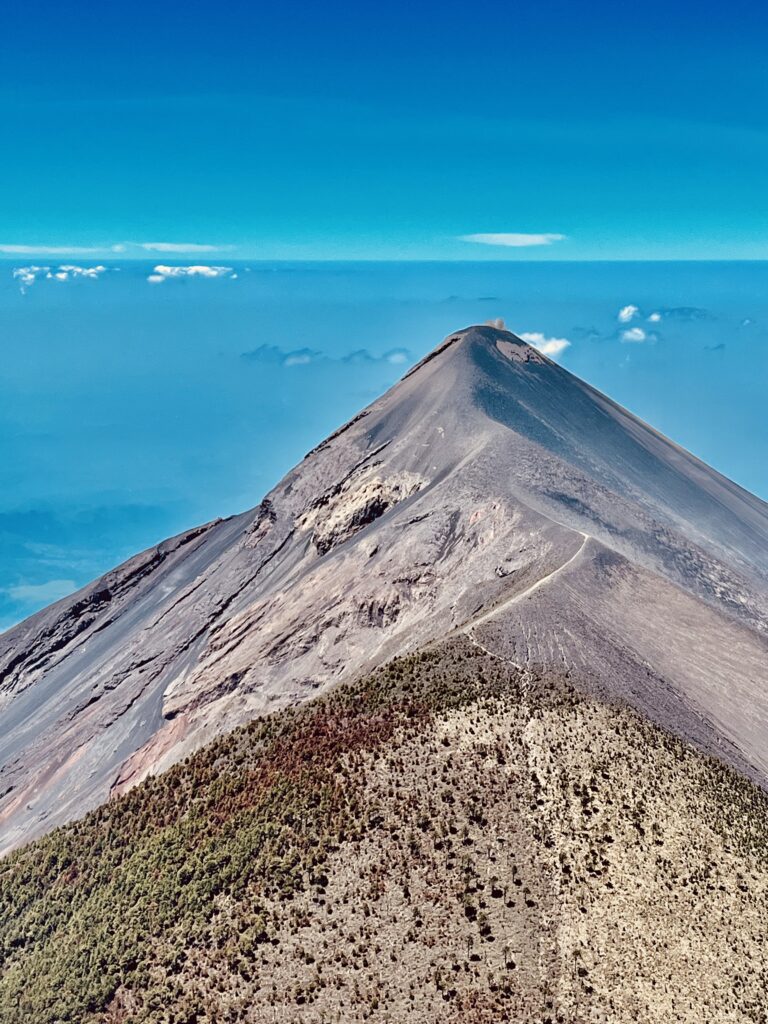
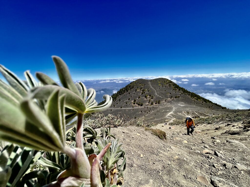
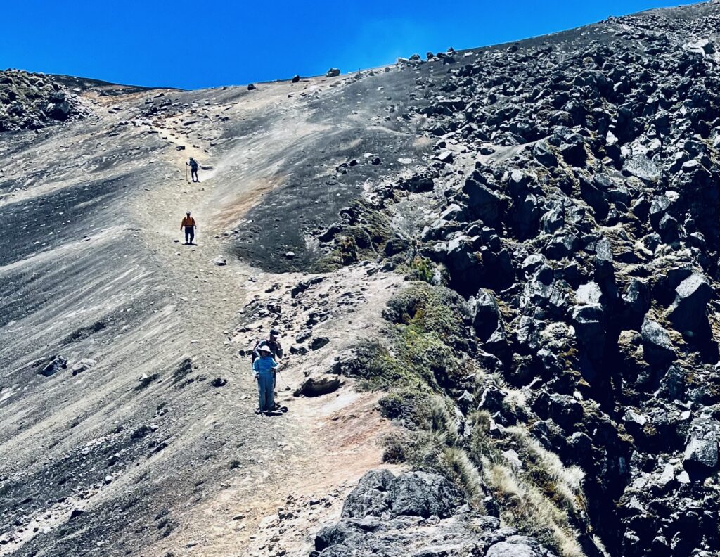
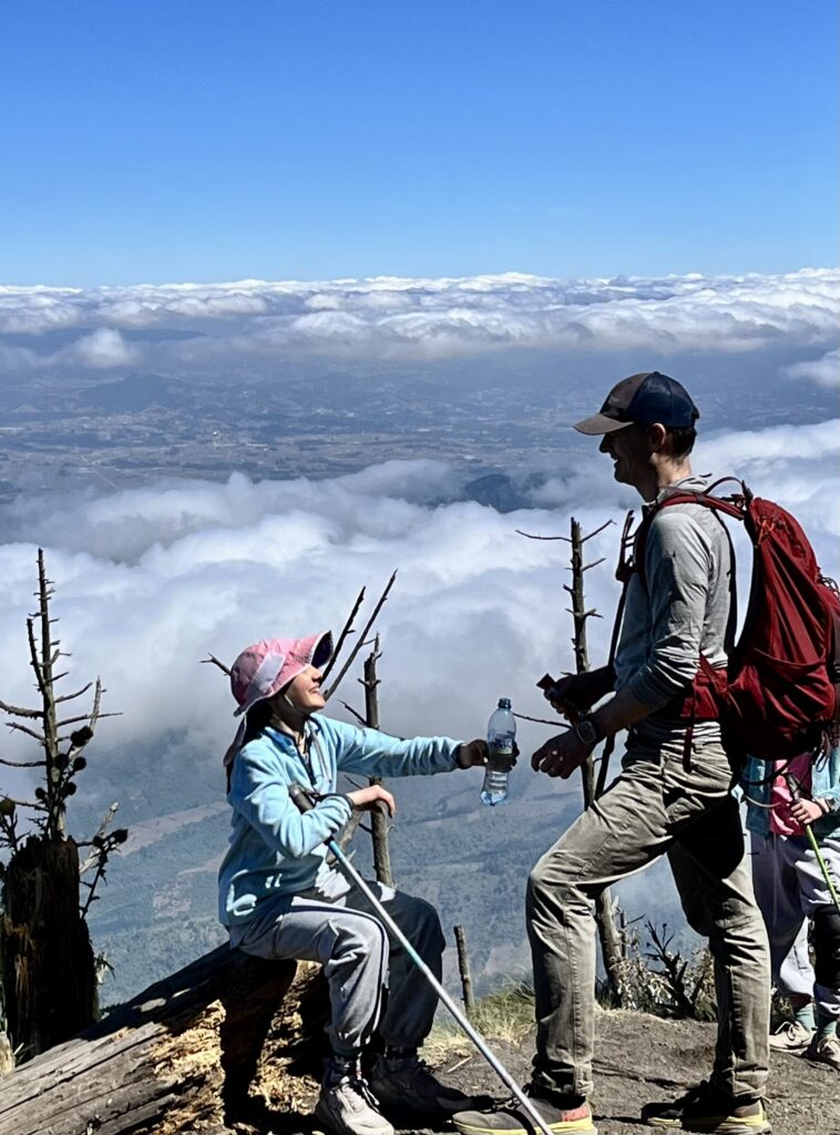
We continued up switchbacks which provided unique views to the north. After reaching a junction with a small shelter, we turned left, savoring our final moments in the shade. The trail turned sharply into the final microclimate: volcanic rock. From here, steep black slopes of gravel cascaded into the forest far below. Across a basin, the summit of Acatenango sat on a massive pile of rocks. To our left, we could see the slopes of the smaller second summit.
The trail contoured around the basin toward the ridge between the two summits. We followed this ridge to the base of Acatenango’s final climb. I pushed ahead of the group, counting steps to two hundred before pausing to catch my breath. My legs felt like they had gained twenty pounds from altitude exposure!
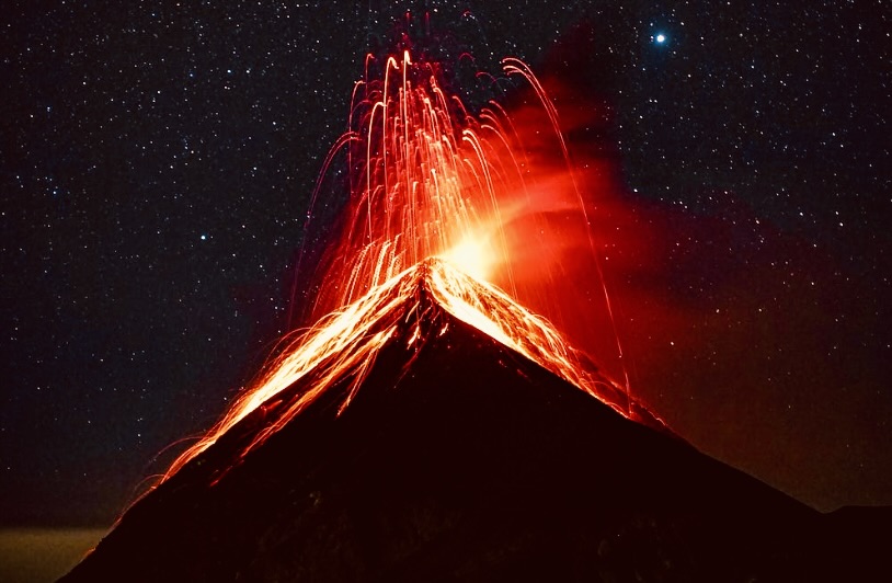
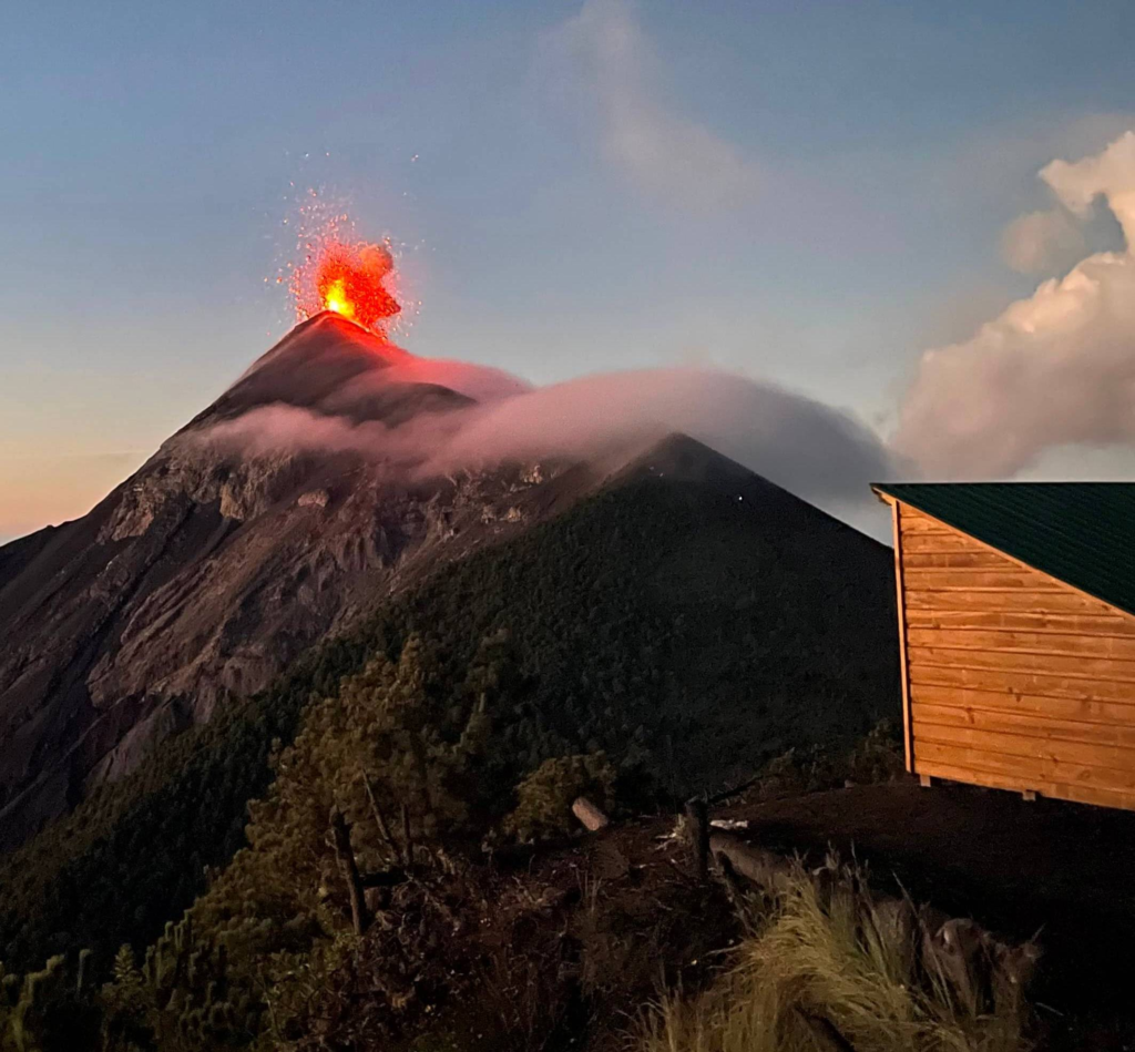
The scree soon turned to talus. (Our guide had directed me to the right of the peak for the most efficient climbing). Minutes later, I had reached the brim of the summit crater. As I planned my next move, Volcán Fuego erupted in a plume of smoke.

While the rest of the group caught up, I jogged around the crater to see the surrounding mountains in greater detail. As the terrain sloped upwards, I found myself gasping for breath. So much for running! I soon realized that an unobstructed view only existed at the summit.
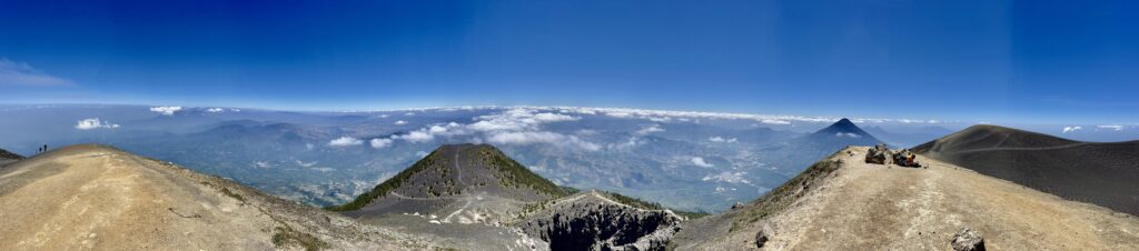
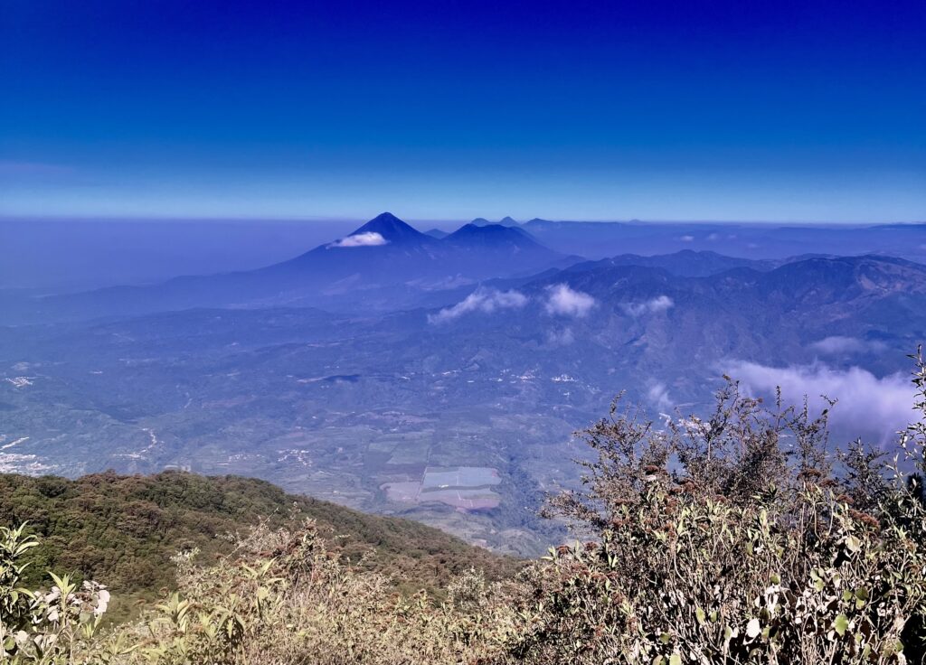
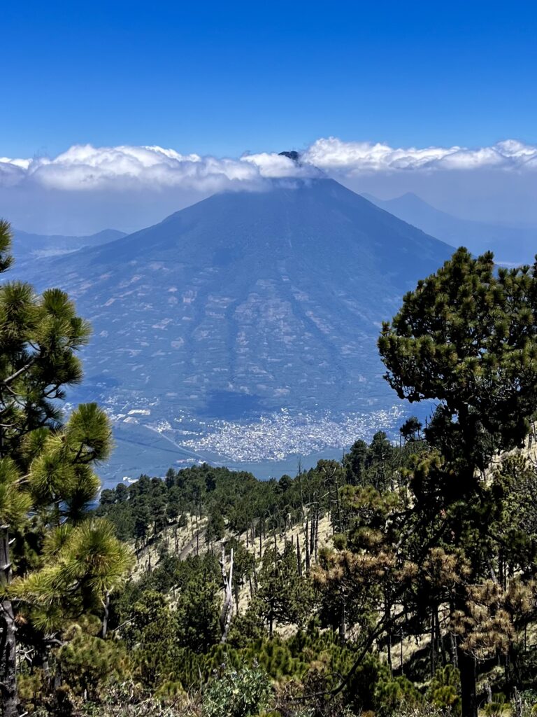
The remainder of the crew crested the crater’s rim, turning directly toward the summit. From Acatenango, we could see most of Guatemala. The volcanoes jutted dramatically from the rolling highlands. It was serene to be so high above the country. Our guide informed us that it was rare to be on the mountain alone at this time of day.
After some food on the summit, we hiked into the crater itself. The view from the bottom was nothing special, but it was exciting to imagine the lava flows that created the bowl. After observing Fuego from the south rim, we contoured back around the crater dropping off the east side of the mountain.
The descent was steep, and covered by a thick sheen of gravel. We found our shoes filled with sand only a few steps down. I had developed a headache as a result of the thin mountain air, so I wanted to descend promptly. Soon enough, we reached a second junction near the base of the second summit. Our guide directed us down the east side of Yepocapa, instead of going west as we had on the ascent.
The terrain was steep, so it wasn’t long before we were under the cover of sparse shrubs. We stopped to empty our shoes, creating a large gravel pile. The sun beat down on the mountain, as an afternoon haze settled. We frequently saw Volcán Agua to the east through the foliage.
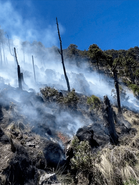
Traversing the lower slopes of Yepocapa, we rounded a bend to find a forest fire in full swing. Thankfully, the path was clear of burning shrubs. The smoke and dust made our eyes water. A man pinwheeled his arms from a ridge below, yelling for us to evacuate the burn zone, but we had come through the worst of it.
We came upon a 4X4 road where we saw streams of backpackers climbing the mountain. Some were headed to a base camp, while others wanted to see Fuego up close from a popular spur trail. Officials soon closed off the trail from which we had come. Vehicles huffed up the road, leaving us in a cloud of dirt. Even our most carefully laid steps kicked dust into the air! We were glad to reach another trail, from which we could escape the road, and reenter undisturbed cloud forest.
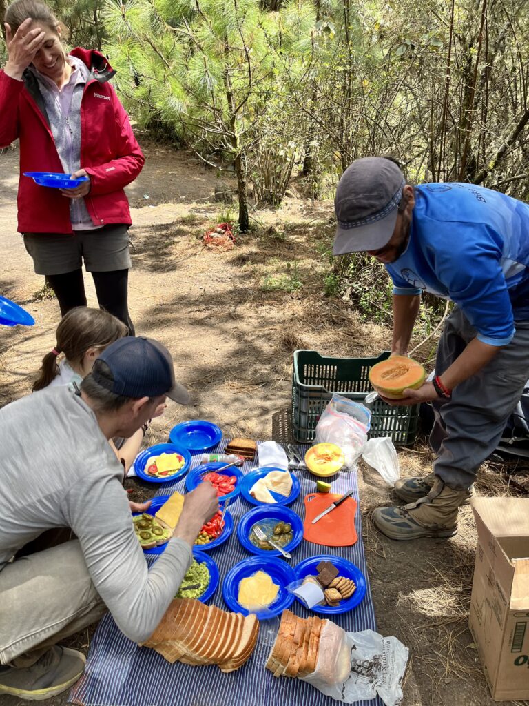
Lunch waited in a clearing where many hikers rested. About fifteen dogs dozed in the slanted rays of sunlight. We shared a meal with our guide and some local boys who were descending back to Soledad. When scrapes were tossed into the forest, dogs would jump up and wander after them. Occasionally frenzied yips could be heard when two dogs fought over the same scrap.
When we rose to hike back to the village, two dogs followed us. When we stopped, they stopped. When we moved, they did as well. We rejoined the trail we had ascended on, passing into farmland soon after. I eyed the barbed wire fencing, worrying that someone would slip and grab it to stabilize themselves.
It felt as though nothing had moved since the morning (aside from a few horses). We reached the top of the steep cobbled road and made our final steps into La Soledad. The dogs ran off to blend with those that had stayed in the village. Across the street, men were hard at work mixing cement on the dirt with sticks. A building that had stood just that morning had been demolished. They seemed to be replacing it. We purchased sodas for the guide and driver at a local store. The village was peaceful and warm, as we sipped our own sodas, sitting on a rail. Occasionally a packed chicken bus would sputter up the road. La Soledad was a magical place to end our trip.
Reflections:
Hiking Acatenango was completely unique from anything I had done back home. Even the adversity we faced was different! In retrospect, the experience was rosy, but we were well-challenged. It wasn’t that the mountain was technical. The heat, dust, and elevation just had us exhausted. Each microclimate was starkly different, and it is hard to believe we hit them all on the same day. Hiking through the rolling farmland was just as incredible as the summit. It also provided a special window into the culture of the area. Watching Fuego erupt was even more exciting than expected, and the cloud forest was filled with new sounds and sights. This is a hike worth completing in a place worth seeing!
Return to the table of contents here.
How to hike Acatenango:
Below is the step-by-step process for how to climb Acatenango. Click on your preference after reading each description for your perfect Acatenango itinerary.
Overnight versus Day Trip:
An overnight on Acatenango is a magical way to see Fuego’s lava flows glow during the night hours. Guide services provide food and camping gear, but hikers must bring a backpack with clothing. Hikers can also climb without a guide at the risk of sub-optimal camping. (More on where to camp below.) The summit gets quite crowded at sunrise, sunset, and throughout the night. However, a night on the mountain is well worth the extra cost (for guide services) and luggage. Hiking overnight also cuts the mileage per day in half.
Despite the perks of an overnight trip, it is more costly, logistically challenging, and time-consuming. Plus, much of the mountain can be seen in one day! We hiked Acatenango in less than 12 hours and had an incredible experience with the mountain to ourselves.
No matter your decision, scroll down to read about the pros and cons of a guided trip.
Guided Trip versus Going Solo
Many non-local people hire a local guide service to alleviate stress and planning, but this isn’t completely necessary. With good planning and some extra supplies, the volcano can be done without one. Hiring a guide further depends on whether or not you plan to stay on the mountain overnight. If you plan on hiking the Fuego Spur Trail to get a closer view of the volcano from the safety of a nearby knoll, you may want to consider going unguided as day trips with the spur are a further expense. Many overnights include the spur.
| Pros (of hiring) | Cons |
| – The farmland section of the hike has a maze of intersecting paths that a guide will show you through. – Interpretation and information of flora, fauna, and landscape.Knowledge of conditions, dangers, and locals. – Low-stress trip – Very little planning involved – Less to carry, provided lunch. (Guide services offer lunch at a location part way down the mountain accessible by road included with the tour). – Transportation from local city to trailhead. – Supports locals. | – Expense – Set route – Less freedom to do Fuego Spur or change the route. – Some experienced hikers may find this unnecessary – Possible delays or hindrances |
We chose to hire a guide for our family of five (including two children under the age of 13). Most of us are highly proficient backpackers, so hiring initially felt like an unnecessary precaution. I also felt uncomfortable with porters carrying food for us to the lunch spot on the descent. Families in the village start point of La Soledad rely on tourism for their incomes, and supporting tourism discourages crime. Our guide was incredibly helpful early in the trip when we were directed through a maze of small farmer’s paths. He was worthwhile, resourceful, and informative throughout the entire trip, often hiking ahead or behind to give us space as a group.
We used Old Town Outfitters for our trip. They were very responsive, and I highly recommend them as a company. Old Town has a great reputation for strong guides and has been servicing tours up Acatenango for twenty years. Their tours are highly customizable. A public day hike with Old Town can cost anywhere from $80 to $170 per person, while a private tour is around $500. Public overnight costs from $140 to $245 per person, but you must call for a private tour quote.
Other guides include Trek Guatemala, OX Expeditions, Wicho & Charlie’s, and V-Hiking Tours. I am not paid to represent any of these companies.
If you want to learn more about a guided day trip, click here…
If you would prefer a guided overnight, click here…
If you are excited about hiking the mountain alone in a day or overnight, click here…
Return to the table of contents.
Guided Day Trip Providers:
| Company | Base Cost | Description |
| Old Town Outfitters | $80 – $125 | Old Town Outfitters offers some of the best day trip service including experienced guides who have versatile expertise. Based in Antigua, they include transportation from the city to the trailhead in all their trips. They allow for adaptability based on the hiker’s skill level and goal. Each experience with Old Town is unique. They were recommended to us by natives of the area and have had reputable and established services for over 25 years. Their guides are bilingual and local. Old Town supports local communities, especially after hardship during the pandemic. They also offer renowned biking trips around Guatemala. For the highest quality guides or gear rental, Old Town is a great option! |
| OX Expeditions | $29 + park fee of $15 | OX Expeditions is a company based in Antigua that provides opportunities for adventures including hiking, zip-lining, mountain biking, and surfing. They provide transportation from Antigua with their guided experience. With their strong environmental focus, OX gives hikers a free t-shirt if they carry a bag of litter off the mountain! You can also win a t-shirt by running around Acatenango’s crater quickly. Their guides are bilingual. If you are adventurous and want a lower-cost option, OX is perfect. |
| Tropicana Tours | $300 for 5 people minimum | Tropicana Hostel offers two incredibly unique tours of Acatenango from Antigua with included transportation. They charge a set price of $300 for a minimum of five people. This is an economic option for a larger group that wishes to have a private tour. They offer a regular day hike experience and a unique nighttime climb. Hikers with the night tour climb the mountain starting from Soledad at 1:00 AM to summit at sunrise. The tour arrives back in Antigua by noon of the next day. |
Once you have considered which company you will use, you can decide whether you will pay for a multi-group or private tour. Private tours are sometimes more economical for larger groups. For day trips, private tours are a worthwhile consideration. Old Town Outfitters charges a little over $400 for a private tour. Tropicana charges $300 for a minimum of five people.
What To Expect:
Your driver will pick you up in Antigua around 5:00 AM at an arranged meeting place. You will travel to the quaint village of La Soledad.
Here, you’ll start your climb with a guide who will lead the way and provide valuable insights throughout the journey.
The trail can be demanding, requiring a reasonable level of fitness and stamina. However, the anticipation of reaching the summit and the promise of breathtaking views serve as powerful motivators.
During the ascent, the guide will share fascinating information about the volcano’s geology, flora, and fauna, enriching your understanding of the natural wonders surrounding you. They will also ensure your safety and provide necessary assistance along the way.
At the summit, you’ll have ample time to rest, recharge, and take in the natural wonders surrounding you. The guide will offer insights into the geological history of the area, allowing you to appreciate the immense power and beauty of the volcanic landscape.
Upon reaching the summit, a world of awe-inspiring vistas unfolds before you. Acatenango’s peak offers panoramic views of neighboring volcanoes, such as Fuego, whose frequent eruptions often paint the sky with plumes of smoke and ash. The stunning landscapes, stretching as far as the eye can see, provide a truly remarkable spectacle. Somewhere near the summit, you will stop for an extravagant lunch.
After immersing yourself in the breathtaking views and capturing photographs, you’ll begin the descent back to the starting point with your guide. You will arrive in La Soledad around 3:00 PM, and be transported back to Antigua by 4:00.
That’s it! You can view my trip report and helpful maps or view my guide (for hiking without a guide service) for information on trails and camping spots. Return to the table of contents.
Guided Overnight Providers:
| Company | Base Cost | Description |
| Old Town Outfitters | $140 | Old Town Outfitters offers incredible overnights on the volcano including experienced guides who have versatile expertise. Based in Antigua, they include transportation from the city to the trailhead in all their trips. They allow for adaptability based on the hiker’s skill level and goal. Each experience with Old Town is unique. They were recommended to us by natives of the area and have had reputable and established services for over 25 years. Their guides are bilingual and local. Old Town supports local communities, especially after hardship during the pandemic. They also offer renowned biking trips around Guatemala. For the highest quality guides or gear rental, Old Town is a great option! |
| Wicho & Charlie’s | $65 (for a shared cabin), $80 for a private two-person cabin | Wicho and Charlie’s offers only overnight on Antigua for those who want to see the magnificent volcano at night. Included in the trip package are a private taxi from Antigua to the trailhead, a guide, a park entrance, and meals. They also include basic camping supplies. They have cabins on the mountain to complement their hostel in Antigua. |
| V-Hiking Tours | $80 (tourists), $65 (Guatemalens) | V-Hiking Tours offers overnight tours on Mt. Acatenango. The owner grew up near the mountain, and delicious local meals are prepared by his mother. Transportation from Antigua, the park entrance fee, two lunches, one dinner, one breakfast, snacks, and camping equipment are all included with the guided trip. |
| Trek Guatemala | Starting at $149 | Trek Guatemala is another guide for overnight experiences on Acatenango which operates out of Antigua. They offer an orientation the day prior to your overnight trip and transport to and from the trailhead. |
| OX Expeditions | $89 (overnight) + park fee of $15 | OX Expeditions is a company based in Antigua that provides opportunities for adventures including hiking, zip-lining, mountain biking, and surfing. They provide transportation from Antigua with their guided experience. With their strong environmental focus, OX gives hikers a free t-shirt if they carry a bag of litter off the mountain! You can also win a t-shirt by running around Acatenango’s crater quickly. Their guides are bilingual. If you are adventurous, OX is perfect. |
| Tropicana Tours | $79 (for group overnight), $249 (for two person private overnight) | Tropicana Hostel offers two options for overnights on Acatenango. The first is a regular overnight where hikers stay in winterized cabins near the summit. The second option allows two hikers to enjoy a private tour overnight on the mountain. |
Some of the companies listed above offer privately guided overnight trips. This can be more economical with larger groups. However, for an overnight hike with less mileage per day, it will not change the experience drastically. Besides, meeting new people could be the highlight of your trip!
What to Expect:
Some companies have a pre-hike meeting the day before you plan to climb the volcano.
Guided overnight hikes to Acatenango begin in Antigua around 9:00 AM. A driver will bring your group to the starting point, often in the village of La Soledad. Here, you’ll join a knowledgeable guide who will lead the way and provide valuable insights throughout the journey.
As you ascend the volcano, you’ll trek through diverse landscapes, passing through lush forests and traversing steep slopes. The hike can be physically demanding, requiring a moderate level of fitness and endurance. However, the reward of witnessing the awe-inspiring scenery and the anticipation of camping near an active volcano make every step worthwhile.
As dusk falls, you’ll reach the overnight camping site near the summit of Acatenango. The guide will assist in setting up the campsite and provide the necessary equipment such as tents and sleeping bags. It’s essential to bring warm clothing, as temperatures can drop significantly at night. We are talking 40-degree difference here!
Sitting around the campfire, you can enjoy a hot meal prepared by the guide. Then you can retire to your cabin or tent platform on the mountain.
Waking up early the next morning is a highlight of the journey. The climb to the summit for sunrise offers an unparalleled panoramic view of the surrounding volcanoes, valleys, and even the Pacific Ocean on clear days. The sight of the Fuego volcano spewing plumes of smoke and occasionally erupting is an awe-inspiring spectacle.
After soaking in the mesmerizing sunrise and taking photos, you’ll descend back to the starting point with your guide. The journey down allows time for reflection on the accomplishment and the memories created during the overnight adventure.
That’s it! You can view my trip report and helpful maps or view my guide (for hiking without a guide service) for information on trails and camping spots. Return to the table of contents.
The Guide for Hiking Acatenango Without a Guide:
The good news is that it is completely possible to hike Acatenango without paying a guide. This portion of the post is intended for those with ample backpacking experience.
Choosing your route is not difficult as there are few trails to choose from. Yes, hikers can climb Acatenango from many surrounding villages, but the safest and most practical route starts in La Soledad. Arranging a ride is difficult if you do not plan to use a tour company. However, Adrenalina Tours offers reliable drivers who will arrange a pickup and dropoff time at a good price. We had a great experience with this company, learning much from the drivers on our trip, and I highly recommend them. Hiking without a guide also allows you to climb Acatenango with a ride from a location other than Antigua (where almost all tour groups are based). Have the driver drop you off at Shop don Martín, La Soledad.
If you want to travel like a local at a much lower cost you can take a chicken bus to La Soledad. From Antigua, simply take the bus going to Parramos. From more distant locations such as Panajachel, Quetzaltenango, or Guatemala City you may need to take a bus to Chimaltenango before boarding another bus to Parramos. From Parramos take the bus headed to Yepocapa and hop off in Soledad. Riding chicken buses can be uncomfortable, but you will have an incredible cultural experience. This website is a great resource on how to ride a chicken bus. (There is more to it than meets the eye.)
A GPS map is imperative to navigate the complex network of farmer’s paths that crisscross the mountain. I recommend subscribing to Gaia or another service such as AllTrails for this hike. You can also refer to the maps inserted below.
This guide aims to help in planning a trip that climbs the El Conejo Trail and descends the Raizales Route. If that means nothing to you then it is not important.
Before you even reach the junction where the ascent and descent split, you need to climb to the Fee Station. This took us a little under an hour. The main route to the fee station starts at Shop don Martín. The shop allows many guide services to organize their clients in the parking area. The owners were also influential in promoting Acatenango tourism years ago. Across the road from the shop, a cobbled path steeply rises off the main road. It soon turns to dirt. There are many trails that diverge from the “correct route”. Two good rules of thumb are to only turn left and stay on the road most traveled. FOLLOW YOUR MAP! Expect to hike on a dirt path through maize fields. You should take a sharp left and cross the fields, passing the bright red hostel Miratenango. Once you have passed the building, turn right to climb into the cloud forest. The trail after Miratenango is lined with barbed wire on both sides. It is easy to follow after this point. You will soon find yourself at the fee station. There are latrines and benches for resting there. The entrance fee is about $15.
Next, climb straight up the El Conejo Trail. There will be a shelter with benches between the fee station and the plateau called El Conejo. In a clearing at the halfway mark, you will find a restaurant and benches. They serve coffee along with other simple meals. From the clearing continue climbing through the alpine forest. There will be benches with a view above the restaurant about a kilometer.
You will come to a junction with trails that access camping, but continue on the tourist route. Follow the tourist route up switchbacks to the west side of the saddle between Yepocapa (the shorter summit) and Acatenango. The trail from El Conejo is wide, well-traveled, and has many rest stops and camping areas along the way. There is a trail that climbs to the summit of Yepocapa, but it is not marked on most maps. It is class III and gnarly! If you are set on summiting Yepocapa you can always climb the well-defined trail from the saddle as an out and back. To climb Acatenango follow La Ruta Maldita or “the cursed route” to the summit on the volcano’s west flank. Climb the scree and sand until you reach the rock field. (There is a well-defined path to this point.) Then hug the right side of the crater for the easiest climbing on the rock field above.
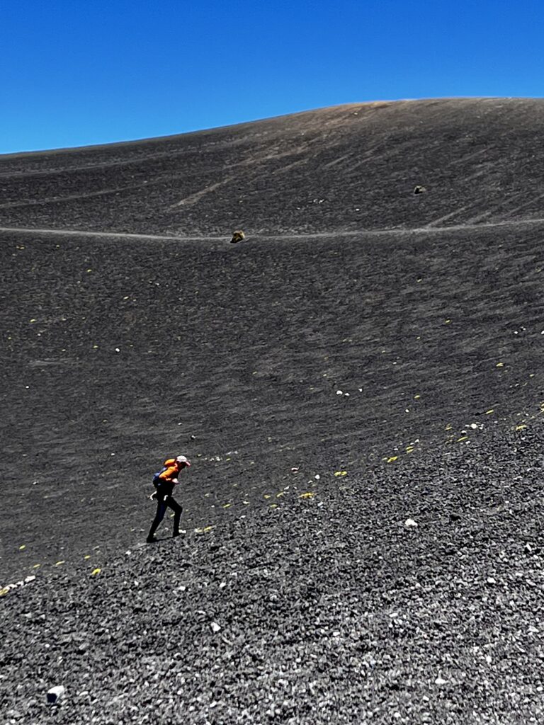
Once you’ve summited hike along the crater. The south side has the best view of Fuego, while the east showcases Volcán Agua. Of course, the crux is the summit itself. You can also descend into the crater. Many athletes test their abilities at elevation by timing a run around the crater using the widest circle available. When you are satisfied with your time at the top, descend from the east near the summit on La Ruta Bendita (the blessed route).
The route is very sandy and you will find yourself sliding. Descend of the saddle, hugging the east side of Yepocapa. The route is easy to follow. You will soon reach a 4X4 road. Follow this road until you reach a junction with a trail. (It is imperative to use your map because this is easy to miss!) Follow the trail into the rest area before descending back to the village the way you came.
CAMPING:
There are designated camping areas on Volcán Acatenango. The most common camping is at the base camp on the southern slopes of the volcano. The camp has an elevation of 11,500 feet (3,500 meters). There, you will find flat places to pitch a tent and easy access to the mountain and eruption views. Many guided services have their own designated camping areas, but some operate from the common base camp also. These companies have facilities such as toilets and cooking areas. Though camping off-trail and at higher elevations is technically allowed, I’d recommend against it due to exposure. If you have the necessary experience, be my guest.
MAPS:
WHAT TO BRING:
There is no specialized equipment needed to climb Volcán Acatenango. However, sturdy hiking boots/trail runners, warm clothing (layers since temperature fluctuates), and trekking poles are important additions to your normal hiking kit.
View my trip report for a better sense of the climb here.
Pingback: HOW TO CLIMB MT. TOUBKAL IN ONE DAY – QUESTIONS ANSWERED